or
ONE WORLD ORDER/NEW WORLD ORDER PIRATES DOCUMENTED
Review by Amelia Gora (2018)
The following article shows proof that England along with the United States moved to usurp Queen Liliuokalani in 1893:

Premeditation PIRATES documented on January 3, 1893:
United States
| United States of America | |
|---|---|
Motto:
| |
 | |
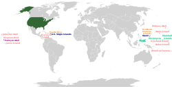
The United States including its territories
| |
| Capital | Washington, D.C. 38°53′N 77°01′W / 38.883°N 77.017°W |
| Largest city | New York City 40°43′N 74°00′W / 40.717°N 74.000°W |
| Official languages | None at federal level[fn 2] |
| National language | English[fn 3] |
| Ethnic groups (2016)[6] | By race:77.1% White 13.3% Black 5.6% Asian 2.6% Other/multiracial 1.2% Native 0.2% Pacific Islander Ethnicity:17.6% Hispanic or Latino 82.4% non-Hispanic or Latino |
| Religion (2016)[7] | 73.7% Christian 18.2% Unaffiliated 2.1% Jewish 0.8% Muslim 2.5% Other 2.6% Unknown |
| Demonym | American |
| Government | Federal presidential constitutional republic |
| Donald Trump | |
| Mike Pence | |
| Paul Ryan | |
| John Roberts | |
| Legislature | Congress |
| Senate | |
| House of Representatives | |
| Independence from Great Britain | |
| July 4, 1776 | |
| March 1, 1781 | |
| September 3, 1783 | |
| June 21, 1788 | |
| March 24, 1976 | |
| Area | |
• Total area
| 3,796,742 sq mi (9,833,520 km2)[8] (3rd/4th) |
• Water (%)
| 6.97 |
• Total land area
| 3,531,905 sq mi (9,147,590 km2) |
| Population | |
• 2017 estimate
| 325,719,178[9] (3rd) |
• 2010 census
| 308,745,538[10] (3rd) |
• Density
| 85/sq mi (32.8/km2) (179th) |
| GDP (PPP) | 2017 estimate |
• Total
| $19.390 trillion[11] (2nd) |
• Per capita
| $59,501[11] (11th) |
| GDP (nominal) | 2017 estimate |
• Total
| $19.390 trillion[11] (1st) |
• Per capita
| $59,501[11] (7th) |
| Gini (2015) | |
| HDI (2017) | |
| Currency | United States dollar ($) (USD) |
| Time zone | UTC−4 to −12, +10, +11 |
• Summer (DST)
| UTC−4 to −10[fn 4] |
| Date format | mm/dd/yyyy |
| Driving side | right[fn 5] |
| Calling code | +1 |
| ISO 3166 code | US |
| Internet TLD | .us |
| French Republic
République française (French)
| |
|---|---|
|
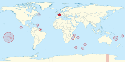
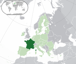
Location of metropolitan France (dark green)
| |
| |
| Capital and largest city | Paris 48°51′N 2°21′E / 48.850°N 2.350°E |
| Official language and national language | French[I] |
| Nationality (2010) | |
| Religion (2016) |
|
| Demonym | French |
| Government | Unitary semi‑presidential republic |
| Emmanuel Macron | |
| Édouard Philippe | |
| Gérard Larcher | |
| Richard Ferrand | |
| Legislature | Parliament |
| Senate | |
| National Assembly | |
| Establishment | |
• Baptism of Clovis I
| 25 December 496 |
| August 843 | |
| 22 September 1792 | |
| 1 January 1958 | |
| 4 October 1958 | |
| Area | |
• Total
| 640,679 km2 (247,368 sq mi) |
| 551,695 km2 (213,011 sq mi) | |
• Metropolitan France (Cadastre)
| 543,940.9 km2 (210,016.8 sq mi) |
| Population | |
• October 2018 estimate
| |
• Density
| 105/km2 (271/sq mi) (106th) |
• Metropolitan France, estimate as of October 2018[update]
| |
• Density
| 116/km2 (300.4/sq mi) (89th) |
| GDP (PPP) | 2018 estimate |
• Total
| $2.960 trillion[7] (10th) |
• Per capita
| $45,473[7] (26th) |
| GDP (nominal) | 2018 estimate |
• Total
| $2.925 trillion[7] (7th) |
• Per capita
| $44,933[7] (22nd) |
| Gini (2013) | 30.1[8]medium |
| HDI (2017) | |
| Currency | |
| Time zone | UTC+1 (Central European Time) |
• Summer (DST)
| UTC+2 (Central European Summer Time[X]) |
| Note: various other time zones are observed in overseas France.[IX] | |
| Date format | dd/mm/yyyy (AD) |
| Driving side | right |
| Calling code | +33[XI] |
| ISO 3166 code | FR |
| Internet TLD | .fr[XII] |
Source gives area of metropolitan France as 551,500 km2 (212,900 sq mi) and lists overseas regions separately, whose areas sum to 89,179 km2 (34,432 sq mi). Adding these give the total shown here for the entire French Republic. The CIA reports the total as 643,801 km2 (248,573 sq mi).
| |
| England | |
|---|---|
 | |
| Status | Country |
| Capital and largest city | London 51°30′N 0°7′WCoordinates: 51°30′N 0°7′W |
| National language | English |
| Regional languages | Cornish |
| Ethnic groups (2011) | |
| Religion | Church of England |
| Demonym | English |
| Government | Part of a constitutional monarchy |
• Monarch
| Elizabeth II |
| Parliament of the United Kingdom | |
| • House of Commons | 533 MPs (of 650) |
| Legislature | UK Parliament[a] |
| Establishment | |
| 5th–6th century | |
| 10th century | |
| 1 May 1707 | |
| Area | |
• Land
| 130,279 km2 (50,301 sq mi)[2] |
| Population | |
• 2017 estimate
| |
• 2011 census
| 53,012,456 |
• Density
| 424.3/km2 (1,098.9/sq mi)[3] |
| GVA | 2016 estimate |
| • Total | £1.5 trillion($2.15 trillion, PPP[4])[5] |
| • Per capita | £27,108 ($38,700, PPP[4])[5] |
| Currency | Pound sterling (GBP; £) |
| Time zone | UTC (Greenwich Mean Time) |
• Summer (DST)
| UTC+1 (British Summer Time) |
| Date format | dd/mm/yyyy (AD) |
| Driving side | left |
| Calling code | +44 |
| Patron saint | Saint George |
| ISO 3166 code | GB-ENG |
| |
Gibraltar
| Gibraltar | |
|---|---|
 | |
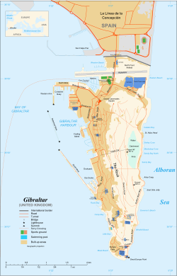
Map of Gibraltar
| |
| Status | British Overseas Territory |
| Capital | Gibraltar 36°8′N 5°21′W / 36.133°N 5.350°W |
| Largest district (by population) | Westside |
| Official languages | English |
| Spoken languages | |
| Ethnic groups |
|
| Demonym | Gibraltarian Llanito (colloquial) |
| Government | Representative democratic parliamentary dependency under constitutional monarchy |
• Monarch
| Elizabeth II |
• Governor
| Ed Davis |
| Fabian Picardo | |
• Mayor
| Kaiane Aldorino |
• UK government minister[b]
| Alan Duncan MP |
| Legislature | Parliament |
| Formation | |
• Captured
| 4 August 1704[3] |
• Ceded
| 11 April 1713[4] |
| 10 September 1967 | |
• Joined the EEC
| 1 January 1973[c] |
| Area | |
• Total
| 6.7 km2 (2.6 sq mi) |
• Water (%)
| 0 |
| Population | |
• 2015 estimate
| 32,194[5] (222nd) |
• Density
| 4,328/km2 (11,209.5/sq mi) (5th) |
| GDP (PPP) | 2013 estimate |
• Total
| £1.64 billion |
• Per capita
| £50,941 (n/a) |
| HDI (2015) | 0.961[6] very high · 5th |
| Currency | Gibraltar pound (£)[d] (GIP) |
| Time zone | UTC+1 (CET) |
• Summer (DST)
| UTC+2 (CEST) |
| Date format | dd/mm/yyyy |
| Driving side | right[e] |
| Calling code | +350[f] |
| Patron saint | |
| ISO 3166 code | GI |
| Internet TLD | .gi[g] |
| |
Malta
| Republic of Malta
Repubblika ta' Malta (Maltese)
| |
|---|---|
![Location of Malta (green circle) – in Europe (light green & dark grey) – in the European Union (light green) – [Legend]](https://upload.wikimedia.org/wikipedia/commons/thumb/6/63/EU-Malta.svg/250px-EU-Malta.svg.png)
Location of Malta (green circle)
| |
 | |
| Capital | Valletta 35°54′N 14°31′E / 35.900°N 14.517°E |
| Largest city | Birkirkara |
| Official languages | Maltese Maltese Sign Language[1]English |
| Common languages | Italian[2] (66% conversational) |
| Ethnic groups (2011[3]) | |
| Religion | Catholicism |
| Demonym | Maltese |
| Government | Unitary parliamentary constitutional republic |
| Marie Louise Coleiro Preca | |
| Joseph Muscat | |
| Legislature | House of Representatives |
| Independence from the United Kingdom | |
• State of Malta
| 21 September 1964 |
• Republic
| 13 December 1974 |
| Area | |
• Total
| 316[4] km2 (122 sq mi) (186th) |
• Water (%)
| 0.001 |
| Population | |
• 2018 estimate
| 475,700[5] (171st) |
• 2011 census
| 416,055[3] |
• Density
| 1,457[3]/km2 (3,773.6/sq mi) (7th) |
| GDP (PPP) | 2018 estimate |
• Total
| $20.861 billion[6] |
• Per capita
| $44,670[6] |
| GDP (nominal) | 2018 estimate |
• Total
| $14.873 billion[6] |
• Per capita
| $31,847[6] |
| Gini (2014) | |
| HDI (2017) | |
| Currency | Euro (€)[b] (EUR) |
| Time zone | UTC+1 (Central European Time) |
• Summer (DST)
| UTC+2 (Central European Summer Time) |
| Date format | dd/mm/yyyy (AD) |
| Driving side | left |
| Calling code | +356 |
| Patron saints | Paul the Apostle, Saint Publius, and Agatha of Sicily[9] |
| ISO 3166 code | MT |
| Internet TLD | .mt[c] |
Website
www.gov.mt | |
Cyprus
| Republic of Cyprus | |
|---|---|
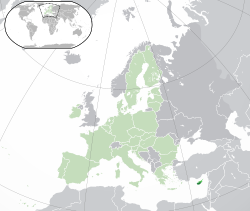
Location of Cyprus (pictured lower right), showing the Republic of Cyprus in darker green and the self-declared republic of Northern Cyprus in brighter green, with the rest of the European Union shown in faded green
| |
| Capital and largest city | Nicosia 35°10′N 33°22′E / 35.167°N 33.367°E |
| Official languages | |
| Minority languages | |
| Vernaculars | |
| Ethnic groups | |
| Demonym | Cypriot |
| Government | Unitary presidential constitutional republic |
| Nicos Anastasiades | |
| Vacant[b] | |
| Demetris Syllouris | |
| Legislature | House of Representatives |
| Independence from the United Kingdom | |
| 19 February 1959 | |
• Independence proclaimed
| 16 August 1960 |
| 1 October 1960 | |
• Joined the European Union
| 1 May 2004 |
| Area | |
• Total[c]
| 9,251 km2 (3,572 sq mi) (162nd) |
• Water (%)
| 9 |
| Population | |
• 2016 estimate
| 1,170,125[c][3] (158th) |
• 2011 census
| 838,897[d][4] |
• Density
| 123.4[c][5]/km2 (319.6/sq mi) (82nd) |
| GDP (PPP) | 2016 estimate |
• Total
| $29.666 billion[6] (126th) |
• Per capita
| $34,970[6] (35th) |
| GDP (nominal) | 2016 estimate |
• Total
| $19.810 billion[6] (114th) |
• Per capita
| $23,352[6] (33rd) |
| Gini (2017) | |
| HDI (2017) | |
| Currency | Euro (EUR) |
| Time zone | UTC+2 (EET) |
• Summer (DST)
| UTC+3 (EEST) |
| Driving side | left |
| Calling code | +357 |
| ISO 3166 code | CY |
| Internet TLD | .cy[e] |
| Republic of the Sudan
جمهورية السودان (Arabic)Jumhūriyyat as-Sūdān
| |
|---|---|
Anthem: نحن جند الله، جند الوطن (Arabic)Naḥnu Jund Allah, Jund Al-waṭan
We are the Soldiers of God, the Soldiers of the Nation | |

Sudan in dark green, disputed regions in light green.
| |
 | |
| Capital and largest city | Khartoum 15°38′N 032°32′E / 15.633°N 32.533°E |
| Official languages | |
| Religion | Islam |
| Demonym | Sudanese |
| Government | Federal dominant-party presidential republic (de jure) Federal one-party state under a totalitarian dictatorship (de facto)[2] |
| Omar al-Bashir | |
| Motazz Moussa | |
| Bakri Hassan Saleh | |
| Hassabu Mohamed Abdalrahman | |
| Legislature | National Legislature |
| Council of States | |
| National Assembly | |
| Formation | |
| 1504[3] | |
| 1820-74 | |
| 1899 | |
• Independence
| 1 January 1956 |
| 9 January 2005 | |
• Secession of South Sudan
| 9 July 2011 |
| Area | |
• Total
| 1,886,068 km2 (728,215 sq mi) (15th) |
| Population | |
• 2016 estimate
| 39,578,828[4] (35th) |
• 2008 census
| 30,894,000 (disputed) [5] |
• Density
| 21.3/km2 (55.2/sq mi) |
| GDP (PPP) | 2018 estimate |
• Total
| $197.825 billion[6] |
• Per capita
| $4,700[6] |
| GDP (nominal) | 2018 estimate |
• Total
| $138.090 billion[6] |
• Per capita
| $3,459[6] |
| Gini (2009) | 35.3[7]medium |
| HDI (2017) | |
| Currency | Sudanese pound (SDG) |
| Time zone | UTC+2 (CAT) |
| Date format | dd/mm/yyyy |
| Driving side | right |
| Calling code | +249 |
| ISO 3166 code | SD |
| Internet TLD | .sd سودان |

| Aden عدن | |
|---|---|
| City | |
|
Clockwise from top:
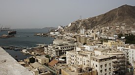
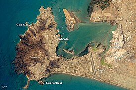
Steamer point, Mosque and the old town, St.Francis of Assisi Church, Cisterns of Tawila, Old Town streetview | |
| Coordinates: 12°48′N 45°02′E | |
| Country | Yemen |
| Governorate | Aden |
| Occupation | |
| Area | |
| • Total | 760 km2 (290 sq mi) |
| Elevation | 6 m (20 ft) |
| Population (2017) | |
| • Total | 1,760,923 |
| • Density | 2,300/km2 (6,000/sq mi) |
| Time zone | UTC+3 (GMT) |
| Area code(s) | 967 |
India
| Republic of India
Bhārat Gaṇarājya
| |
|---|---|
Motto: "Satyameva Jayate" (Sanskrit)
"Truth Alone Triumphs"[1] | |

Area controlled by India shown in dark green;
claimed but uncontrolled regions shown in light green. | |
| Capital | New Delhi 28°36′50″N 77°12′30″E / 28.61389°N 77.20833°E |
| Largest city | Mumbai 18°58′30″N 72°49′40″E / 18.97500°N 72.82778°E |
| Official languages | |
| Recognised regional languages | |
| National language | None[8][9][10] |
| Religion | |
| Demonym | Indian |
| Membership | UN, WTO, BRICS, SAARC, SCO, G8+5, G20, Commonwealth of Nations |
| Government | Federal parliamentary socialist republic[1][12] |
| Ram Nath Kovind | |
| Venkaiah Naidu | |
| Narendra Modi | |
| Ranjan Gogoi | |
| Sumitra Mahajan | |
| Legislature | Parliament |
| Rajya Sabha | |
| Lok Sabha | |
| Independence from the United Kingdom | |
• Dominion
| 15 August 1947 |
• Republic
| 26 January 1950 |
| Area | |
• Total
| 3,287,263[5] km2 (1,269,219 sq mi)[d] (7th) |
• Water (%)
| 9.6 |
| Population | |
• 2016 estimate
| |
• 2011 census
| 1,210,854,977[14][15] (2nd) |
• Density
| 399.1/km2 (1,033.7/sq mi) (31st) |
| GDP (PPP) | 2018 estimate |
• Total
| $10.401 trillion[16] (3rd) |
• Per capita
| $7,795[16] (116th) |
| GDP (nominal) | 2018 estimate |
• Total
| $2.690 trillion[16] (6th) |
• Per capita
| $2,016[16] (133rd) |
| Gini (2013) | 33.9[17]medium · 79th |
| HDI (2017) | |
| Currency | Indian rupee (₹) (INR) |
| Time zone | UTC+05:30 (IST) |
| DST is not observed | |
| Date format | dd-mm-yyyy |
| Driving side | left |
| Calling code | +91 |
| ISO 3166 code | IN |
| Internet TLD | .in (others) |
| Republic of Singapore | |
|---|---|
Motto:
"Majulah Singapura" (Malay) (English: "Onward, Singapore") | |
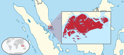
Location of Singapore (red)
| |
| Capital | Singapore (city-state) 1°17′N 103°50′E / 1.283°N 103.833°E |
| Largest PA | Bedok[1] 1°19′25″N 103°55′38″E / 1.32361°N 103.92722°E |
| Official languages | |
| Recognised national languages | |
| Official scripts | |
| Ethnic groups (2015)[2] | |
| Religion |
|
| Demonym | Singaporean |
| Government | Unitary dominant-party parliamentary republic |
| Halimah Yacob | |
| Lee Hsien Loong | |
| Legislature | Parliament |
| Independence from the United Kingdom | |
• Independence of the Federation of Malaya
| 31 August 1957[3] |
| 16 September 1963 | |
| 9 August 1965 | |
| 8 August 1967 | |
| Area | |
• Total
| 722.5 km2 (279.0 sq mi)[4] (176th) |
| Population | |
• 2017 estimate
| 5,612,300[5] (113th) |
• of which citizens (2017)
| 3,439,200[5] |
• Density
| 7,796/km2 (20,191.5/sq mi) (3rd) |
| GDP (PPP) | 2018 estimate |
• Total
| $554.855 billion[6] (39th) |
• Per capita
| $98,014[6] (3rd) |
| GDP (nominal) | 2018 estimate |
• Total
| $349.659 billion[6] (41st) |
• Per capita
| $61,766[6] (8th) |
| Gini (2014) | |
| HDI (2017) | |
| Currency | Singapore dollar (SGD) |
| Time zone | UTC+8 (SST) |
| Date format | dd-mm-yyyy |
| Driving side | left |
| Calling code | +65 |
| ISO 3166 code | SG |
| Internet TLD | |
| Hong Kong Special Administrative Region of the People's Republic of China
中華人民共和國香港特別行政區 (Chinese in Traditional characters)Jūng'wàh Yàhnmàhn Guhng'wòhgwok Hēunggóng Dahkbiht Hàhngjingkēui (Hong Kong Cantonese in Yale romanisation)
| |
|---|---|
|
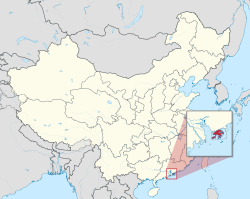
Location of Hong Kong
| |
| Official languages | |
| Regional language | Cantonese[a] |
| Official scripts | Traditional Chinese[b]English alphabet |
| Ethnic groups (2016) | 92.0% Chinese 2.5% Filipino 2.1% Indonesians 0.8% European descent 2.6% others[7] |
| Demonym | Hong Kongese Hongkonger |
| Government | Devolved executive-led system within a socialist republic |
| Carrie Lam | |
| Matthew Cheung | |
| Paul Chan | |
| Teresa Cheng | |
| Andrew Leung | |
| Geoffrey Ma | |
| Legislature | Legislative Council |
| National representation | |
| 36 deputies (of 2,924) | |
| 203 delegates[8] | |
| Special administrative region within the People's Republic of China | |
| 26 January 1841 | |
| 29 August 1842 | |
| 18 October 1860 | |
| 9 June 1898 | |
| 25 December 1941 to 30 August 1945 | |
• Transfer of sovereignty
from the United Kingdom | 1 July 1997 |
| Area | |
• Total
| 2,779[9] km2 (1,073 sq mi) (168th) |
• Water (%)
| 3.16 (35 km2; 13.51 sq mi)[9] |
| Population | |
• 2018 estimate
| 7,448,900[10] (102nd) |
• Density
| 6,777[11]/km2 (17,552.3/sq mi) (4th) |
| GDP (PPP) | 2018[12] estimate |
• Total
| $482.101 billion (44th) |
• Per capita
| $64,533 (10th) |
| GDP (nominal) | 2018[12] estimate |
• Total
| $364.782 billion (35th) |
• Per capita
| $48,829 (16th) |
| Gini (2016) | |
| HDI (2017) | |
| Currency | Hong Kong dollar (HK$) (HKD) |
| Time zone | UTC+8 (Hong Kong Time) |
| Date format | dd-mm-yyyy yyyy年mm月dd日 |
| Driving side | left |
| Calling code | +852 |
| ISO 3166 code | HK |
| Internet TLD | |
Website
gov.hk | |
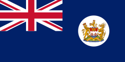
Hong Kong became a colony of the British Empire after Qing China ceded Hong Kong Island at the end of the First Opium War in 1842.[16] The colony expanded to the Kowloon Peninsula in 1860 after the Second Opium War, and was further extended when Britain obtained a 99-year lease of the New Territories in 1898.[17][18] The territory was returned to China when the lease expired in 1997.[19] As a special administrative region, Hong Kong's system of government is separate from that of mainland China.[20]
Originally a sparsely populated area of farming and fishing villages,[16] the territory has become one of the world's most significant financial centres and commercial ports.[21] It is the world's seventh-largest trading entity,[22][23] and its legal tender (the Hong Kong dollar) is the world's 13th-most-traded currency.[24] Although the city has one of the highest per capita incomes in the world, it has severe income inequality.[25]
The territory has the largest number of skyscrapers in the world, most surrounding Victoria Harbour.[26] Hong Kong ranks seventh on the UN Human Development Index, and has the seventh-longest life expectancy in the world.[9] Although over 90 per cent of its population uses public transportation,[27] air pollution from neighbouring industrial areas of mainland China has resulted in a high level of atmospheric particulates.[28]
Etymology
| Hong Kong | |||

"Hong Kong" in Chinese characters
| |||
| Chinese | 香港 | ||
|---|---|---|---|
| Cantonese Yale | or Hèunggóng | ||
| Literal meaning | Fragrant Harbour, Incense Harbour[29][30] | ||
| |||
| Hong Kong Special Administrative Region | |||
| Traditional Chinese | 香港特別行政區 (香港特區) | ||
| Simplified Chinese | 香港特别行政区 (香港特区) | ||
| Cantonese Yale | Hēunggóng Dahkbiht Hàhngjingkēui (Hēunggóng Dahkkēui) or Hèunggóng Dahkbiht Hàhngjingkēui (Hèunggóng Dahkkēui) | ||
| |||
The simplified name Hong Kong was frequently used by 1810,[35] also written as a single word. Hongkong was common until 1926, when the government officially adopted the two-word name.[36] Some corporations founded during the early colonial era still keep this name, including Hongkong Land, Hongkong Electric, Hongkong and Shanghai Hotels and the Hongkong and Shanghai Banking Corporation.[37][38]
History
The region is first known to have been occupied by humans during the Neolithic period, about 6,000 years ago.[39] Early Hong Kong settlers were a semi-coastal people[39] who migrated from inland and brought knowledge of rice cultivation.[40] The Qin dynasty incorporated the Hong Kong area into China for the first time in 214 BCE, after conquering the indigenous Baiyue.[41] The region was consolidated under the Nanyue kingdom (a predecessor state of Vietnam) after the Qin collapse,[42] and recaptured by China after the Han conquest.[43] During the Mongol conquest, the Southern Song court was briefly located in modern-day Kowloon City (the Sung Wong Toi site) before its final defeat in the 1279 Battle of Yamen.[44] By the end of the Yuan dynasty, seven large families had settled in the region and owned most of the land. Settlers from nearby provinces migrated to Kowloon throughout the Ming dynasty.[45] The earliest European visitor was Portuguese explorer Jorge Álvares, who arrived in 1513.[46][47] Portuguese merchants established a trading post called (Tamão) in Hong Kong waters, and began regular trade with southern China. Although the traders were expelled after military clashes in the 1520s,[48] Portuguese-Chinese trade relations were reestablished by 1549. Portugal acquired a permanent lease for Macau in 1557.[49]After the Qing conquest, maritime trade was banned under the Haijin policies. The Kangxi Emperor lifted the prohibition, allowing foreigners to enter Chinese ports in 1684.[50] Qing authorities established the Canton System in 1757 to regulate trade more strictly, restricting non-Russian ships to the port of Canton.[51] Although European demand for Chinese commodities like tea, silk, and porcelain was high, Chinese interest in European manufactured goods was insignificant. To counter the trade imbalance, the British sold large amounts of Indian opium to China. Faced with a drug crisis, Qing officials pursued ever-more-aggressive actions to halt the opium trade.[52] The Daoguang Emperor rejected proposals to legalise and tax opium, ordering imperial commissioner Lin Zexu to eradicate the opium trade in 1839. The commissioner destroyed opium stockpiles and halted all foreign trade,[53] forcing a British military response and triggering the First Opium War. The Qing surrendered early in the war and ceded Hong Kong Island in the Convention of Chuenpi. However, both countries were dissatisfied and did not ratify the agreement.[54] After over a year of further hostilities, Hong Kong Island was formally ceded to the United Kingdom in the 29 August 1842 Treaty of Nanking.[55]
| Commonwealth of Australia | |
|---|---|
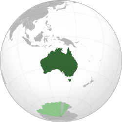
Commonwealth of Australia, including the Australian territorial claim in the Antarctic
| |
| Capital | Canberra 35°18′29″S 149°07′28″E / 35.30806°S 149.12444°E |
| Largest city | Sydney |
| National language | English[N 2] |
| Religion | |
| Demonym |
|
| Government | Federal parliamentary constitutional monarchy |
• Monarch
| Elizabeth II |
| Sir Peter Cosgrove | |
| Scott Morrison | |
| Susan Kiefel | |
| Legislature | Parliament |
| Senate | |
| House of Representatives | |
| Independence from the United Kingdom | |
| 1 January 1901 | |
| 9 October 1942 (with effect from 3 September 1939) | |
| 3 March 1986 | |
| Area | |
• Total
| 7,692,024 km2 (2,969,907 sq mi) (6th) |
• Water (%)
| 0.76 |
| Population | |
• 2018 estimate
| 25,122,400[6] (51st) |
• 2016 census
| 23,401,892[7] |
• Density
| 3.3/km2 (8.5/sq mi) (236th) |
| GDP (PPP) | 2018 estimate |
• Total
| $1.313 trillion[8] (19th) |
• Per capita
| $52,191[8] (17th) |
| GDP (nominal) | 2018 estimate |
• Total
| $1.500 trillion[8] (13th) |
• Per capita
| $59,655[8] (10th) |
| Gini (2012) | 44.9[9]medium · 26th |
| HDI (2017) | |
| Currency | Australian dollar (AUD) |
| Time zone | UTC+8 to +10.5 (Various[N 3]) |
• Summer (DST)
| UTC+8 to +11 (Various[N 3]) |
| Date format | dd/mm/yyyy |
| Driving side | left |
| Calling code | +61 |
| ISO 3166 code | AU |
| Internet TLD | .au |
| New Zealand
Aotearoa (Māori)
| |
|---|---|
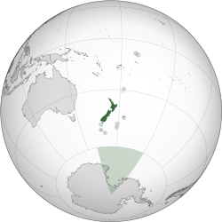
Location of New Zealand, including outlying islands, its territorial claim in the Antarctic, and Tokelau
| |
| Capital | Wellington 41°17′S 174°27′E / 41.283°S 174.450°E |
| Largest city | Auckland |
| Official languages | |
| Ethnic groups (2013) | |
| Demonym | New Zealander Kiwi (informal) |
| Government | Unitary parliamentary constitutional monarchy |
• Monarch
| Elizabeth II |
| Dame Patsy Reddy | |
| Jacinda Ardern | |
| Legislature | Parliament (House of Representatives) |
| Stages of Independence from the United Kingdom | |
| 7 May 1856 | |
• Dominion
| 26 September 1907 |
| 25 November 1947 | |
| Area | |
• Total
| 268,021 km2 (103,483 sq mi) (75th) |
• Water (%)
| 1.6[n 4] |
| Population | |
• November 2018 estimate
| 4,918,350[5] (120th) |
• 2013 census
| 4,242,048 |
• Density
| 18.2/km2 (47.1/sq mi) (203rd) |
| GDP (PPP) | 2018 estimate |
• Total
| $199 billion[6] |
• Per capita
| $40,266[6] |
| GDP (nominal) | 2018 estimate |
• Total
| $206 billion[6] |
• Per capita
| $41,616[6] |
| Gini (2014) | 33.0[7]medium · 22nd |
| HDI (2017) | |
| Currency | New Zealand dollar ($) (NZD) |
| Time zone | UTC+12 (NZST[n 5]) |
• Summer (DST)
| UTC+13 (NZDT[n 6]) |
| Date format | dd/mm/yyyy |
| Driving side | left |
| Calling code | +64 |
| ISO 3166 code | NZ |
| Internet TLD | .nz |
Republic of Fiji
| |
|---|---|
 | |
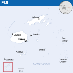 | |
| Capital and largest city | Suva[2]18°10′S 178°27′E / 18.167°S 178.450°E |
| Official languages[3] | |
| Ethnic groups (2016[4]) |
|
| Religion (2007[5]) |
|
| Demonym | Fijian |
| Government | Unitary parliamentary constitutional republic |
| George Konrote | |
| Frank Bainimarama | |
| Legislature | Parliament |
| Independence | |
• from the United Kingdom
| 10 October 1970 |
• Republic
| 7 October 1987 |
| Area | |
• Total
| 18,274 km2 (7,056 sq mi) (151st) |
• Water (%)
| negligible |
| Population | |
• 2018 estimate
| 912,241[6] (161st) |
• 2017 census
| 884,887[7] |
• Density
| 46.4/km2 (120.2/sq mi) (148th) |
| GDP (PPP) | 2017 estimate |
• Total
| $8.798 billion[8] |
• Per capita
| $9,777[8] |
| GDP (nominal) | 2017 estimate |
• Total
| $4.869 billion[8] |
• Per capita
| $5,411[8] |
| Gini (2013) | 36.4[9]medium |
| HDI (2015) | |
| Currency | Fijian dollar (FJD) |
| Time zone | UTC+12 (FJT) |
• Summer (DST)
| UTC+13[11] (FJST[12]) |
| Driving side | left |
| Calling code | +679 |
| ISO 3166 code | FJ |
| Internet TLD | .fj |
| Esquimalt | |
|---|---|
| District municipality | |
| Corporation of the Township of Esquimalt[1] | |

View of Esquimalt from the Highrock Cairn
| |

Location of Esquimalt in British Columbia
| |
| Coordinates: 48°25′50″N 123°24′53″W | |
| Country | |
| Province | |
| Region | South Island/Greater Victoria |
| Regional district | Capital Regional District |
| Incorporated | 1912 |
| Area[2] | |
| • Total | 7.08 km2 (2.73 sq mi) |
| Elevation | 10 m (30 ft) |
| Population (2016)[2] | |
| • Total | 17,655 |
| • Density | 2,494.7/km2 (6,461/sq mi) |
| Time zone | UTC−8 (PST) |
| • Summer (DST) | UTC−7 (PDT) |
| Highways | 1A |
| Waterways | Strait of Juan de Fuca |
| Website | District of Esquimalt |
Halifax
https://en.wikipedia.org/wiki/Halifax
Bermuda
| Bermuda | |
|---|---|
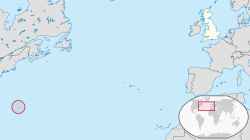 | |
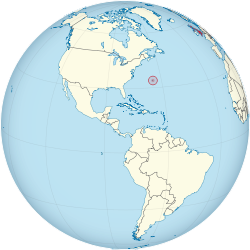 | |
| Status | British Overseas Territory |
| Capital | Hamilton 32°18′N 64°47′W / 32.300°N 64.783°W |
| Largest city | St George's |
| Official languages | English[2] |
| Ethnic groups (2010) |
|
| Demonym | Bermudian |
| Government | Parliamentary dependency under constitutional monarchy |
• Monarch
| Elizabeth II |
• Governor
| John Rankin |
• Premier
| E. David Burt |
• UK government minister[b]
| Tariq Ahmad |
| Legislature | Parliament |
| Senate | |
| House of Assembly | |
| Area | |
• Total
| 53.2 km2 (20.5 sq mi) |
• Water (%)
| 27 |
| Population | |
• Census
| 63,779 |
• Density
| 1,275/km2 (3,302.2/sq mi) (9th) |
| GDP (nominal) | 2017[4] estimate |
• Total
| $5.853 billion (161st (estimate)) |
• Per capita
| $94,400 (4th) |
| HDI (2013) | very high |
| Currency | Bermudian dollar[c] (BMD) |
| Time zone | UTC–4 (AST) |
• Summer (DST)
| UTC–3 (ADT) |
| Date format | dd/mm/yyyy (AD) |
| Driving side | left |
| Calling code | +1-441 |
| ISO 3166 code | BM |
| Internet TLD | .bm |
Website
www | |
| |
Hawaii - goal of United States, England, and France
DISCUSSION
The vehicle used by the United States, France, and England was the Pacific Cable Company which was financed by Pirates of the Pacific: Charles Reed Bishop and Friends, and other countries.
Premeditation Assistants included Celso Moreno, Robert W. Wilcox, Booth, Boyd and others:
More Premeditation Evidence: ROBERT WILCOX, CELSO MORENO ...
Vol VI No. 672 Part 1c Updating Info on International ...
Oct 14, 2017 · Amelia Gora The above article shows the collusion of Robert Wilcox, President of the International Club with Celso Moreno....they were planning the dethronement of our Queen in 1891 or soon after King Kalakaua died.... to date records show that the Wilcox family has conspired to defraud the Kamehameha's over time.... this article is evidence of ...Hawaiian Kingdom: The Royal Families and the Problematic ...
Apr 24, 2018 · -Other Evidence - see articles, pamphlets, books, the IOLANI - The Royal Hawk news on the web by Amelia Gora Queen Liliuokalani's supporters of 40,000 also opposed Annexation. Their Oppositions/ signatures were hidden in the National Archives in Maryland and rediscovered by researcher Noenoe Silva, etc.Hawaiian Genealogies References: Kamehameha Descendants ...
Mar 14, 2015 · Robert Wilcox was one of the early leaders in Hawaii, who was schooled in ITALY funded by the Kingdom of Hawaii during King Kalakaua’s time period. Celso Moreno, friend of King Kalakaua, early suspected spy in Hawaii talked King Kalakaua into taking several young Hawaiians/kanaka maoli to ITALY for educational purposes.Amelia Gora-Kanaka Maoli Truth : Keep for the Records with ...
Jan 16, 2011 · References: Various articles in the IOLANI - the Royal Hawk news from Hawaii, THE NEW YORK TIMES, January 9, 1893, CHRONOLOGICAL HISTORY OF HAWAII, ABROAD, AND THE UNITED STATES (2003) and other books by Amelia Kuulei Gora, a Royal personLegal Notice No. 2018-0408 First Supreme Court Court Case ...
Apr 08, 2018 · I, Amelia Gora entered evidence of Fraud, Corruption through my testimony of truth, as a Royal person not subject to the laws by maintaining that we found the Crown Land deeds of Kamehameha III - Kauikeaouli who said that the Crown lands belonged to himself, his heirs and successors, forever.OpEd Posts Affecting the Hawaiian Islands by Amelia Gora
News from the Hawaiian Kingdom: February 2016
Hawaiian Kingdom: Important Historical Events - Keep for ...
Apr 26, 2018 · Important Historical Events - Keep for Your Records: Updated: Illegal U.S. Documented in Hawaii - A Review- by Amelia Gora (2018) Important Historical Events - Keep for Your Records. ... The Good the Bad and Very Ugly - Robert Wilcox (Part 3) Popular Posts.Kings and Queens of Hawaii: Kamehameha's Heirs and ...
May 17, 2015 · Kekaaniau Pratt, Kaohelelani Wilcox, Robert Wilcox, David Kalakaua/King Kalakaua, Sanford B. Dole, U.S. Congress were all in the mind set or planned fabrication that the the Kamehameha's were "extinct and other heirs dead", the years spanning from 1874 thru 1950.Genocide: History of Tongues Pulled Out, Cut Out etc ...
Oct 25, 2015 · Representative, Amelia Kuulei Gora is descendant of Kalaniopuu (Alii Nui during the time of Captain James Cook), Kamehameha thru daughter Kanekapolei, through son Kaoleioku, Nuuanu, John Young, Isaac Davis, Akahi (w), Mataio …OUR HAWAIIAN MONARCHY: FOCUS ON FACTS – A Pictorial ...
Jul 11, 2010 · Subject: Fwd: OUR HAWAIIAN MONARCHY: FOCUS ON FACTS - A Pictorial History - by Amelia Gora, a Royal person (2010) To: hawaiianhistory@gmail.com, hawaiianhistory@yahoo.com, hawaiianhistory@hotmail.com Greetings everyone! ... His cousin named Robert Wilcox tried to take over the Hawaiian Kingdom. He was charged with treason and pardoned.Amelia Gora-Kanaka Maoli Truth : Keep for the Records with ...
Jan 16, 2011 · References: Various articles in the IOLANI - the Royal Hawk news from Hawaii, THE NEW YORK TIMES, January 9, 1893, CHRONOLOGICAL HISTORY OF HAWAII, ABROAD, AND THE UNITED STATES (2003) and other books by Amelia Kuulei Gora, a Royal person
Hawaiian History - Premeditation Issues: The Robert Wilcox ...
More Premeditation Evidence: ROBERT WILCOX, CELSO MORENO ...
Oct 29, 2017 · by Amelia Gora (2017) The following are some of the articles found on chroniclingamerica.com website, which is evidence of treasonous activities of Robert Wilcox, Celso Moreno et., als. vs. the true Patriots of the Kingdom of Hawaii, etc.











No comments:
Post a Comment