
Here and there among the refuse were found the upper jaw, with left orbit, of a young person; a fragment of an occiput, perhaps belonging with the above though not lying near it; fragments of the skull of a young child; half of an ulna of a child probably 12 years old; a small fragment of the lower jaw of an adult with one molar remaining in it, which has been burned until black. These fragments were all in such position and condition as to show they were not carried in by animals; were not disinterred from graves and placed [77]here; were not in any way accidentally present; but had been gathered up with the refuse and thrown in as a part of it. The broken or burned condition of these, as well as of other human bones found at random among the ashes of the main cave, are presumptive evidence that dwellers here sometimes devoured the flesh of human beings; and the fact that a majority of such bones are those of children indicates that it was not eaten through a belief that the valor and skill of an enemy could be thus absorbed by the victor, but that it was used as food, like the flesh of any other animal. Such conclusion may not be justified; but the facts are not readily accounted for otherwise, except on the equally repulsive hypothesis that the inmates of the cave were brutally indifferent to the bodies or skeletal remains of their fellows.
Omitting this question from consideration, however, there is still ample evidence that the inhabitants of Miller's Cave were in a low state of savagery, or, if the phrase be preferred, in a very primitive stage of culture. There was a remarkable paucity of articles used as ornaments or for personal decoration, and the few that were found were simple and crude, being only rubbed stones or rough pieces of bones which were possibly intended for beads or pendants. The pottery, while strong and serviceable, was plain in form and devoid of any ornamentation or design except that a few pieces showed impressions such as would be made by scratching or pressing with the end of a small stick or bone. Nearly all of it was cord-marked, though some was smooth, one red piece appearing almost glazed. It varied much in thickness, hardness, and color. Most of it was dark gray, some red, occasionally a piece yellowish or nearly white; due to the different clays of which it was made. So far as observed it was tempered with shell. The shards were small, as if when a pot was broken the fragments were still further demolished. The curvature showed there was a wide range in size, from about a pint to 2 gallons or more.
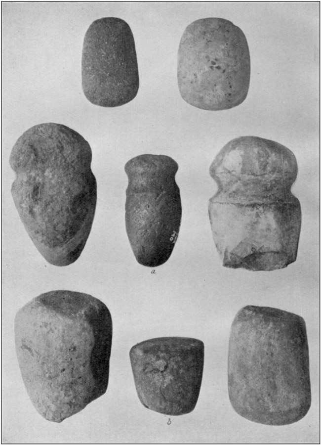
Their mortars were natural blocks or slabs of sandstone, such as may be picked up by thousands in the immediate neighborhood, and showed no alteration of form beyond ordinary wear except that the rough faces of a few were pecked, apparently with a pointed flint tool, to make them less irregular. Some were flat and smooth from use with a muller or grinding stone; most of them were worked or hollowed on only one face; a few showed depressions on both sides; one had a few hemispherical indentations near the margin, like those observed in cup-stones.
Only one pestle was dressed into any of the forms which we are accustomed to associate with the name, and this was a truncated cone with rounded top, shown at b in plate 29. All the others were cobblestones from ravines or the river shore. A few had undergone [78]no change in form; most of them were battered on the perimeter; a few had pitted sides; some had been used as pestles, mullers, or grinding stones until the surface was more or less smooth. All such stones are classed as "pestles," for convenience; they could have also been used as hammers, bone crushers, and in various other ways.
In all, 73 mortars were found; counting only those stones which bore marks of use as such. The largest one was at the bottom of the ashes, near the doorway. There were more than 100 pestles which bore evidence of much use; and probably as many more on which there was little or no sign of wear. As the cavern was not of sufficient size to provide living quarters for many families at any one time—10 or 12 at the most—the large number of these utensils may imply that the inmates would not use an object which had previously belonged to some one else.
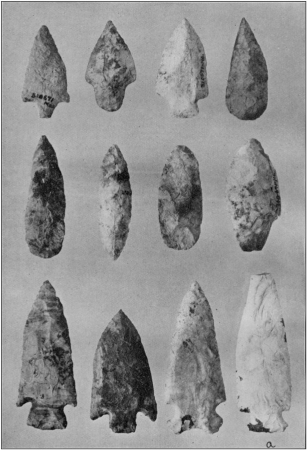
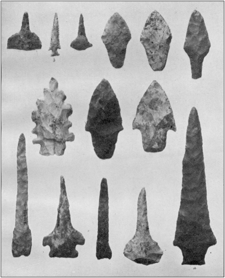
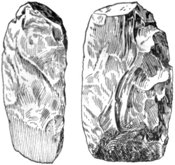
Among the flint implements there was a wide range in the character of stone, the shape, and the degree of finish, although the variation in size was quite limited. Very few of them may be classed as either large or small. The longest, shown at a in plate 28, measured 5½ inches; few were more than 4 or less than 2 inches. Tapering stems predominated. The principal forms are shown in plates 26-28. Only three arrowheads were found; but this was to be expected, as arrows would be used only out of doors. One of these of clear, fine-grained pink and white chert, shown at b in plate 28, so far surpasses in delicate finish any other specimen secured that it is probably exotic. The large number of cores, blocks, spalls, and flakes shows that many implements were made and repaired here. But, while a few specimens showed that their fabricators were masters of the chipping art, most of them were roughly finished. Some which are so little altered from the original form of the rough flake or spall that they would be classed as "rejects" if found about a flint workshop have a smoothness or "hand polish" which denotes much service. There is the possibility, of course, that hunting or traveling parties from some other part of the country may have availed themselves of the shelter, either when it was temporarily unoccupied, or as guests of those living in it; and that these, also, may have left some small articles when they departed. However this may have been, all the objects from the top to the bottom of the deposits, in dry ashes or in sticky mud, in crevices or branch caverns, on the red clay, the barren muck, or the bedrock—all, if we may except the few flints of superior workmanship—are identical in general character: That is to say, any object from any part of the deposited material had its practical duplicate at various other points on different levels.
Only three grooved axes and three pestles were found. They are shown in plate 29, along with a cobblestone used as a pestle.
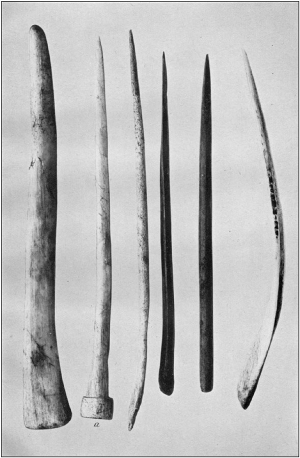
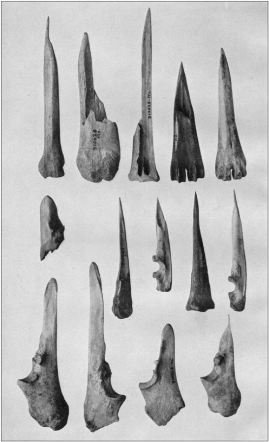
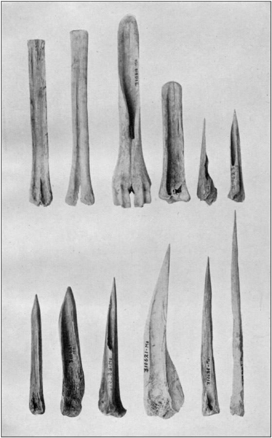
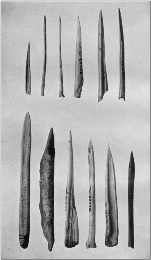
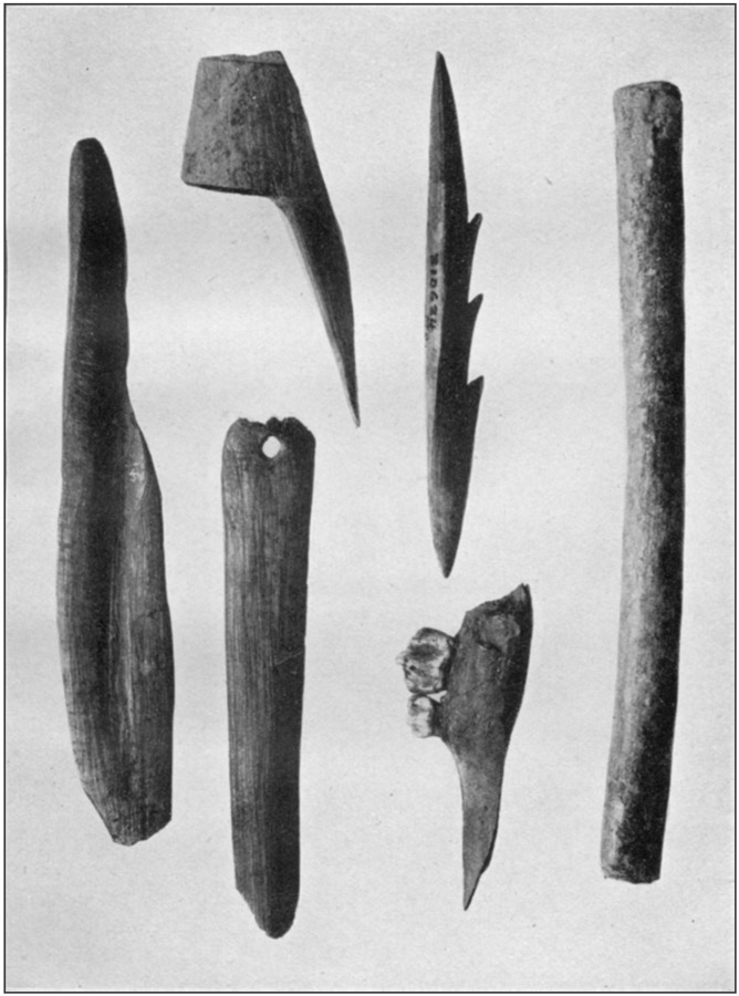
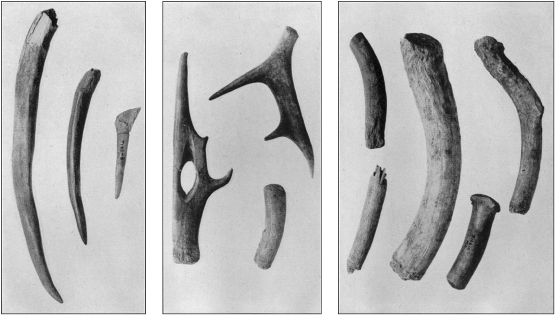
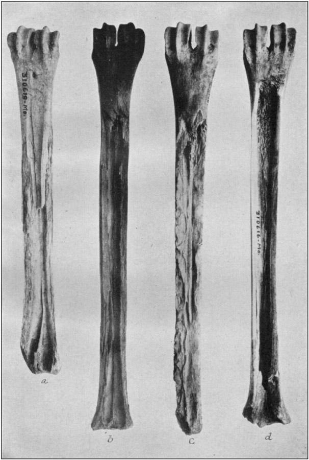
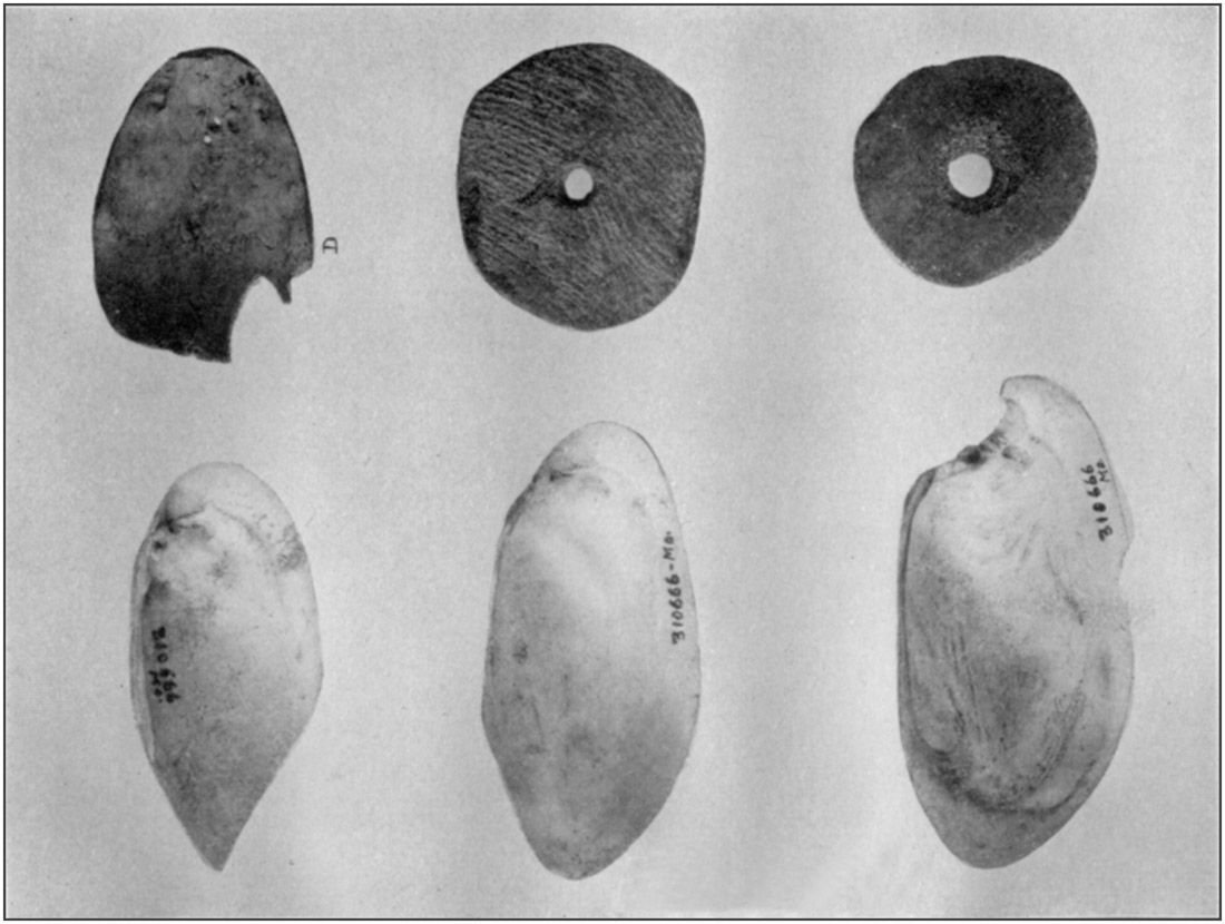
PLATE 37
SHELL SPOONS, POTTERY DISKS, AND BROKEN SPOON MADE OF A DEER'S SKULL, FROM MILLER'S CAVEToList
SHELL SPOONS, POTTERY DISKS, AND BROKEN SPOON MADE OF A DEER'S SKULL, FROM MILLER'S CAVEToList
Plate 36 illustrates four stages in the manufacture of skivers. It shows that instead of being always rubbed down from its natural form the bone was sometimes split by blows of a stone hammer until complete, subsequent smoothing probably resulting from use, as shown by the implement at c. When skivers were broken, the ends were dressed down for other uses; as observed in the upper row of plate 32.
Shell spoons, knives, and scrapers were abundant. Some are shown in plate 37, along with perforated pottery disks and the bowl of a spoon made from the frontal bone of a deer.
Figure 16 represents the only adz or gouge form implement found. It is made of gray chert, the edge highly polished. In figure 17 is shown a broken clay pipe, identical in form and material with that in figure 14.
The red clay which had formed the floor of the excavated area from the mouth of the cavern to well past the central portion suddenly dipped to the north and to the east shortly before reaching the corner of the west wall. Attempts to follow it downward were frustrated by black earth, which when dug with pick or shovel assumed the consistency of "hog-wallow mud."
For a space of 4 or 5 feet inside the doorway, whose floor was about 3 feet higher than the average surface level in the cave, the ashes were not more than a foot thick, the clay rising to this extent. It spread out fan shape, with a continuous slope for several yards in every direction, thus making an easy grade for entrance and exit.
There are three ways in which this condition could have been brought about.
First, the aborigines may have constructed a graded way; though it is not at all likely they would have piled the clay so far to each side.
[80]Secondly, it may have washed through the doorway from the outer cave when the main outlet of the latter in the face of the bluff toward D (fig. 13) was obstructed in some way. This is improbable.
Thirdly, it may be due to material deposited in the eddy or swirl created by the corner of the west wall whenever a large volume of drainage water flowed from the westward in the main cave and was sharply deflected toward the south when it struck the east wall. This is no doubt the correct explanation.
Whether or not these floods had any part in piling up the clay at the doorway, beyond doubt it was to them that the clay, gravel, and sand resting upon the floor of the main cave owe their origin. To them is likewise due the dark earth overlying the clay at the rear and covering the floor of the recess in the east wall. Clearly, there was at one time in the cave's history a current at intervals, which carried mud and small rocks from the interior of the cave, or from the outside surface through sink holes, and left at least a part of it where the velocity of the stream was checked. Later, much of this water found other drainage channels, and the coarser matter could no longer be carried into the cave; but at times of unusually heavy precipitation enough of the torrent followed the old course to bring in the dark earth. The last is due to top soil containing a large amount of humus from decaying vegetation. Finally, no more water came this way except as seepage, which is the condition at present.
The pool at the rear may be entirely empty in dry seasons; and after heavy rains may contain a depth of 2 feet. This water now has a greasy looking scum and a sour, unpleasant odor.
The cave was inhabited before the water had entirely ceased to flow through it; this is proven by the alternation of refuse and silt in the recess under the east wall. Kitchen waste would be thrown here, and when the water rose sediment would cover it. There was then dry ground near the doorway; and the water in the pool, having an outlet toward the east, through the crevice, was fit for use, except, perhaps, when turbid.
On the rear slope, 18 feet from the water, the excavation was carried to the level of the bottom of the pool. The lower 2 feet was mud, and at the bottom water oozed in. Scattered through this muddy earth was much charcoal in small fragments; and for a short distance it also occurred for a few inches below the surface of [81]the red clay. This charcoal was carried in by the water at the same time as the earth with which it was associated, and must be due to fires on the hill outside. At any rate, it did not come from any fires made within the cavern. No refuse or worked objects of any kind were found in this black earth, except in the recess in the east wall, as described, and in the upper portion immediately under the ashes. Such as existed outside the recess may have become mixed in the same way; that is, by being thrown on the top as it existed at the moment and being later covered by the water; or it may have worked in from the ashes above. Nor was there much refuse in the ashes on the rear slope, although these were quite regularly stratified.
To entirely remove the rocks and clay and expose in a satisfactory manner the bedrock floor would require months of labor, the use of mechanical appliances, and complete drainage to the rear wall through the mouth of the cave.
Without attempting to make a detailed list, there may be given a summary of the objects shipped to the National Museum:
- 12 skulls, most of them more or less broken.
- 10 partial skeletons, including those of children.
- 8 fragments of skulls from different individuals not included in the above.
- 74 objects of shell.
- 711 worked flint objects; knives, scrapers, cores, etc.
- 10 grooved axes, tomahawks, and flint hammers.
- 10 mortars.
- 40 pestles, stone hammers, rubbing stones, etc.
- 413 wrought objects of bone and stag horn.
- 2 clay pipes.
- 1 box of pottery fragments.
- A number of small objects, not classified.
There is no way in which the age of the deposits in either the Miller or the Sells Cave can be determined. The accumulation of ashes in the one and of talus at the front of the other would certainly imply the lapse of several centuries, perhaps a thousand years of continuous occupation. Intermittent habitation would lengthen this period.
RAMSEY'S CAVE
Ramsey's Cave, better known as Freeman's Cave, is in a bluff on the right bank of Big Piney River, 3 miles below Miller's Cave. It is about 150 feet above the level of the stream and the same below the summit of the hill behind it. Within a hundred yards to east and west are shallow ravines by which access is fairly easy to a ledge [82]nearly on the same level as the cave; this is wide enough for one person to traverse, but in most places too narrow for two abreast. The talus in front is rough and steep but a crooked path with no difficult grades can be made to the water.Chambers on each side near the entrance, which are accessible only by means of a ladder, provide excellent living quarters and command approach from any direction, even along the foot of the cliff on either side.
The entrance, which faces southwest, is a symmetrical arch 75 feet wide and 20 feet high.
Bedrock shows just in front, covered with loose material washed over the cliff. The floor ascends and the roof descends toward the rear, until at 70 feet they approach within 6 feet of each other; beyond this the cave is choked with fallen rocks and with earth and gravel probably from a sink hole some distance back on top of the hill.
Refuse shows about the entrance and for 40 feet toward the rear, where earth from the interior has worked down over it. The surface is strewn with rocks, large and small, so that excavations are possible only in small areas. Several holes were dug at intervals between the front and the rear; a considerable amount of ashes was found over the middle portion, thrown from still farther back. Very little was found in them. The rock bottom slopes upward slightly and was covered in some places with clay and gravel, on which lay the ashes and other refuse; these were nowhere more than 3 feet deep, and usually much thinner.
The place was so difficult to work in and the returns were so scanty that systematic investigation did not seem warranted, and the work was not extended. The only objects secured were a bone perforator, part of another one, a snail shell, apparently a bead, a very small piece of sandstone used as a grinder or polisher for bones, a fragment of worked mussel shell, and nine rough flints. There were also a few small fragments of pottery.
A man living near the cave reported that a few years ago he was digging in a narrow space between the east wall and a large fallen rock. He came upon the feet of two skeletons and took out the lower leg bones. Being assured by a friend that these were not bones of Indians because they were not "red," and so must be remains of white people, he replaced them and threw the earth back on them. He was certain the spot had never since been disturbed; but in this he was mistaken, for investigation revealed a pile of human bones lying in confusion, in which the frames of two individuals, as he had said, were mingled; but no trace of the skull or jaw of either. Evidently some one had come afterwards in search of the skulls. The femur of the larger individual was just 19 inches long; the other [83]frame was much smaller; but all other bones were in such fragmentary condition they could not be measured.
There is a rock shelter a short distance down the river from the Ramsey Cave and in the same ledge. It is 45 feet long, 15 feet deep, and 8 feet high in front, the roof coming down to the floor at the rear. There is nothing to show that it was ever used, even as a camping place.
A fourth of a mile above this cave is another from which flows a never-failing spring. There is a pile of ashes near the front, containing some refuse, but these mark only the site of an occasional camp, as the place could not be occupied in wet weather.
GRAHAM CAVE
On Graham's land, high up in a bluff facing Big Piney, opposite the mouth of Spring Creek, is a small cave difficult to reach and not suitable for occupancy.PILLMAN'S OR SPRING CREEK, CAVE (25)
At the mouth of Spring Creek, on land of John Pillman, near the top of the bluff, is a cave with an entrance 30 feet wide and 30 feet high. A steep rock ledge at the front offers an impassable obstacle to any stock except goats. The front chamber is well lighted for a distance of 80 feet, where it makes a turn. Bedrock is exposed near the entrance and rises toward the rear, showing here and there through the covering of earth, which is not more than 2 feet deep anywhere. Water cracks appear even in the highest spots, proving the floor to be saturated at times. There is considerable refuse inside the cave, but none in front, and it is reported that human skeletons have been found in it. If so they must have been on a ledge or in a crevice. Plate 2, a, shows the hill, from the west; plate 2, b, the entrance to the cave.Two large cairns stood on top of the bluff above the cave. So far as can be determined in their dilapidated condition, there seems to have been a row of stones inclosing a definite area, but it is impossible to ascertain with certainty whether this was the case.
On a lower ridge, to the north, are three similar but smaller cairns. These are constructed entirely of sandstone slabs, and there was plainly some sort of system used in placing them; but, as in the case of the first, it can not now be determined whether there was a continuous wall, and, if so, whether it was more than one stone high.
A village site is reported in the river bottom on David Thomas's farm on the Big Piney, near Moab.
[84]There were cairns, now totally destroyed, at two places on the ridge over which passes the road from Devil's Elbow to Spring Creek.WOODLAND HOLLOW CAVE
A minor ravine, known as Woodland Hollow, opens into a small unnamed creek a mile above its junction with Big Piney River at the Devil's Elbow. In the west slope of this ravine is a large cave, named from its location. Through the middle part the floor is muddy; along the wall on the left, dry cave earth, with a width of 20 to 30 feet, extends for 70 feet from the entrance, its surface 4 feet above the level of the wet floor. A smaller amount of dry earth lies along the opposite wall. The sides of the cavern recede at the bottom, the dry earth passing under them. No estimate can be made as to the total depth of the deposits. At the mouth of a ground-hog burrow were two bone perforators, potsherds, fragments of bones, and pieces of worked flint, including two knives, which had been thrown out by the animal. Two mortar stones were found on the margin of the dry earth.The cave belongs to Philip Becker, of St. Louis, who peremptorily refused to allow any examination whatever to be made; the only case in the whole region where cheerful permission was not given for any amount of excavation desired.
Three cairns, all demolished, stood on the Stuart property, half a mile from Woodland Cave.
There is a cairn on top of Lost Hill, half a mile south of Blue, or Shanghai, Spring on Big Piney.
WALLED GRAVES AT DEVIL'S ELBOW (26)
Three miles above the point at which it passes out of the hills into the bottom lands on its way to the Gasconade, the Big Piney River doubles on itself with an abrupt curve, which raftsmen have named "The Devil's Elbow." For more than a mile above and below this bend the stream flows in opposite directions in nearly parallel east and west channels around the foot of a spur from the high land to the west.Into the Elbow, on its outer curve, three ravines from the east and southeast open within a fourth of a mile. They form the boundaries of two very narrow ridges or "hog-backs," which terminate in precipitous slopes near the river. For some distance back from the points the limestone bedrock crops out, a slight accumulation of earth in the crevices supporting a scanty covering of weeds but being insufficient to permit the growth of trees or bushes; hence the term "balds" by which they are locally known. The ridges have a gradual and nearly uniform slope toward the summit of the hill, which [85]lies half a mile to the eastward. The sandstone capping the hill appears within a few hundred feet and is covered with an abundant growth. On the upland are many large trees.
The ridge farthest south, on the farm of Joseph Ross, has five stone graves along the crest, numbered here in their order from the bluff. Number (1) is a few rods below the sandstone outcrop, and is constructed partly of weathered limestone blocks such as are now lying around it and partly of sandstone slabs carried from farther up the hill. All the other cairns, although (2) and (3) stand on the limestone bedrock, are built entirely of sandstone fragments ranging from the size of a brick or smaller to pieces weighing over 200 pounds.
At first sight the cairns appeared to be only piles of stones thrown together; but more careful inspection showed that each burial place was outlined by a wall, laid up with as much regularity as was practicable with the material at hand, and inclosing a space approximately square. Measuring from face to face of their walls, the spaces between these cairns were as follows: (1) to (2), 21 feet; (2) to (3), 19 feet; (3) to (4), 36 feet; (4) to (5), 34 feet.
Not one of these walls was intact at the time of examination; hunters had torn away portions of all of them in pursuit of small animals which had sought refuge among the stones; and such parts as were not thus injured were more or less displaced by roots of trees penetrating in every direction the soil which had accumulated in the open spaces.
So far as could be judged in their chaotic condition, the first step in their construction was to lay a row of slabs around the area required; then another row upon this; and the work was continued in this manner until the desired height was reached. As a rule, the stones were so laid as to break joints and to interlock at the corners, for greater stability; but in a few places this was not done. If a stone, once laid up, did not fit as it should, the builders apparently did not take the trouble to replace it with another better suited to the requirements. Seemingly, care was taken to build in such a manner that each outer face should be vertical, and in a straight line from corner to corner; but the inner side was left rough and irregular according to the shape and size of the blocks, no attempt being made to even it up. If timbers of any kind had been laid across the top, resting on the walls, there remained no indication of the fact. However, the bodies may have been protected at the time of interment by small vaults or pens constructed of poles, whose decay would allow the stones to settle, and of which no traces would now be left.
The space inclosed by the walls was filled with loose stones lying in such disorder as to suggest that they had been carelessly or hastily [86]thrown in to fill the interior and round up the top; but some of this confusion may have resulted from the same causes by which the walls were defaced.
It does not appear that any stones had been piled against the outside of the walls to assist in retaining them in place; such as were found in this position were either thrown there by the present inhabitants or had fallen from the top.
Two of the cairns, the second and the third in order, were so torn up and overgrown that no investigation of them was attempted; the three others were fully examined.
Cairn (1)
In the first, that nearest the terminus of the ridge, all stones lying against the outside of the structure were thrown aside, bringing the outer face into plain view. The inclosure thus revealed resembled the rude foundation of a small building. Measuring from corner to corner the north wall was 14 feet long, the south wall 16 feet, the east wall 14 feet, the west wall 13 feet. The walls were as straight and the corners as square as they could well be made with surface rocks not trimmed or dressed from their natural rough condition.The space within was next freed of stones; the topmost were 3 feet above the outside level, though no doubt higher when first piled. The inside measurements were: North wall 10 feet, south wall 10 feet, east wall 9 feet, west wall 9 feet; all measurements being approximate, as no definite boundaries could be determined.
The south wall was practically destroyed; the others were not much injured, but no longer plumb, as they undoubtedly were when constructed. The east wall was in best condition; the outer face was nearly vertical; the top of the highest stone remaining in it was 28 inches above the bottom of the lowest. The general appearance of the wall indicates that it was somewhat higher.
After the stones were thrown out there remained a deposit of loose material, composed to some extent of very scanty soil and of humus from decayed weeds and leaves, but principally of disintegrated sandstone which had settled or washed in. Its thickness above bedrock was about 16 inches. All this was carefully examined.
Near the center, a few inches above the natural bedrock, were some fragments of human bones which seemed to belong to two adults. Another adult body, or skeleton, bundled or closely folded, had been placed against the south wall, which had partially fallen in on it. Pieces of long bones, including heads of two femurs, the ends of the bones at an elbow, phalanges, and a fragment of rib were found in a space less than a foot across. Nothing more of them remained and nothing else was found.
[87]
Cairn (4)
The fourth grave in order was worked out in the same manner as the first. On the outer face the north wall measured 14 feet, the south wall 15½ feet, the east wall 16 feet, the west wall 14 feet. The interior lengths were: North wall 12 feet, south wall 11½ feet, east wall 12 feet, west wall 11 feet.Near the center were a few fragments of bone, with a columella bead 4 inches long, perforated lengthwise. It is shown in figure 18. To the east of these, also to the south, were other fragments, indicating, in all, at least three interments.
Cairn (5)
In grave No. 5 the walls on the north and the south were entirely torn out except some stones in the bottom row of each; the upper portions of the east and the west walls were also gone. For this reason the rocks lying outside the structure were not removed.The north wall, outside, was 15 feet long; the south wall, 14 feet; the east wall, 16 feet; the west wall, 14½ feet. The corresponding inner measurements were, north wall, 10 feet; south wall, 10 feet; east wall, 12 feet; west wall, 12 feet. But as the position of the corners was uncertain these figures are no doubt somewhat in error in either direction.
The central portion had never been disturbed, the stones lying as they were put originally, except for a possible settling due to their weight; the top of the rounded heap was about 4 feet high. This justified the hope that something might be discovered beneath them. But although the entire space within, up to the fairly defined inner faces of the walls, was thoroughly cleaned out down into the untouched gravelly subsoil, no trace of a bone or other indication of a burial was found. The only artificial object was a section 3¼ inches long of a columella perforated lengthwise, apparently lost by the wearer, as it lay on the natural surface. This is shown in figure 19.
CAIRNS ON HELM'S FARM
To the north of the Ross farm, on the ridge which is owned by Daniel Helm, are three stone graves made of shapeless limestone blocks such as cover the surface around them. One of these is about [88]300 yards from the bluff, on a knoll capped with the sandstone; the others are at the break of the ridge. All have been opened, two of them practically demolished. Those on the end of the ridge are only 14 feet apart, measuring from their adjacent margins, and were about 16 and 20 feet in diameter as built, both being somewhat widened now owing to the stones having been thrown outward from the central parts by hunters. Each was probably 3 feet high.The smaller, being least defaced and nearly free from timber, was entirely removed, except a small portion along one margin, and the earth beneath it examined down to the bedrock. There was no sign of a wall; but one that would stand could not be made with stones rounded by weathering.
Remains of at least three bodies were found. One was laid in a crevice; only a few fragments of the long bones were left. With scraps of bone from another body were four teeth worn almost to the roots. They were not close together, but this was due to small burrowing animals which had scattered them. Of the third body, a few pieces of arm and leg bones remained. By itself, loose in the earth, was a single molar, not in the least worn, and with a very small root.
So far as appearances go, it seems the bodies were laid on outcropping rock, or in crevices, and stones piled on them without any attempt at order or arrangement.
The graves on the Helm farm are merely piles of stone, such as are found in various States. Those on the Ross place are of the same type as the cairns on Lost Hill at the mouth of Gourd Creek in Phelps County, but of a more advanced form. In both places flat stones were laid to inclose the burials. At Lost Hill, however, there was seldom more than a single layer, while at the Devil's Elbow a regular wall was built, seven superposed slabs being observed at one point with a certainty that others had been placed above these. They are not of the same class as the walled graves found in earth mounds along the Missouri River. In the latter, the inner face of the wall was as smooth and regular as it could be made, the outside being rough and upheld by stones and earth piled against them; while in those on Big Piney care was taken with the outer face which, it seems, was intended to be left exposed to view, while the inside was rough and hidden by stones thrown in. But no inference must be drawn from the different methods of filling or covering the vaults after they were completed. Along the Missouri, earth was abundant right at hand, but stones had, as a rule, to be carried some distance; while on the bluffs of the Gasconade and its tributaries the reverse was the case.
[89]Petroglyphs, 75 feet above the level of the river bottom, are reported to be cut in a bluff facing the Gasconade River on the east side, 2 miles below the mouth of Big Piney.
A rock shelter not more than 15 feet wide and 10 feet deep is near the top of the bluff overlooking the Gasconade, almost opposite the mouth of Big Piney. It contains a quantity of ashes, but as it was frequently resorted to by bushwhackers during the Civil War, and is still much used by trappers and hunters who camp in it, these are probably not due to Indians.
ASH CAVE
So near to the county line that there is some uncertainty as to whether it lies in Pulaski or Phelps County is Ash Cave in a bluff over Baker's Lake, an artificial pond, 4 miles west of Arlington. The cave is small, and notwithstanding its name it contains no ashes or other remains of occupancy. The great number of large rocks on the floor makes examination impossible.CLEMMENS CREEK CAVE (27)
At the head of a ravine opening into Clemmens Creek, about 4 miles south of Dixon, near the Piquet orchards, is a cavern with an entrance 55 feet wide and 40 feet high. The depth is 110 feet to loose rocks and clay, partly from the sides and roof, partly washed in through side caves and crevices. There is a small amount of cave earth along one wall, but it is damp, moldy, and covered with a growth of minute green fungus. Most of the floor, however, is of clay strewn with loose rocks and swept over by water at times.There is no refuse, and the cave was never fit for habitation.
CAMDEN COUNTY
ALONG THE NIANGUA RIVER (28)
It is widely known that many caverns exist along the Niangua River and its tributaries, in Camden County, especially in the vicinity of Hahatonka, or, as it is locally termed, "Tonky." This is one of the show places of Missouri. The name includes a post office; a store; a school; an immense spring coming out at the foot of a cliff; the creek formed by this spring; a lake of several hundred acres, made by damming the creek; a picturesque ruined mill with the usual accessories of such a building; numerous caves; and a magnificent, but unfinished, residence crowning one of the hills. This has already called for an expenditure of half a million dollars; and at least double that sum, additional, will be required to complete it in [90]accordance with the original plans. Whether it be due to the national appreciation of architectural beauty or the national appreciation of ability to do things in a large way, the palace seems to impress most visitors more than the remarkable combination of natural features.The principal caves in the vicinity have distinctive names, as "Onyx" (there being two thus called), "Robbers'," "River" (this because there is a stream in it which can be crossed only in a boat), "Bridal," etc. Others are named for the owners of the land, or from some peculiarity, as "Dry," "Bunch," "Morgan," "Arnholdt." Many are not deemed of sufficient importance to have specific titles.
All those named were visited, as well as a number of the others.
A detailed description is not necessary. Not one of these caverns has ever been occupied unless as a temporary shelter. Some are flooded at intervals, either from the outside or by interior drainage; some have very restricted entrances and are dark at the front; some have rock floors or muddy bottoms; some can be entered only by clambering over talus to an opening at the bottom, or near the bottom, of a sink hole. Some shallow cavities, which under different conditions would be available as rock shelters, are in places difficult of access, remote from water, or otherwise unsuitable.
Some of these caverns have wonderful deposits on ceilings, walls, and floors, rivaling in beauty and ornate patterns those of the most famous caves of the country; and if they were easily accessible or could be conveniently explored, would attract hosts of visitors. One in particular, the "Bridal Cave," so called from a mass of stalactite material fully 10 feet from side to side at the top, which hangs in delicate translucent loops and folds and convolutions, equals Luray or Wyandotte for beauty, though not for extent.
It was reported that two walled graves stand on a "bald" on the farm of Will Robert Eidson, on the divide between the Niangua and the Little Niangua Rivers, about 4 miles north of Roach post office. They were described as "rocks laid up in a regular wall about 4 feet high, and about 30 steps square, and filled up inside with rocks." A visit to the site disclosed two ordinary cairns, made by throwing weathered limestone boulders into a rounded heap. Both piles have been scattered, and as they now exist one is about 25 feet, the other about 30 feet across. Such exaggerated, misleading descriptions are common, and result in much fruitless investigation.
Several caves are reported in the vicinity of Toronto, in Camden and Miller Counties; especially the Cokely Cave, 4 miles from Brumley on the Linn Creek road. From the descriptions given by informants, none of them appear to be suitable for habitation.Many cairns exist on the ridges in this region, especially on high points overlooking valleys. All of them were built up with chert [91]or limestone blocks, and all are more or less torn up. So far as could be learned there is no sign of a wall in any of them.
In the present state of knowledge, Camden County offers no inducement for archeological research.
A FOSSIL CAVE (29)
The geological deposits in this region comprise three principal formations which are named in the State report as the Jefferson City limestone, the Roubidoux sandstone, and the Gasconade limestone. It is in the last (which is the lowest) that caverns are found.In various places erosion, either internal or superficial, or both, has formed crevices or sink holes through which the disintegrated sandstone finds its way into caverns below, where it accumulates and hardens until more resistant than when in its original condition.
Further erosion has in several places carried away the limestone from around these intrusive masses, allowing them to project above the present surface. Sometimes, where the sand piled up, they resemble haystacks; but usually they are of indefinite form, having spread out on the floor of the cavern, as such material will do in a shallow stream.
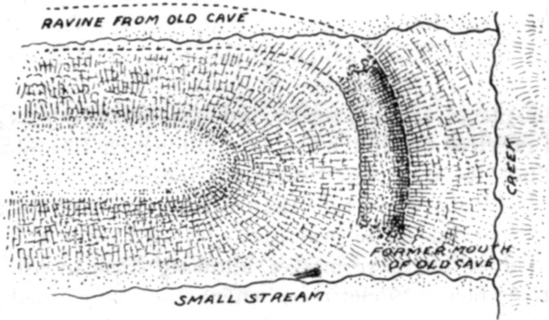
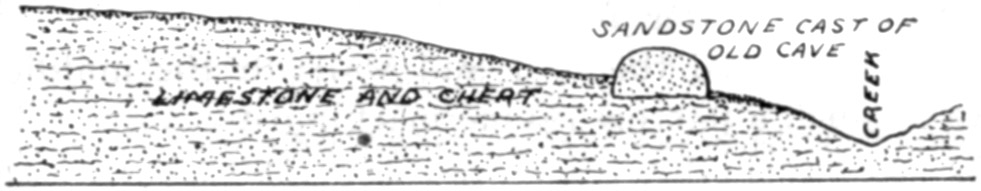
An interesting example of this action is the "Standing Rock," 4 miles west of Linn Creek, the county seat. Here was formerly a large cave with an eastward trend until near the mouth, when it turned sharply southward, the opening being in the direction of a little stream. The lower end of this cave became solidly filled with sand, and the water found an outlet farther back. All the limestone which formed the roof and walls of the middle portion of the cave is gone, a narrow ravine marking its course. The sandstone obstruction held its place, and now extends directly across the ridge between the two ravines. Its surface is an exact cast of the interior of the cave which it filled, and nodules of chert, remaining when the limestone dissolved, are still imbedded in its surface. The line of demarkation between the limestone matrix, where this still exists in part, and the siliceous filling is as distinct as that between the stone and brick in a building. The loose cave earth shows plainly under the sandstone near the former mouth of the cavern. Plan and section are shown in figures 20 and 21.
MILLER COUNTY
WRIGHT CAVE (30)
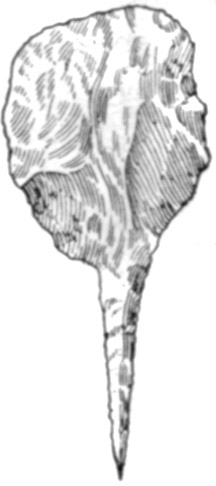
A mile and a half west of Brumley, near Glaize Creek, is Wright, or Brumley, Cave. The entrance is 15 feet high and 40 feet wide. [92]At 20 feet from the mouth the width contracts to 20 feet. The depth is 120 feet in daylight to a stalagmite floor. Dry cave earth extends for 35 feet from the entrance, at which distance it reaches tough, sticky clay; this continues to the stalagmite. Above the clay are growing stalactites.In front of the entrance were a few flint chips, but no indications of pottery or shell. A small implement, shown in figure 22, was found which is of interest because it was worked to a sharp point at one end of a narrow drill, while the other end widened into a squared form with a straight base which was dulled and polished from use as a cutting tool; the entire surface was polished from long service. An object of this kind would be highly suitable for mending moccasins and leggins. Finding this and nothing else strengthens the probability that this cave was used as a temporary camping place, but was never permanently occupied.
WILSON CAVE (31)
Facing Barren Fork of Tavern Creek, on the farm of John R. Bond, 8 miles northwest of Iberia and 12 miles southeast of Tuscumbia, is a cave celebrated by reason of a provision in the will of a former eccentric owner.There is a small cave which has an opening in the bluff, a few feet to one side of the larger cave. This can be reached only by means of ladders 60 feet long.
Jack Wilson came from Ireland and settled on Tavern (or Cavern) Creek in 1822. For a number of years he lived in this cave, with [93]his family. He died in 1855, leaving instructions that his body was to be packed in salt and placed in the small cave, "with a ten-gallon cask of good whisky," the entrance then to be sealed up. In order to carry out his last wishes, and at the same time to give him a "Christian burial," his wife had all his internal organs removed and interred in a cemetery; his body was filled with salt, and placed in a coffin, which, according to his wishes, was deposited in the cave, with the whisky. On the seventh anniversary of his death the whole community was to assemble to "eat, drink, and be merry." For many years residents in the vicinity had used the cave as a place for festive gatherings; but this occasion was to be on a scale beyond anything previously attempted. If necessary, Scriptural methods were to be employed; that is, messengers were to be sent out in all directions, urging every one to come. The floor was to be enlarged, and a platform erected on it. When all were assembled, the whisky and the coffin were to be brought from their resting place and set on the platform. Then certain famous fiddlers were to ascend the platform and play, while the guests danced. When the whisky was exhausted, and the fiddlers in the same condition, the picnic was over and the assembly would disperse. The coffin was then to be replaced in the little cave, which was to be again sealed up, not to be reopened until the Day of Judgment.
The preliminaries were carried out according to program, but when the time for the celebration came round the people were more concerned with the Civil War, and especially in the activities of the bushwhackers who infested that part of the country, than they were in picnics; and Wilson's resurrection was brought about by persons whose identity was never discovered. They got into his tomb in some manner, drank all the whisky, broke open the coffin, and threw Wilson's bones to the outside, where they were scattered down the slope. Horrified relatives gathered them up, replaced them in the cave, sealed it again, and Wilson is still there awaiting his final summons.
The entrance is 20 feet high and 45 feet wide. Dry cave earth extends for 135 feet; from this point it continues, partially filled with fallen rock and stalagmite, 40 feet farther, or 175 feet in all, in plain daylight, at which distance the cave makes a turn; and the cave earth was followed in this to complete darkness without coming to its termination.
Beginning 100 feet from the entrance and extending for 35 feet, a narrow row of loose rocks fallen from the outcrop of stratum along the center of the roof lies on the surface. The cavern here measures 35 feet in width.
[94]There is a wet weather stream along one wall, but the amount of water passing out is never large.
Solid bedrock, with patches of cave earth on it, is exposed, in slightly rising strata, for 10 feet from the little bluff at the mouth; within this it is hidden by the earth which gradually rises to a height of 6 feet; but some of this rise may be due to increased elevation of the rock floor. The entire cave can be easily cleared out to the stalagmite; and it would be advisable to remove at least portions of this in order to ascertain what may lie beneath it.
Refuse appears in considerable quantity in the bottom of the little stream bed and under the receding walls; and likewise a small amount outside the entrance. But the bedrock crops out frequently in narrow ledges between the mouth of the cavern and the foot of the hill, so very little débris of any kind lies on the slope outside.
Some alteration of the surface of the earth floor has taken place in consequence of the construction of platforms; but aside from this it has remained practically undisturbed.
BAGNELL CAVE (32)
A large cavern is near the top of the "Bagnell Hill" on the Bagnell and Linn Creek road, on the right (south) side of the Osage River, and about 3 miles from the town of Bagnell. On account of the "millions" of bats which shelter in it, the name of Bat Cave is applied to this as it is to many other caves in the region.The entrance is so small that the cavern can be entered only by crawling in; and as no traces of Indian remains have ever been observed in it, or around the front, no examination was deemed necessary.
BODE CAVE (33)
Half a mile south of St. Elizabeth is the Ben Bode Cave. The roof has fallen in near the front, leaving the original exterior standing as a natural bridge a few feet wide. The present entrance to the cavern is 40 feet behind the bridge. It has a wet, rocky floor, and much water flows through it after a rain.LUCKENHOFF CAVE
On John Luckenhoff's farm, three-fourths of a mile south of St. Elizabeth, facing Tavern Creek, is a small cave with a rocky floor. The entrance is nearly blocked with a mass of stalagmite, behind which the cave is dark.JURGGENMEYER CAVE
It was reported that in a "cave" on the farm of Conrad Jurggenmeyer, 2½ miles east of St. Elizabeth, a human skull was discovered. [95]The statement may be true; but instead of a cave there is only a tunnel a few rods in length. Beyond the upper arch is an open ravine.DAERHOFF CAVE
On Ben Daerhoff's farm, 4 miles north of St. Elizabeth, is a cavern facing a narrow valley through which a small stream flows to Tavern Creek a mile and a half away. The entrance is 8 feet high and 55 feet wide. It is well lighted to a depth of 120 feet, where it makes a turn. Dry earth extends back for 55 feet; from there on it is muddy. A small stream flows along one wall, from the wet portion of the floor to the entrance; with a little ditching this could be made to drain off all the water, forming a dry bottom to the rear wall. No refuse of any kind could be found, and the owner says he has never observed any either in the cave or in front of it.CAVE NEAR MOUTH OF TAVERN CREEK
In the bluff facing Tavern Creek, half a mile above its junction with the Osage, is a cave with an entrance 10 feet high and the same in width. It has a depth of 45 feet in daylight. The floor is of clay and angular gravel, and so wet that puddles are found near the entrance.BAT CAVE (34)
This is in a bluff facing the Osage, a mile south of the Rock Island Railway bridge. It is not accessible except by means of a ladder or stairway fully 60 feet long. The roof overhangs the entrance, and the floor projects over a shallow rock shelter which reaches for a few rods along the foot of the bluff. A small amount of water seeps from the entrance. Persons who explored the cavern years ago—there is no way to reach it at present—say it divides into three large chambers, mostly dry, and with floors of solid rock or of earth containing much rock.GRAVE AT MOUTH OF SALINE CREEK (35)
Four miles below Tuscumbia, on the left bank of the Osage, is the mouth of Saline Creek which comes in from the north. On the lower (east) side of their junction, on the farm of Charles Tillman, is a low spur projecting toward the creek. On this is a pile of stones, all that remains of a vault or box grave which formerly existed there. Mr. Tillman says it was originally 35 or 40 feet across, a mound or rounded heap of stones, those about the top being larger than those nearer the base. Needing rock for various purposes, he procured them from this pile, beginning at the top to remove them and proceeding outward. In the course of this work [96]he found that a wall had been built up to a height of about 4 feet, forming a practically square inclosure. The space within was filled and the structure entirely covered with rocks of various sizes. He removed the stones as he reached them, and consequently did not notice whether the outer face of the wall was straighter or smoother than the inner face, or whether there was any particular difference. In all, he took away not less than 40 wagon loads of stones.On the level top of the hill from which the spur extends is a village site, where mortars, pestles, quantities of flints, and much broken pottery have been found; but no shell.
STARK'S CAVE (36)
Six miles south of Eldon, on a farm now owned by George Irvin, is a cave which is continuous with a small ravine leading up to it. The entrance is 45 feet wide and 16 feet high; a small stream flows from it, along the foot of the left (northern) wall. This skirts a thin deposit of damp earth, which lies along the southern wall, gradually narrowing as it extends inward, until at 50 feet it runs out at the edge of a shallow pool reaching nearly across the cave. The bottom, except for the earth mentioned, is rocky.The cave was never fit for occupancy.
HOUSE MOUNDS
In an old "History of Miller County" mention is made of a large group of small mounds on a certain man's farm, without giving the locality. It is believed by old residents that this man "lived at one time 2 or 3 miles west of Ullman." If they existed, they were no doubt house mounds.CAIRNS
Several graves, in a group, were formerly on John Tillman's land, 6 miles south of Eugene. The stones have been entirely removed. When the ground was plowed bullets were found under the sites of the cairns.MARIES COUNTY
INDIAN FORD CAVE (37)
This is a fourth of a mile up the river from the bridge crossing the Gasconade, 2½ miles east of Vienna. It is near the top of the hill at the head of a shallow ravine. The entrance, 35 feet wide, can be reached conveniently only near one wall, as a pile of talus immediately in front completely closes the opening; behind it the roof is 7 feet above the floor. If this accumulated material, which has [97]increased somewhat in height within the memory of men now living, were removed to the level of the floor, the main chamber would be amply lighted to its end, a distance of 150 feet. There is a gradual downward incline from front to rear, the floor sloping more rapidly than the roof. After hard rains some water runs into the cavern from the inner slope of the talus; otherwise the floor is perfectly dry for 65 feet, then becomes wet, and near the rear wall there is standing water. It is apparent that a former drainage outlet in this direction is now choked with sediment, brought down perhaps through a branch opening. At 25 feet within the entrance the cavern is 25 feet wide; at 65 feet the distance across is 35 feet, with both walls sloping away like a low-pitched roof and loose earth filling the space under them. At the rear wall the width between the two branches into which the cave divides is 40 to 50 feet. The floor here is clay, with numerous little puddles.Some pottery, bone, and much shell, but no flint chips, are scattered on the floor and for 50 or 60 feet down the slope outside.
The cavern would make an excellent habitation and is well worth excavating.
LACKAYE'S BLUFF CAVE (38)
This is on the farm of Harrison Hutchinson, who lives 10 miles southeast of Freeburg, on the road to Paydown. It is near the top of a bluff facing the Gasconade. Talus has accumulated in the front part of the cavern until it rises within 2 feet of the roof; farther back the cavity is of sufficient height for a man to stand erect, although nowhere more than 10 feet wide. Owing to the talus the interior is in almost total darkness. Were this accumulation removed the roof at the entrance would be 8 or 9 feet above the floor. The cavern may have been occupied, but there are no indications of such fact, although the recent natural deposits may conceal some remains.HURRICANE BLUFF CAVE
Half a mile below Lackaye Bluff, opposite the lower end of an island in the Gasconade, is a rock shelter 85 feet in length, 15 feet high in front, 6 feet high at the rear, and 15 feet deep along the middle portion, wedging out at either end. A large pile of talus in front forms a natural windbreak, and the depression is a favorite camping place with present-day hunters and fishermen. A small quantity of flint chips and many shells can be seen around the wall and for some distance down the slope in front. The site may repay investigation, though there is no great depth of earth.
It is reported that paintings of a deer or elk and other objects are to be seen on the face of a bluff near Paydown.
[98]STRATMAN CAVE (39)
On the farm of Henry L. Stratman, 2½ miles above the Rock Island Railway bridge across the Gasconade River, is a cave near the top of a bluff facing the Gasconade. The entrance is 33 feet wide and 35 feet high. Forty feet back the walls approach each other, forming a doorway or short passage 5 feet wide. Beyond this is a room 18 feet deep and 9 feet across, with a rock ledge or shelf on each side several feet wide and elevated from a foot to 2 feet above the earth floor. This room is well lighted. The earth at the rear is 10 feet higher than at the main entrance. Behind this, in turn, nearly shut off by a large column of stalagmite, is a third room, 8 feet wide, whose earth floor rises rapidly. Were the stalagmite removed, there would be ample light for 20 or 30 feet farther, or about 90 feet in all.Refuse, mostly shell, shows for 100 feet down the hill. There is some shell in the cave, along the walls; but most of the floor is a comparatively recent accumulation of roof dust and small fragments of rock, and is quite dry as far as light penetrates.
The entrance is much more easily reached from the top of the hill than from the foot of the bluff.
The trend and appearance of the reentrant side walls connecting the present entrance with the straight face of the cliff indicates that the earth in the cavern has a depth of 30 feet or more. Should this prove to be the case, here would be a most excellent place to search for evidence of occupation which, whether continuous or not, might bridge the time from the modern Indian to the earliest inhabitant.
Certainly no other cave in Missouri offers such facilities or inducements for careful and thorough investigation with a view to determining the existence of an early "cave man" in this country.
OSAGE COUNTY
RIVER CAVE (40)
This is at the foot of a bluff facing the Gasconade, 2½ miles below Gascondy. It has a solid rock bottom, rising steeply for a few feet within the entrance, and a constantly flowing stream covers half the space between the walls.ROCK SHELTER
There is an excellent rock shelter, 50 feet long, over which the cliff projects for 15 feet, in front and to one side of the entrance of River Cave. On this is a slight depth of earth in which were found some broken bones and shells. The site is an excellent one for camping parties, but has no evidence of other than temporary use.[99]
STEUFFER CAVE
Four miles east of Freeburg, in a ravine, is a cavern popularly known as Beer Cave, being formerly used as a storage room for beer made in a brewery built just in front of it. The entrance is 8 feet wide and 12 feet high. The front chamber, having practically the same dimensions, extends directly back for 50 feet, then makes a turn. The floor is a mixture of clay and angular gravel, with a continuous downward slope from front to rear. Water cracks show that it is sometimes flooded.The place was never fit for living in.
CAIRNS
At the Gasconade River bridge, on the Rich Fountain road, two creeks on the west side, Brush and Swan, separated only by a narrow ridge which terminates abruptly at either end, come in a fourth of a mile apart. Both rise in the same lake, 6 miles from the river, and flow through parallel valleys, thus draining an abandoned ox-bow curve of the stream.On the extreme eastern point of this ridge are two cairns. A fourth of a mile from these are two others; and farther back still more of them. All are now destroyed. They were the usual conical heaps of stone, 18 to 20 feet across.
HOUSE MOUNDS (41)
A group of house mounds extends for half a mile eastward from Rich Fountain, along the valley of Brush Creek. They are fully 100 in number, and it is said there were formerly many more which are now leveled by cultivation. The ground is low, in some places swampy, so that water or mud surrounds many of them after a heavy rain."INDIAN FORT" (42)
This structure, also called the "Indian Lookout," is located on a bluff facing the Osage, half a mile below the "Painted Rock," and near the buildings of the Painted Rock Country Club, of Jefferson City.Except for a slight projection or offset at one side, which contains an opening or doorway, it was practically identical in appearance with the vault graves along the Missouri River bluffs, described in Bureau of American Ethnology Bulletin 37; or else with those on Big Piney River in Pulaski County. It is formed of sandstone slabs, once laid up in a wall but now scattered in confusion as if fallen or thrown down. Apparently it measured about 32 to 35 feet outside and 12 or 13 feet inside.
[100]
COLE COUNTY
NATURAL BRIDGE CAVE
This is at the top of a bluff facing the Osage, one-half mile below the Rock Island bridge. It is only 10 feet wide and the same in height, and extends back 20 feet to a narrow passage which is almost closed by stalagmite. The site is difficult to reach, but disclosed a few fragments of pottery and some shell. The earth of the floor ascends rather steeply to the rear and contains many large rocks. It was only a camping place.MORGAN COUNTY
SPEERS CAVE
On the Brown property, 7 miles southeast of Stover, is a reported cave, which proved to be a natural tunnel 400 feet long. The drainage from several farms passes through it from ravines above. The lower entrance is 40 feet wide and 50 feet high, the upper entrance 20 feet wide and 10 feet high.Natural bridges and tunnels of varying lengths and widths are rather common in this part of the Osage Valley.
HOUSE MOUNDS (43)
Southeast of Stover, beginning at the edge of the town, is a group of house mounds extending over an area having a very irregular outline, but fully half a mile across in any direction. They vary from 20 to 35 feet in diameter and are scattered promiscuously at intervals of 25 to 150 feet. The surface on which they are built reaches over a succession of small knolls and ridges with slopes of 4 or 5 degrees. Most of them are along the sides of a wide, shallow valley draining northward, and of two or three small tributary depressions coming into it from either side, though a number are also to be found beyond the slight watershed which separates this drainage area from that to the southward. They exist in woods, meadows, and cultivated ground, so that some of them retain their original form, others are flattened and widened, while still others are barely traceable. Probably some have been entirely effaced by plow and harrow.[101]
II. CAVE EXPLORATIONS IN OTHER STATESToC
INTRODUCTION
Certain conditions are to be taken into account in deciding whether a cave afforded a desirable permanent shelter to primitive man. It should be accessible; the floor should be dry, at least fairly level, and sufficiently free from large rocks to allow the inmates to move about freely; the entrance should be large enough to permit free passage and to light the interior to a distance that would insure protection from the elements. Temporary shelters or camping places might be deficient in some of these particulars and still be resorted to frequently; but if there were opportunity for choice, a man with intelligence to select a cave in which to live continually would, it is fair to assume, look for one possessing such features.
If such conditions, once established, were free from the mutations of time, the explorer would have but little difficulty in deciding upon a suitable site for his labors. But limestone, more than any other solid rock, is subject to constant erosion, crumbling, and falling; while the soil and loose fragments resulting from such action move downward year by year over the slopes and into any cavities where they can find their way. In the course of centuries the entire aspect of a cave may be so altered as to bear no resemblance whatever to its original appearance. Consequently a careful study must be made of the immediate surroundings, in order to determine what topographical changes may have occurred since the earliest time within which it is probable that man may have existed in that locality. Should the floor, at present, be of solid rock; or covered with only a slight layer of earth; or have a stream flowing over it; or show by marks upon the walls that it is subject to inundation either from adjacent streams or by surface water which finds its way in through sink holes; or be in such situation as to make it apparent that the original bottom was thus flooded in comparatively modern times, even though such may not now be the case—in any such event excavation would be labor wasted. On the other hand, all the necessary requirements for a convenient residence may now be present, and yet result from causes which have begun to operate within the historic period. In other words, there are very few cases in which the present appearance of a cave is to be deemed a certain or even an approximate indication of its actual state a few thousand years ago. There is [102]only one way to determine whether extended excavations may possibly result in satisfactory returns, and that is to sink shafts or run trenches in the superficial deposits.
INDIANA
The cave region of this State extends from Owen and Morgan Counties to the Ohio River. The caverns and sink holes gradually increase in number and size toward the south, until they culminate in Wyandotte Cave, second only to Mammoth Cave of Kentucky in extent, and in the so-called "valleys" of Harrison County which are in reality nothing but sink holes several square miles in extent. Some of the caverns are described in detail by W.S. Blatchley, the State geologist, in the Twenty-first Annual Report of the Survey (1896). Very few of those mentioned by him are at all suitable for permanent occupancy, though several would afford excellent shelter except in the rainy season, at which time most of them have the floors muddy or perhaps covered with water for weeks in succession. Such as were visited in these explorations will now be taken up in their order.LAWRENCE COUNTY
Rock Ledge Quarry.—Early in 1903 periodicals mentioned an interesting discovery made at this place. According to the report, workmen in excavating a cut for a railway found an old cave entirely filled with stalagmite matter. In this, 10 feet below the former top of the cave—the cut did not extend to the bottom of the stalagmite—were discovered some bones which were pronounced by "several physicians" to be those of a human being. Among them was a "jaw tooth" (molar) and part of a skull. Correspondence failing to elicit any satisfactory information, a visit was made to the site. The cave could not be traced in either direction from the railway cut; but it had plainly served as an outlet for several large sink holes on the hill above it. Nothing could be learned here regarding the matter except that the objects had been found and were then in the museum of the State University at Bloomington. This place was next visited and the specimens inspected. There were many fragments still imbedded in the matrix, which was travertine rather than stalagmite. No exact determination of them had been made, but only casual inspection was needed to see that none of them could be human. The "jaw tooth" was from a peccary, the "human skull" was the carapace of a tortoise.Shiloah Cave.—It was reported that, although the entrance to this cavern, 7 miles northwest of Bedford, was in a sink hole, the floor was level and accessible. The opening is almost at the bottom of the sink, whose slope is quite steep. After every rain the water [103]runs in; and while the floor is level, as stated, it has a constant stream of water flowing over it and is in absolute darkness.
Donnehue's Cave.—Although water flows continuously from the entrance, the amount of discharge was said to be small and the cave floor level and covered with earth, while the cave itself was large and well lighted. The approach, however, is quite difficult; the earth is nowhere more than 2 or 3 feet thick, and after a heavy rain the stream extends from wall to wall.
Between Bedford and Donnehue's cave is one, unnamed, at the head of a ravine which was once an extension of the cavern. The opening is of fair size but the floor is of rock and the outflow of water is steady.
Just outside the corporate limits of Bedford, to the south, is an opening in the cliff at the head of a deep ravine, more in the nature of a rock house than of a cave. It would make an excellent shelter for a few persons, being accessible, protected from winds, and close to water. While it may have been so used formerly, the deposit of earth and stone on the floor is very scanty and anything beneath could well be quite modern.
Two caves were reported 2 miles south of Bedford. One is a small opening from which a stream issues, flows across a meadow, and enters the other cave, which is much larger. They are parts of one passage, the roof between these openings having broken down, and the stream is the same which finds its outlet at Donnehue's cave.
Several other caves in the vicinity of Bedford were visited. They are all small and of no importance from an archeological standpoint.
Donnelson's Cave.—"The mouth of the cave is found at the head of a deep gorge worn through the limestone by a good-sized stream which flows from the cave and down the gorge to the broader valley beyond. Many centuries ago the cave extended the full length of the gorge, and the waters of the stream flowed directly from its mouth into the valley. The roof of the underground channel finally became so thin that it collapsed, the gorge was then started, and as the centuries went by grew in length, the cave becoming ever shorter by the continued falling of the roof.
"Three passages open directly into the mouth of the cave. The right hand passage has the level of its floor about 5 feet above that of the entrance, while the opening on the left is 12 feet above the level of the stream and very difficult to enter without a ladder. The middle passage extends straight back from the common vestibule or main entry. The latter is 25 feet long, 21 feet high, and 18 feet wide, but at its farther end is reduced to the narrow middle passage between great masses of limestone. The water in this passage is waist deep and explorations must be made by wading or in a light [104]canoe. One hundred feet within is a magnificent cascade, where the stream rushes and leaps down a narrow passage with such violence that the noise is plainly heard at the entrance.
"The right-hand passage for the first 100 feet is about 10 feet high by 15 wide, with a clay bottom and a roof on a level with that of the vestibule. It then expands into a large room, 230 feet long and 40 feet wide, which lies east and west at right angles to the entering passage. This narrows at the west end to 20 feet, and at one point the outer air flows in through a small opening in the roof. From near the small end of the room a narrow passage starts off to the southward and can be traveled for 200 feet, when it becomes too small for further advance. Along this passage a small stream flows, disappearing through a hole in the floor near the entrance to the larger room. Other than this, both right and left passages leaving the main entry are dry.
"The passage at the left of the main entrance to the cave is about 150 feet long by 20 broad, and contains no points of especial interest." [W.S. Blatchley.]
It may be added to the above description that a heavy rain causes a rapid rise of several feet in the stream through the middle passage.
The cavern is situated 3½ miles east of Mitchell. It has been fitted up by the State University as an experiment station for the study of underground fauna and flora.
The branch to the right is never entirely dry. Throughout the year water trickles or seeps over the stones and keeps the mud soft and sloppy, while after extremely heavy rains the water may be 2 or 3 inches deep for a short time—enough to keep all the earth washed from the floor for 50 or 60 feet from the entrance.
The northern or left branch presented a smooth, solid floor of rock at the beginning. The roof is about 13 feet above the floor, being a flat stratum broken by a joint-seam along which there is a slight fault. A ledge of friable sandstone 3½ feet thick lies next below the roof. The disintegration of this gave a dry covering to the clayey earth which covered the floor almost to the extreme edge of the rock overhanging the stream and gradually rose toward the rear, where it entirely filled the space from floor to roof. The distance between the side walls is 8 feet at the mouth. They diverge slightly, and at 65 feet are about 12 feet apart. Here they separate more sharply, forming a chamber 30 feet in diameter, measuring on every side to the contact of the earth and the roof. At the extreme rear a slight wash or depression in the earth revealed the top of a vertical solid wall, thus marking the limit of the cave in that direction. It seems, however, to extend farther to the east and the west than it can now be followed; in fact, the indications are that at one time a considerable cross-cavern extended along this line.
[105]The work of clearing out this branch began at the entrance. The superincumbent earth was removed by a trench whose boundary was the solid rock on each side until the cave widened to more than 8 feet between the walls; then a width of 7 to 9 feet was excavated midway between the sides, the entire trench having a length of 92 feet, or reaching nearly to the vertical wall at the rear. For about 60 feet the earth was removed to the rock floor. At this distance the floor dipped. The bottom of the trench continued to follow the same level it had held to this point, in the belief that the dip in the floor was due to a crevice or slight erosion channel and would soon disappear, bringing the rock to its normal position. This was not the case; several holes were dug, the deepest one 3 feet, into the mingled clay and rock, without finding any evidence of a solid bottom. The conclusion seemed certain that the passage leading from the entrance of the cave to the large room at its farther end was only a tributary or branch of a cross-cave extending in an east and west direction, as intimated above. Prof. Eigenmann, of the State university, reached the same conclusion through surveys not connected with this work. Under the circumstances further digging seemed useless; for if this should be a cross-cave the bottom would probably, almost certainly, be on a level with the stream now flowing through the central passage, while if it should prove to be only a cellar-like deepening, it would not be utilized for a habitation.
At 30 feet from the entrance the accumulated earth had a thickness of 6 feet; from there it rose gradually to the roof at the end.
At 37 feet, in a pocket of coarse sand on the rock floor, such as settles in a gentle current, were four fragments of bone. There is not enough of them to identify with certainty, but they seem to belong to a deer, a turkey, and some bird about the size of a quail.
At 66 feet in, a foot lower than the surface of the bedrock (being 5 or 6 feet beyond the above-mentioned dip), were small fragments or particles of charcoal, or what had every appearance of such. They were in earth that showed the lamination or stratification due to successive water deposits, and had been introduced in the same manner. The entire earth deposit below the sand capping showed this lamination, sometimes horizontal, sometimes curved, proving a long period of deposition. Further evidence of age is found in the travertine, 7 inches thick, that occurs on top of the earth at the back of the cave.
In the absence of all other evidence the specks of charcoal can not be accepted as proof of human life in the vicinity at the time these deposits were forming.
While the work was in progress three students from the university came through the central cave in a small boat, having entered through a sink hole 3 miles away in an air line. At some point of their course [106]they lost their lanterns and made the remainder of the journey in absolute darkness, feeling their way along the walls, dragging or carrying the craft over shallows, and at one place lying flat in the bottom and propelling the boat by applying hands and feet to the roof, which was less than a foot above the water.
MARTIN COUNTY
Various caves are reported in the vicinity of Shoals. Those whose location was clearly given are merely "rock houses" or recesses in the Carboniferous conglomerate bluffs bordering the east fork of White River. Some of them would make fairly good shelters, but all which can now be examined are at so low a level that the river gets into them or very close to them in flood periods. Consequently there is no probability that ancient remains are to be found in them. Some of the shelters higher up on the cliffs may have been utilized, but the bottom of these is now covered with huge blocks, some weighing a hundred tons. It is true that such rock houses, in all parts of the country, were regular resorts for modern Indians, and they probably furnished shelter to the earliest inhabitants of this region, no matter how remote the period of occupation. But owing to their open front and the exposed situation of most of them, it is quite possible that the wind may remove the fine material falling from roof and sides almost as fast as it is deposited. At any rate the débris on the floors is seldom more than 3 or 4 feet deep, and articles very plainly of no great age are frequently found at all levels in it.In a few places along the river bluffs limestone crops out beneath the sandstone, and springs occasionally appear along the line of junction, eroding small cavities, but these are subject to overflow, and none of them has an opening large enough to enter without crawling.
ORANGE COUNTY
Vicinity of Paoli.—From this town six caves were visited, all that could be located by diligent inquiry. None of them has any particular designation except "Mill Cave," which is so named because the stream issuing from it furnishes power for a flour mill. The water covers the floor at all seasons.One, though quite small, could have been occupied at a former period, but the roof and front fell in some years ago, entirely closing it.
A third has a small entrance on a hillside. A steep and rough descent was followed beyond reach of daylight without coming to a level bottom.
The other three are very small with rock bottoms.
[107]French Lick Springs.—Two or three miles from this place is "Star Cavern," which is advertised as being of great size and beauty. The immediate surroundings are quite romantic and deserve the praise accorded the spot by visitors. The cave itself, however, more resembles an artificial tunnel than a natural result of erosion. The floor is clean rock with a little brook flowing over it.
Two other caves not far from Star Cave are dry, but with solid rock floors, so they were not visited.
Orangeville.—Near this place are the so-called Gulfs of Lost River. The stream sinks a few miles east of Orleans, emerges at the "Gulfs" from one side of a very large sink hole with precipitous margin, and immediately goes out of sight again in a deep pool or chasm. It reappears a mile or so away at the foot of a cliff where, after heavy rains, it boils up like a gigantic fountain. Numerous small caves or sink holes exist in the neighborhood, three of which were reported as being dry, lighted, having good entrances, and well suited for habitancy. One of them is at the bottom of a sink hole on a hill. The descent is steep and rocky for 20 feet (it was not followed farther) and no doubt so continues to the level of the river which flows almost directly under it.
The two others are in the principal "Gulf." They are open and of good size, but mud high on the walls shows they are filled with water in wet seasons.
CRAWFORD COUNTY
Marengo Cave.—This is growing famous as it becomes better known. Blatchley says that in it "are probably crowded more beautiful formations of crystalline limestone than in any other known cave of similar size in the United States." Visitors who have been in both say it surpasses Luray Cavern in the magnificence of its sheets and columns of deposited material.As it was not opened until 1883, and the bottom can be reached only by a stairway 60 feet high, it was of course unknown to the aborigines.
A small cave near Marengo has an opening on a hillside, and can be directly entered from the outside; but it is at times a passageway for a strong current of water 3 feet deep and extending the full width of the cavity.
Milltown.—A mile north of the town is a large cave which would furnish an abode for scores of people. The entrance is in a slight depression on the level upland west of Blue River. The descent is down an easy slope of fallen rock and earth about 30 feet deep to a rock floor. Beyond the foot of the slope there is a slight thickness of earth, so that explorations could reveal nothing that had a certainty of antiquity.
[108]There is presented here a fine example of the manner in which caves of this character become exposed to the upper world. At first, there was an underground channel draining the adjacent country over a territory of varying extent, sometimes many square miles. At some point the roof fell in more rapidly than in other parts, until at last it became so thin as to give way entirely. If the débris was not sufficient in amount to extend above that part of the roof which remained intact on either side, so that it would be gradually carried away, the cave would remain open in both directions, as is the case at the "Gulfs" just described and at other caves statements of which appear in subsequent pages. Usually the débris quite chokes up one side and all the superficial drainage is turned into the other, which is thus kept open. In time, the slope around the depression becomes tolerably uniform except close to the entrance, and there is no outward indication that the cave ever extended farther than the spot where the new entrance is located. So the cave, as it is now open to examination, is only a portion of the original passage, and as the explorer pursues his way, he may be going toward either the former mouth or the source. In the former case, he comes out of a large opening, or what was formerly such, on some slope in the neighborhood, or descends until his way is obstructed by water. In the latter, he may find his way shut off by diminishing passages, or he may descend to lower levels through newer drainage channels cut by the streams which have been reversed and forced to carve other outlets for themselves.
This change occurred in the Milltown Cave a very long time ago. Standing on the débris, several feet within the entrance and beneath a part of the roof now perfectly dry and showing no marks of percolating water, is a stalagmite 31 inches in diameter, which has weathered to a depth of 3 to 4 inches from atmospheric influences alone.
Wyandotte Cave.—So much has been printed concerning this celebrated cavern that no mention need be made of its interior features. The place seems excellently adapted as a habitation for primitive people. It is situated on a hill at whose foot is the bank of Blue River. Five miles away, as the road runs, is the Ohio. The backwater sometimes reaches up the tributary for more than 10 miles. The flint-bearing stratum of the Harrison County aboriginal quarries outcrops a short distance away and appears at several points within the cave. The country is extremely rugged, and good springs occur frequently. Game was formerly abundant in the hills, and Blue River still rewards the angler with various species of fish, many of them of large size.
A former race, presumably the modern Indian, did much work within the cave. Tons of travertine or stalagmite, the so-called [109]alabaster, have been quarried from some of the deposits, while a large number of flint nodules has been dug out of the cave-earth where they fell from the disintegrating limestone. Some of this labor was carried on more than a mile from daylight.
The mouth of the cave was formerly almost closed by a mass of talus. About 10 feet has been removed from the top of this, so that one may now walk in without difficulty. On the inner side of the portion remaining there is a slope for 96 feet, to a vertical depth of a little more than 27 feet. The next 100 feet gives a descent of about 3 feet; then another steep slope begins. The first point at which bedrock floor is found within the cave is 120 feet lower than the point of entry. It is supposed that the drainage to which the cave owes its origin was outward; if this was the case the floor must be more than 120 feet below the roof at the doorway. While this may be true, it is not indicated by the condition of the visible strata. For about 50 feet outward the side walls are nearly parallel and nowhere more than 30 feet apart. Then they terminate at an angle in the outcrop of the ledge along the hillside. The appearance and condition of the upper strata, together with this narrow separation of the side walls outside the cave, produce the impression that at a period not very remote the roof of the cavern reached to the outcropping ledge in which the walls end. Even though the rock floor should be at the great depth supposed there is a possibility that an earth floor could be found below the detritus which has accumulated since the roof fell in or has worn away.
To test the matter a shaft was begun at a point 16 feet in front of the doorway. This was as near as such work could be done without interfering with the advent of visitors, and allowed a margin of 30 feet toward the outer slope. The shaft, 6 feet in diameter, soon passed into a compact mass of red clay filled with rocks of various sizes. At 14 feet down this was broken by an irregular stratum averaging a foot in thickness, of coarse sand or fine gravel with a slight admixture of clay, such as would form in a running stream. Its slope was inward or toward the cave. As there are sandstone ledges on the hillside above, this sand may have come from them, but, if so, it is singular that none appeared elsewhere. At 18 feet down was a mass of travertine measuring nearly 3 feet across and from 6 to 12 inches thick. It had formed around the lower part of a stalagmite 18 inches long, and the bottom of the whole formation rested horizontally on clay. This gave the excavators hope that an earth floor had been reached, as the stalagmite was vertical and resembled in all respects stalagmites in the cave. But it was soon found to be a foreign inclusion, and the same confused mixture of clay and stone continued below as above. Various fragments of stalactites and stalagmites were found as part of the [110]detritus. These, especially the vertical one, seem to confirm the supposition that the roof reached out this far at a period which is quite recent as compared with the age of the cave.
To a depth of 25 or 26 feet the task of excavating was as tedious and difficult as digging up a much-traveled, rocky road, the earth being dry enough to scour the shovels. Then the earth grew moist and within 2 feet was muddy. Cavities appeared, into some of which a switch could be thrust 3 or 4 feet. Where such a cavity extended under a large stone, stalactites were in process of formation. Soon the earth began to work into a soft mud under the feet of the workmen, and at 32 feet particles and small clods were noticed falling from the sides of the shaft. A foot lower this breaking away became more decided. It may have been due merely to the loose condition of the wet earth allowing unsupported portions to fall from the freshly exposed surface, but there was also the risk that the softer earth was sliding under the weight of that above. The workmen, two of whom were experienced well and cistern diggers, declared the risk too great and demanded to be brought to the surface.
The depth reached by this shaft was at least 5 feet lower than at any point inside, within 200 feet of the mouth of the cave. The material, with the exception of the sand layer, was almost identical from top to bottom, there being no apparent difference other than increase of moisture in the lower part. The only explanation suggesting itself at present is that the chasm is filled with large loose rocks up to a point near the bottom of the shaft; that débris from the hillside above has covered these more rapidly than it could settle in the crevices and cavities among them; and that water which makes its way downward finds some obstruction to its free passage out at the bottom of the chasm.
The only safe plan of excavation seems to require the removal of all the earth between the side walls to a depth below the mud. If the rock bottom, or any solid bottom, is at a depth of 120 feet, there is small chance that man lived in this region at a time when it was easily accessible.
Saltpeter Cave.—This is about 600 yards northwest of Wyandotte Cave. "The entrance, in a side of a ravine, is 5 feet high and 19 feet wide. Once within, a gigantic room expands, 220 feet long, 75 feet wide, and 10 to 30 feet in height, with smooth flat ceiling and earthen floor, the latter descending and with its edges much encumbered with fallen rock." [W.S. Blatchley.]
From the description given, this would seem an ideal site for research. Unfortunately, the bottom of the ravine is not more than 5 feet lower than the top of the talus at the entrance. This slight [111]elevation is the only barrier which keeps the surface water from flowing in, and while the ravine seldom has any water in it, there would be enough after a moderate rain to drown out the diggers who were working below its level if the bank were removed.
Little Wyandotte.—This, like three caves on Blue River above Wyandotte, four in the vicinity of Leavenworth, and one on the opposite side of the river in Meade County, Ky., has a small entrance in solid rock, with a steep and narrow passage to the foot of a slope which does not expand into a room of any size until at some distance beyond daylight.
HARRISON COUNTY
The only cave of any note in Harrison County is at the King quarries, 5 miles east of Corydon. It has two outlets, one at the foot of a little cliff, through which a fine spring has an exit; the other in the face of the cliff, about 10 feet higher and a little to one side. The latter discharges more or less water after every rain. The drainage of several large sink holes is through the two openings. The owner says mud has accumulated to a depth of 3 feet on the floor within his remembrance, due to cultivation around the sink holes, which causes the soil to waste.ILLINOIS
MONROE COUNTY
Mammoth Cave.—The so-called "Mammoth Cave of Illinois" is near Burksville, in Monroe County. An opportunity was afforded to visit it while engaged in the cave work. It is very extensive, according to the owner's description, being "7 or 8 miles long." The mouth is at the bottom of a sink hole, and the cave is now reached by a narrow stairway 40 feet high. Formerly it was necessary to clamber down the walls, stepping from ledge to ledge with a foot and a hand on either side. Then a ladder was made, said to have been 50 feet long; and, with more frequent visitors, the stairway followed. The crevice is very short, a mere crack, apparently made by water working its way down from the bottom of the sink. All the drainage within the rim goes into the cave, and it accumulates in the rainy season until the floor is covered. A farmer living near says he has seen the water from the cave rise until it covered the bottom of the sink hole. As similar depressions are numerous in the vicinity, probably the combined inflow is greater than the cave can carry away. The floor has been leveled and a close pavement of large slabs laid over the muddy portions. No one has ever heard of human remains being found anywhere in the cave.[112]
KENTUCKY
Crossing the Ohio River from the southern Indiana cave region, the counties of Kentucky lying in the belt of lower Carboniferous limestone were next visited. No cave that seemed worth examining could be heard of above the extreme southern portion of Hardin County. The sections examined will be taken in their geographical order from north to south.HARDIN COUNTY
Hutchins or Bradley Cave.—This is in the bluff bordering on the left bank of Nolin River, 2 miles west of Upton. It was reported that human remains had been found in it. The present owners, who have known the cave for a long time, never heard of any such finds. The entrance is low and narrow, so that access to the cave is to be had only by creeping several yards. The cavern then expands into a very large chamber, separated into three by curtains or partitions of stalactites and stalagmites. Very little of floor, roof, or walls is to be seen, being almost entirely covered by secondary deposits. Some of these are remarkable for size and beauty. There is no probability that the cave was ever inhabited.Saltpeter Cave.—This is 3 miles southwest of Upton. It has a large entrance and an earth floor, but the dirt has all been worked over for making saltpeter, so there is nothing to search for.
HART COUNTY
Laird's Cave.—About 2 miles north of Northtown is a large, roomy cave, with a good entrance, but water drips from all parts of the ceiling, and the floor is muddy and rocky. The drainage from 3 or 4 acres of hillside flows over the arch of the entrance and logs 6 inches in diameter are carried into it by the surface floods.Lock's Cave.—This is a mile east of Rowlett's Station, near the top of a ridge, and lying nearly parallel with its crest. It affords another instance of a cave which has come to light only after a portion of its roof has fallen in. The detritus entirely conceals the opening at one end. The other end is entered by going down the fallen rocks over a slope of 15 or 20 feet, which leads to a bottom strewn with rocks. In such cases there can be nothing under the loose material, because the cave had no entrance until this had fallen in.
Garvin Cave.—This cavern, which is 3 miles southeast of Munfordville, has an opening at the bottom of a sink hole, requiring a rope or ladder for descent.
Harlow Cave.—This is 3½ miles southeast of Munfordville. It is a very large cave, apparently, as the slope down the débris is more [113]than 40 feet high, to a rocky shelf, beyond which the descent was followed some yards without finding any indications that a level bottom was near. It is another illustration of the fallen roof.
Wynne's Cave.—Three miles south of Rowlett's Station is a large sink hole. Stones thrown into the vertical shaft at the bottom can be heard striking the sides for three or four seconds before coming to rest.
Wash. Rowlett Cave.—On "the old Lewis Martin place," 1½ miles west of Rowlett's Station, a section of roof, 20 or 25 feet across, has dropped into a deep cavity. The sides are still insecure. The descent to a spring under what appears to be the original roof is somewhat more than 40 feet. The ceiling is not more than 6 feet high.
Steffy's Cave.—Four miles southwest of Munfordville between 200 and 300 feet in length of the roof of a high and wide cave has fallen in. Ice remains in this cave until May or later every year.
Joel Buckner's Cave.—About 10 miles northeast of Munfordville is a large cave with the entrance on a hillside. The roof has evidently extended several rods farther out than at present. The front part of the cavern is wide and high, but is now nearly filled with débris. The roof slopes at about the same angle as loose material within, there being not more than 3 feet of space between the two at any place nearer than 30 feet from the present mouth. Rocks thrown back showed the same uniformity of slope to continue at least several yards and the depth there to be about 20 feet below the top of the detritus at the mouth. This cave was suitable as a habitation before the material now choking the mouth had accumulated, provided water was obtainable. The nearest spring now is more than a mile away. An exploration would require, as a preliminary, the removal of several hundred cubic yards of compacted rocks and clay.
Harry Buckner Cave.—Half a mile north of the cavern last named is another with a very narrow entrance. The floor, which slopes downward, is solid rock in part, and the place is not adapted for occupancy.
Cub Run Cave.—Cub Run is a little settlement 12 miles west of Munfordville, near the Edmonson County line and about equidistant from Green River and Nolin River. Two miles in a direct line south of the village is a cave or rock shelter which has much local notoriety from the fact that three skeletons were found in it. They were imbedded in mixed ashes and earth and accompanied with several pestles, bone perforators, three flint knives, a small celt, and part of a clay pipe stem. One of the skeletons was that of a child not more than 8 or 10 years old. It has been pronounced the frame of a white [114]child on account of the shape of the skull, but is more probably Indian, as the three were found together. Two of the bodies had been laid side by side; the other was near their feet at a right angle to them. In the back of the child's head is an incision somewhat over an inch long. The skull is slightly fractured downward from one end of this cut, and the corner or angle thus formed in the bone is pressed outward.
A flint implement found almost in contact with the skull fits closely into the aperture and may have produced it, as the form of the wound could have been thus caused.
The cavity or chamber of this cavern is about 100 feet across in each direction. There is a small opening near the back which has been examined to a distance of 75 or 80 feet, being there obstructed by large blocks of sandstone similar to those which fill the space from floor to ceiling along the back end of the shelter.
There is another very large block just at the entrance, in which are one shallow and two deep circular depressions which were probably mortars. Bones of deer, bear, and other animals have been found within a foot or two of the surface both outside and inside of the cave. Contrary to what is usual in sandstone cavities of this sort, the outside earth slopes upward from the entrance and after heavy rains considerable water flows into the cave. This makes the earth on the floor quite sticky at times, although it is mainly sand, containing very little clay.
The skeletons were found at a depth of about 16 inches, close to the side wall. A small trench dug where they were unearthed showed, in succession, a layer of ashes 4 or 5 inches thick and not more than 3 feet across, a foot below the surface of the floor; a few inches of earth; a layer of ashes an inch thick, at two feet; below this, yellowish undisturbed sand, apparently fallen from the sandstone roof, and continuing to the rock floor, which was about 32 inches below the top.
Another trench was dug about midway across the cave and the same distance from the front as the skeletons were found. This was on or close to the line of heaviest drainage into the cave and the earth was so wet as to be very sticky. A few little patches of what appeared to be ashes but which had not resulted from fires made on the spot, three or four broken mussel shells, and a chip of flint were found in the first 18 or 20 inches. More than this amount of earth could easily have washed in since they were left here by modern Indians. Below this level the earth contained not the slightest object of human origin, to the rock floor which was found at a depth of 6 feet. On the rock was nearly pure sand, probably the result of disintegration; some clay lay on this; then the mixed loam, sand, and clay composing the outside soil.
It would appear that this cave was utilized as a place of shelter at irregular intervals by Indians in tolerably recent times; that at least [115]one of those found, perhaps all three, had died or been killed during a somewhat protracted sojourn; and that only a slight covering of earth, if any at all, had been placed over them.
Two similar caves are within 8 or 10 miles, but were not visited.
EDMONSON COUNTY
Mammoth Cave.—For miles from the entrance saltpeter workers have dug down to a level where the amount of loose rock rendered further excavation too expensive. In many places walls of stone are piled against the sides of the cavern. They were among the earth that was removed and have been so piled to get them out of the way.As far back as "Chief City," 3 miles from the mouth of the cave, the floor is littered with fragments of canes (reeds) and saplings, which, from the appearance of the ends, were broken, twisted, or bruised off with blunt tools like stone hatchets. Most of those remaining are lying on massive loose rocks now forming the floor, though the ends of some are seen projecting from beneath stones much larger than two men can lift. It is possible the latter have recently slid or slipped from higher up the slopes, but the indications are that they have dropped from the roof since the time of these early explorers. If this be the case, it points to a considerable antiquity for the remains, because no such downfalls are known to have occurred since the cave was first explored by white men.
So much work has been done about the entrance of late years for improving the approaches that excavation would be useless, even if allowed, unless carried to a depth of more than 20 feet. Such work would greatly interfere with the plans of the management.
White's Cave.—This is about three-fourths of a mile from Mammoth Cave. The entrance, quite small, is near the crest of a ridge, and the floor descends abruptly. Only a narrow chamber exists within reach of daylight, and the cave is wet all the time a short distance back.
Colossal Cave.—It is said to be 4 miles from Mammoth Cave, but is really only a little more than 2 miles. The present entrance is entirely artificial, the descent to the floor being about 120 feet. The original entrance was in a crevice which explorers descended by means of ropes. It is said that another entrance is known to one man who, however, has to crawl a long distance.
Salt Cave.—This is 4 miles from Mammoth Cave, though belonging to the same company. The entrance is at the bottom of a conical sink hole draining about an acre. Not much water runs into the cave from this cause, as the surface slopes outward from the margin except on one side, where a ridge leads to the hills. A spring which comes out near the top of the sink falls over a ledge at the bottom [116]into the entrance to the cave. It is said that this water soaks into the ground within a few rods and that just beyond are large, dry rooms, well adapted for habitation, which formerly contained many evidences of aboriginal occupation. Exploration is impossible now, as the entrance was effectually closed some years ago by throwing in logs, brush, rocks, and earth, in order to protect the formations from relic hunters. The water from the spring falls directly on and flows into this, and can not now be turned aside. Even if it could, all excavated material would have to be carried up a steep slope and deposited in the field surrounding the sink hole.
Dixon's Cave.—It is supposed, with good reason, that this was at one time connected with Mammoth Cave. It can be easily entered, through a large crevice, where the surface rock has fallen in. Approach to the bottom is down a steep and rugged slope of about 60 feet vertically. Within, no earth is visible, it having been entirely removed by saltpeter miners, who left the rocks piled in great rows from side to side across the cavern.
Mammal Cave.—This is so named because a tusk was formerly exhibited at the hotel which was reported to have come from here. It was afterwards learned that the specimen was imported from another State. The cave is small and damp, not suitable for living or even for stopping in.
Proctor's Cave.—This is 6 miles from Mammoth Cave. The present entrance is artificial and so far as could be learned the cave is a recent discovery.
Haunted Cave.—The name is given to commemorate the fact that human bones were found in it. Physicians, it is said, pronounced them bones of a white person. The cave, which is on Green River, some miles below Mammoth Cave, was not visited, as the entrance is described as a crevice through which a man has difficulty in squeezing his way, while the interior is nowhere more than 8 feet wide. The cave soon connects with another narrow vertical crevice which reaches the surface at the top of a ridge.
Briggs's Cave.—About 6 miles west of Cave City, and 4 miles west of north from Glasgow Junction, is a cave on land of Ike Briggs, which was described as fit for habitation. Its entrance is in a small sink hole, on a hillside. The approach is easy, and entry not difficult; but the cave receives the drainage of several acres and the floor is always muddy.
Poyner's Cave.—This is a mile east of Briggs's. While a large cave, the entrance is at the foot of a sink hole an acre in area. It is necessary to stoop for some distance on entering, and the bottom here is rough and wet. Farther in it is dry and roomy—so much so, that people in the neighborhood use one chamber as a "ballroom." This part is some distance beyond daylight. As in all caves which [117]are entered from a sink, it would be very difficult to dispose of any excavated earth, as it would have to be carried up the steep slope to the outside.
Short Cave.—Chaumont is a station on the road to Mammoth Cave, 3 miles from the Glasgow Junction. The cavern, which is so named from its limited extent as compared with Mammoth, is a mile from the station. The entrance, reached by a winding way along the ridges, is on one side of an irregular depression comprising 3 or 4 acres. At present there is a heavy bank of earth, several feet high, across the entrance, nearly closing it to the top, except at the middle where a wagon road has been cut through to allow fertilizers for mushroom beds to be hauled in. This earth, so it is stated, was not there when the cave was discovered, but has been carried from the interior partly by saltpeter workers, and partly by the present owner in order to cover up some rocks and to make the floor smooth and level. In front of the cave and of the earth piled at the entrance is a level space of 25 or 30 feet to a deep sink hole. Some water and mud, in time of wet weather, runs into the front part of the cave but its effect is not noticeable for more than 30 or 40 feet. Beyond this is a reach of more than 200 feet of perfectly dry level floor. It was not so smooth before some grading was done for the mushroom beds, but was at no time rugged or difficult to travel over. At 300 feet from the entrance is a slope about 20 feet high, at the foot of which begins another floor so dry as to be dusty in places. Whether this apparent thickness of 20 feet is of earth, or earth and stone mixed, or is indicative of a dip in the rock floor, is not known, as no excavation has ever been made except for the plant beds. There is a slight descent, not more than 3 or 4 feet, from the entrance to the point where the flood water seems to reach. This is seemingly due altogether to the wash. The width of the cave is about 50 feet, and notwithstanding the partial closure of the entrance there is sufficient light as far back as 200 feet to enable one to read ordinary print. So there is ample room within reach of daylight for several hundred people to gather without inconvenience.
The owner, Capt. J.B. Briggs, who lives in Russellville, has granted permission to make any excavations desired, provided the floor be left in good shape when done. It is evident that any satisfactory examination will demand a large expenditure. If only a preliminary trench were made, the necessary slope would require a considerable width at top, while if anything should be disclosed that called for extensive research, the earth must be wheeled or otherwise removed to the sink hole in front, and the whole floor brought to a nearly uniform level.
[118]So far as appearances go, this cavern is better adapted for occupancy than any other which has been examined. The depth of earth shows it to have been open for a long period. If nothing can be found here, denoting extreme antiquity of man, it would seem useless to make further search in central or western Kentucky.
Bear Creek.—A very large rock house is on the right bank of Bear Creek, 3 miles above its mouth. It would afford good shelter to a large number of people, except in rainy seasons when they were most in need of it. After heavy storms the creek covers the entire floor.
Other rock-shelters exist along Green River above and below Bear Creek. They are not worth investigating. Some are flooded; others difficult of access; still others become muddy after rains; while in none of them is there any great depth of earth.
WARREN COUNTY
Crump's Cave.—A mile north of Smith's Grove is a large sink hole, from one side of which extends a cave nearly a mile long. There is abundant room and a good light near the front, and it is reported that quantities of ashes were formerly to be seen on the earth a short distance in. A considerable outside area drains into the cave, and the floor at the present time is everywhere so wet as to be quite muddy. Much water also falls from the roof. A hydraulic ram, not far from the entrance, formerly forced water from one of these falls to the farm residence. A descent of 6 feet, over large rocks and wet earth, brings one to the nearly level floor, 40 feet from the mouth. The amount of flood water running into the cave is indicated by a gully 4 feet deep and the same in width, while trash and driftwood litter the floor from wall to wall for more than a hundred yards.Thomas Cave.—This is a mile north of Bowling Green. The roof of a cavern has fallen in and forms a high mound of rocky débris, down which a path winds on each side, giving access toward either end of the cavern. There is scarcely a possibility that it was ever occupied.
Mill Cave.—Three miles south of Bowling Green a stream emerges from the foot of a slope, flows a hundred yards through a canyon-like open channel, and disappears under a cliff. This is another instance of an open cave due to a falling roof. The open end is large and forms an excellent shelter for cattle. On either side of the stream, under the cliff, is a shelf or projecting ledge, covered with loose stones. Neither is 2 feet higher than the water level in a wet season.
[119]
BARREN COUNTY
Payne Cave.—This, also known as Saltpeter Cave, is near Temple Hill, 9 miles southeast of Glasgow. The bluff in which it is situated is a conglomerate limestone, rising from the waters of Skagg's Creek. The cave has three different entrances, 100 feet or more apart, and each entrance is broken into three or four by columns or masses of stone that have resisted erosion. None of the entrances is large, or opens into spacious chambers within daylight. Flood marks are visible in all, and it is said that after prolonged or heavy spring rains the water covers the floors.Ben Smith's Cave.—This was discovered while digging out a fox den. It is a tunnel-like cavity, not more than 6 feet high or wide, and not suitable for habitation. It lies a mile and a half south of Temple Hill.
Ford's Cave.—This is between Freedom and Mount Hermon, about 14 miles southeast of Glasgow. Originally the entrance was about 8 feet high and 20 feet wide, and opened into a well-lighted chamber probably 40 feet wide and 60 feet long. The floor was of earth and level, with ample space between it and the roof, as shown by marks on the walls, for people to move about readily in any part of the room. The entrance is now artificially closed by earth and stone, except for a space 4 feet square in which a door is hung. Old men in the neighborhood claim they can remember when the floor was 20 feet lower than at present; a manifest impossibility, for that measure would bring it several feet lower than the bed of Mill Creek just in front of the cave. They also claim that blocks of conglomerate and travertine 5 to 10 feet in each dimension have formed from "drip" within their recollection; which, if true, would prove these persons to be almost contemporaneous with the cave men. The more probable statement is also made by them that in early days saltpeter workers dug up and leached all the earth in the cave, filling the entrance and the narrow space before it with the leached earth from the front part of the cave and throwing that from farther back into the cavities and pits left by the prior workings. Inside the cave, near the entrance, is a never-failing spring whose waters flow through a short, narrow crevice at one side. While easily accessible, the water does not reach any of the earth floor.
This would have been an excellent site for aboriginal residence, but there is now no undisturbed earth within daylight nor for some distance beyond, and no one can remember that anything of an artificial nature was ever exhumed.
The Esmith Caves.—Two caves situated on Peters Creek near Dry Fork post office, 14 miles southeast of Glasgow, were reported to be admirably suited for shelter purposes. The smaller is not more [120]than a foot high, from floor to roof, and is filled with flood water after every heavy rain. The larger is above flood line, but the entrance is not over 2 feet high, and the "cave" is scarcely sufficient for a sheep shelter. If the floor were cleared off to a depth of 4 feet from its present level, it would be covered whenever the creek reached high-water mark.
Bone Cave.—Five miles east of Glasgow human bones were found in a cavern. Particulars could not be obtained. The cave is on a hillside and is entered through a narrow crevice by straddling the walls or going down a ladder. Rocks and trash form a mound in this, the top being 15 feet below the outside surface. On either side of this mound one can make his way continuously downward to darkness, and a rock thrown ahead can be heard going on down some distance over loose stones. If human bones were ever found in here, either they were thrown in or some person fell in and was unable to escape.
Slick Rock Cave.—This is near the post office of Slick Rock, 7 miles east of Glasgow. The entrance is in a narrow crevice at the brow of a low hill. The descent is steep and rugged to beyond daylight.
Love's Cave.—This is located on Dr. Love's farm, 3 miles north of Slick Rock. It is now used for storing apples and potatoes. The entrance is through a large sink hole, formed by the falling in of the roof of a cave which was at least 50 feet wide at this point. As is usual, the débris has blocked the cave in one direction. Descent is regular, though steep, along the slope into the other end of the cave. The floor is wet and muddy the entire year on account of the drip from roof and overhanging rock at the mouth. The vertical distance from top of the débris to the level floor is about 30 feet, and from the top to the outer surface about 20 feet more. Any attempt at excavation would be difficult and costly, and conditions are such as to make it probably fruitless.
MONROE COUNTY
Four caves in this county were represented as being worth investigation. All are north of Tompkinsville, the county seat.(1) A rock house in the conglomerate sandstone on the land of Dr. E.E. Palmer, 7 miles north of Tompkinsville, shows smoke stains on the ceiling, and some flint chips among the gravel and earth in front where they have been exposed by water dripping over the face of the cliff. There is, however, only 2 to 4 feet of space between the earth floor and the roof, across the cave from side to side, a distance of 20 feet, and from the front to a point 10 feet back. From this rear portion the earth slopes downward, parallel with the roof of the cave, to the wall behind. The amount of descent could not be [121]accurately ascertained owing to the cramped space, but seems to be 5 or 6 feet. At about that level on the outside a ledge was found on both sides of the entrance and appears to continue across. If so, the earth covers the part immediately in front of the cave. Neither tools nor men could be found to do any trenching, but it is not probable the shelter was ever high enough for a man to stand erect in, because most, or all, of the floor earth must have come from the ceiling.
(2) A mile north of Dr. Palmer's is the McCreary Cave. The entrance is from 60 to 70 feet across and the cavern reaches back fully a hundred feet without any diminution of breadth. Two branches then start under the hill. Each has been explored more than a mile. From each branch flows a considerable brook. They unite near the entrance, sink into the floor, and reappear as a strong spring 30 feet lower in the ravine leading from the cave. The earth is not more than 3 feet deep near the front. It becomes greater in amount farther back, but is wet everywhere below the level of the running water, consequently no excavation was practicable. Flood marks show that the whole floor, except in places a strip along the side walls, is completely submerged at times. On one side a rock ledge or shelf above reach of the water is covered with dry loose earth from 1 to 3 feet deep. This has been dug up in nearly every part by treasure seekers, but nothing of human workmanship has ever been found.
(3) The Belcher Cave is 7 miles northwest of Tompkinsville. It is also called Mill Cave, because a gristmill near the foot of the hill below it is run by the outflowing stream. The entrance is wide and high; the front chamber or vault is fully a hundred feet across each way. But the bedrock is exposed in places and the earth is not more than 2 feet thick anywhere. Water from the brook percolating through this keeps the lower portion saturated.
(4) On John Black Tuley's land, on Meshach Creek, 6 miles northeast of Tompkinsville, two human skeletons were found in a small opening, which has since been known as the Bone Cave. It is a room not over 10 feet across at any part, in a limestone conglomerate, and may be of quite recent origin. Being inconvenient of access, it is not in a position for residence purposes. The skeletons, which were less than 2 feet below the surface, were probably those of Indian hunters. The material in which the little cave is formed will crumble easily in cold weather, being rather wet from the soil water soaking through the hill above it.
There are other caves in this county, but from the descriptions they do not seem at all suited even for temporary camping needs.
[122]
LOGAN COUNTY
Very little limestone appears in Logan County, the surface rock being mostly conglomerate. A reconnoissance was made here, however, from Russellville to Diamond Springs, to investigate "a broad valley" which was reported to extend in a general north and south direction from the Ohio, near Brandenburg, toward the Cumberland. It was also claimed that beds of drift gravel exist at a considerable elevation above the little creek now flowing through the valley and that rock shelters are numerous at various levels.As there is an abandoned drainage system, different from the present, somewhere in this part of Kentucky, which has never been traced, the place seemed worth a visit. The result was disappointing.
The valley is due entirely to causes now at work. The gravel beds result from weathering of lower Coal Measure conglomerates. The rock shelters are shallow, or with a thin covering of earth on the floor, or subject to overflow. None was found that offered any incentive for examination.
TODD COUNTY
On the farm of Mr. Robert Glover, 3½ miles southwest of Trenton, is a cave known generally as "Bell's Cave," from a former owner. This forms the outlet of a large sink hole, all the rainfall of 6 or 8 acres draining out through it. The entrance is wide and deep, with an easy descent to the level floor. It was for a long time a shelter for Indians, for there is a layer of ashes more than 6 feet in depth, 50 or 60 feet long, and about 15 or 20 feet wide. These represent the probable original dimensions, but the top has been leveled for a dancing floor, and the drainage water has cut away a large part of it, depositing the material farther back in the cave. Six feet of vertical face is exposed at one place by the water, but the ashes extend still deeper. It is said that bone needles, animal bones, antlers, mussel shells ("different from any in the creek now"), burnt rock, and much broken pottery were found in leveling the top. A very fine polished flint celt 12 inches or more in length is also reported. One human skeleton has been found, either at the edge of the ash bed or a few feet away from the edge. The floor is covered, where the earth is washed off, with flint nodules and fragments, and the slopes outside have considerable on the surface. The gullies washed along the slope are paved with nodules like a macadamized road, and in a few places the streams have cut into them so as to show a foot or more at the lower part of the bank so filled and packed with nodules that a knife blade could not be thrust in more than 2 or 3 inches. But there is no evidence of aboriginal quarrying. Probably the [123]Indians dug nodules out of the gullies, for chips are found above and on each side of the mouth of the cave.To the west, on top of the hill in which the sink hole occurs, and beginning at its edge, is an aboriginal cemetery. There are two small mounds and numerous graves. Scores of the latter have been opened. They are all alike; flat stones form bottom, ends, sides, and top. Many have only one skeleton; others more. The greatest number yet found in one was six. Few are more than a foot deep or much over 5 feet long. About one in ten contains relics of some sort—in two or three entire pots, beads, arrowheads, and gorgets occurred.
I opened three; two contained one body each. The face of one was down, but all the other bones of this and all the bones in the second grave were so decayed that no statement of their position can be made. In the third grave, which was 2½ feet deep—the deepest yet found—were three bodies. Two lay with faces north; the other, behind these, with face south. The grave was 24 inches wide and less than 6 feet long. Most skeletons (it is reported) were doubled up; often the graves were not over 3 feet long and 10 to 16 inches wide. In some the bones denoted skeleton burial. One skull had been perforated by a ball; at least there was a round hole on each side exactly such as would have been produced by a bullet.
Another large cemetery is on the farm of Mr. G.S. Wood, next north of Glover's. Mr. Wood has opened 50 or more graves and found some relics.
Flint arrows, spears, knives, drills, hoes, spades, and celts, not to mention unfinished pieces, have been found by the thousand on the surface within a mile radius of these cemeteries.
It would seem useless to make any further examination of the level limestone region of central or southern Kentucky. Nearly all the minor drainage is underground, and most of the caves have inlets through sink holes or in small crevices. The water supply is scanty except along streams, and in such situations the caves are usually, for various reasons, of such character as to preclude a continuous occupation, or one extending to a very ancient date. Search is more likely to be rewarded in the mountains where an ample water supply is always at hand.
TENNESSEE
MONTGOMERY COUNTY
Dunbar's Cave.—Three miles east of Clarksville a large cave has been fitted up as a summer resort. The earth has been leveled around the entrance, both inside and outside, floors laid for picnics and other gatherings, booths, refreshment stands, and places of [124]amusement erected and the surrounding grounds somewhat improved. On account of all this, the place has become quite noted. At present there is from 15 to 20 feet of loose stones and earth on the solid rock floor, and a strong stream makes its way beneath them. It could never have been occupied in prehistoric times until the débris had practically reached the stage at which it was found by the whites.Indian Mound Cave.—A report was received to the effect that the mouth of a cave on the Stewart County line, about 18 miles west of Clarksville, had been closed by a rock wall, and earth piled against the outside of the wall; also, that tool marks are quite distinct in a chamber which is plainly of artificial origin.
The rock wall is the stratified rock, in place; the earth in front has washed down from the hillside; the tool marks are water channelings; and other remarkable things mentioned in the report are equally natural. The entrance is a narrow crevice.
SULLIVAN COUNTY
Linville Cave.—This is 4 miles almost directly west of Bluff City. Apparently it is of great extent, for large sink holes connected with it are scattered over an area of several hundred acres. There are three principal openings. The largest is near the top of a knoll or low hill, and is due to the falling in of the roof. The sunken part has an area of about 30 by 60 feet. Usually, in such cases, the débris entirely fills one end of the cavity thus made, obscuring that part of the cavern, the other end being kept open by surface drainage. In this case, owing to the dip of the strata—some 8 or 10 degrees—and to a change in direction of the cavern at this point, both ends may be entered from the fallen rocks and earth. At one side the descent is precipitous and winding, over and among large fallen rocks. No level place is reached in daylight. At the other side the descent follows the natural dip of the strata and no level space can be found from which the entrance is visible. This part, also, is filled with rocks, large and small, from the roof and sides, and was never habitable.Fifty yards from the main entrance is another much smaller cave, on the slope of the knoll. It is at the bottom of a crevice 10 feet deep. The floor is level, but only a few square yards in extent, the sloping roof reaching it within 10 feet. As there is considerable drainage into the cavity from the hillside, it is probable that this floor, at least the upper portion, is of recent origin, and that the earth extends downward indefinitely toward the subterranean stream.
West of the knoll on which these openings are found is a valley 2 or 3 miles long. Timber shuts off the view toward its head. This [125]is drained by a constant stream which after winding from side to side of the little vale flows under the knoll. The hole where it disappears is small, but as no rock floor is visible it may lead into a large cavern, and there is no doubt that all the sink holes in the vicinity as well as the two openings above described eventually have the same outlet. Excavations would be difficult and useless.
Thomas Cave.—In the face of a steep hillside, near the south (left) bank of the Holston, 3 miles east of Bluff City, is a room with a nearly level floor 10 by 18 feet in the longest measurements. A narrow passage, high enough for a man to walk in, branches off to the right but soon begins to diminish in size and at 100 feet becomes too small to crawl through. The débris in front of the cave is piled to a height of 16 feet above the present floor, and the highest floods of the river reach to about the same level on the outside. The rapid disappearance of the surface water which finds its way in indicates an underground passage to the river, so that a solid floor would not probably be reached above the ordinary water level.
Arklow Cave.—This is a mile and a half southeast of Bluff City. It was reported to have a level earth floor, not more than 4 feet below the accumulation outside. While this was formerly the case, cultivation of the hills around now causes a great amount of surface water to flow over the little bluff into which the cave opens, and this has carried nearly all of the loose earth away through some underground channel. The descent for upward of 30 feet is steep and rugged; it was not traced farther.
Morrell Cave.—On the south side of the Holston River, 2½ miles east of Bluff City, lies the farm of E.S. Worley. Except for a narrow strip of river bottom land, the surface is broken and rocky, the highest point being some 400 feet above the stream. Beginning near the brow of the river hill the central portion of the farm is in a depression whose very irregular rim or watershed surrounds an area of more than 100 acres. All the water that falls within this space drains into a sink hole the bottom of which is but little above flood stage of the Holston. On the south side of this sink is a vertical bluff 120 feet high, from whose foot emerges a stream that after a winding course of 50 or 60 yards disappears in a small opening on the east side of the sink hole, and finally comes to the surface at the foot of the hill, near the river. Its volume is sufficient, even in time of severest drought, to turn the undershot wheel of a large mill. The course of the stream above the point where it is first visible is through a cave which has been traced to the foot of the Holston Mountains, 3 miles away, and there are many unexplored branches. Chambers are known with a cross measure of 100 feet or more, and some of them have a height nearly as great. Stalactites and stalagmites, some of them possessing unusual size and beauty, are abundant.
[126]The sink hole is due to the falling in of the roof of the cave, which could no doubt be followed to the river if it were free from obstructions in this direction.
North of west from the mouth of the cave is another opening, partly in the same strata but 40 feet higher, the dip of the rock being 10 or 12 degrees to the southeast. This was so blocked with talus which had fallen from the cliff and washed down the side of the sink hole that it was necessary to creep nearly 40 feet from the entrance, down a moderate slope, before coming to a point where it was possible to stand upright. From here progress to the junction of the two caves, about half a mile from the entrance, is easy except where fallen rocks interfere somewhat.
Early in the Civil War a large amount of saltpeter was manufactured here. A dam was constructed just within the mouth of the main cave, and in the pool thus formed boats were used to transport the material from the interior. The workmen not required for handling the craft usually preferred to walk through the upper cave to the place where the earth was procured.
The combination of natural features at this place is unusually favorable to aboriginal habitation. The main cave is excluded from consideration by reason of the stream filling it from wall to wall after very heavy rains. The upper cave, however, showed, beyond the débris choking the entrance, a level floor, cumbered, it is true, by fallen rocks, but apparently quite suitable for a dwelling place were these removed. Although opening toward the north, its position so far below the summits of the surrounding hills protects it from winter winds. The creek assures an ample supply of clear cold water. Mountains, refuge for game, are in sight in various directions, while the Holston River is less than a quarter of a mile away.
In order to remove the débris a point 3 feet below the lowest spot on the floor was selected on the slope outside. From here a trench was carried in on a level, the additional depth being taken to facilitate clearing away all material that had accumulated inside the cavern in comparatively recent time, and thus lighten the task of deeper excavations should these be required. The trench needed to be only wide enough at the bottom to allow room for running a wheelbarrow, but owing to the great amount of broken rock, loosely held together by a small quantity of earth, the sides continually gave way, so that by the time it was safe to pass through the trench was 25 feet wide at the top and 24 feet deep at the mouth of the cave. The rocks were of every size from small pebbles to blocks weighing more than a ton each.
Nothing whatever of artificial character, not even a flint chip or fragment of charcoal, was unearthed until at a point 4 feet inside the farthest projecting stratum of the roof. Here was found a [127]prehistoric stone wall whose outer side and top had been entirely concealed by débris. On the inner side the upper portion was visible, owing to the fact that the owner had gathered a quantity of loose stones to construct a wall farther down the slope. Previous to this the ancient wall was entirely covered by the detritus, and even after this partial exposure its true nature was not suspected. It was about 6 feet high, built up of rocks of various sizes and shapes loosely fitted together, earth from the outside surface being used to level up in places where the stones would not bind properly. The largest rock in the top layer weighed about 800 pounds.
The horizontal distance between the top of the wall as it was when cleared off and the corresponding portion of the cave roof was 4 feet; to the roof directly above it, about 2 feet. Apparently it had at one time entirely closed the entrance; at the western end where it abutted against the solid rock the upper portion was firmly consolidated by travertine. Directly above it, nearly 2 feet higher, a slab and some small irregular fragments were securely attached to the side and roof by the same agency. A crevice in the bedrock just at the end of the artificial wall contained several wagonloads of small rocks which had been thrown into it. These also were united into a solid mass by the travertine, all of which had been deposited by water flowing through the crevice. It does not follow that the wall was ever higher toward the opposite end than at this time. In the centuries that have elapsed since it was put up, the roof at the front of the cave, being rather thin-bedded, may have disintegrated. It was not possible to uncover the wall in shape for illustrating; portions of it continually crumbled as the looser material piled against it was removed.
From the wall inward the foreign material piled against the west side of the cave was composed almost entirely of small rocks, with scarcely any earth, and so compactly bound with travertine and stalagmite as to resist all attempts to remove it by ordinary means. On the east side—the left as the cave is entered—there was a great variation in the size of the stones; they were intermixed with much loose dry earth, and there was scarcely any "drip-formation" in the mass. The removal of all this disclosed a projection of solid rock forming a shelf from 8 to 12 feet wide, whose top was about 2 feet higher than the bottom of our trench. About 20 feet from the ancient wall the trench reached the original bottom of the cave as the latter was left by the stream to which its origin was due. This was the tough red or yellow clay, filled with water-worn stones such as appear in all gullies or ravines in this region. It contained a small quantity of stalagmitic material here and there and gradually rose until at 20 feet farther, or 40 feet from the old wall, it terminated against solid bedrock, reaching across the cave, the entire width of which at this point was 26 feet. The shelf on the left belonged to the same stratum.
[128]This brought the work to the terminus that had been the aim from the first, namely, the lowest level of the floor, which was thus shown to be only a foot above the solid rock instead of at least 10 or 12 feet as the general appearance of the entrance and its surroundings had indicated. It was completely cleaned off as far as this was possible, but within 3 feet of the end of the trench began a mass several feet in thickness of fragmentary rocks of every size up to 20 tons or more which had fallen from the roof and were bound together by stalagmite.
Altogether, more than 300 cubic yards of material were removed. The workmen had been carefully instructed as to what the search was for, and kept a close lookout, as evidenced by the very small objects they were continually offering for inspection. It is safe to say that not a spadeful of earth missed scrutiny; but, aside from the artificial wall, the only traces of human presence were three valves of mussels, a turkey bone rudely pointed for use as a perforator, and three or four bones which seem to have been subjected to fire. Not a chip of flint or other stone showing work, no ashes or charcoal, not a piece of pottery, were discovered. If aboriginal burials were made in the cave—and the wall is almost definite proof of such fact—they are either on the floor under stalagmite or in crevices now concealed by fallen rocks.
Numerous small fragments of animal bones were found scattered singly at all depths in the material removed. Nearly every one showed marks of the teeth of rodents. According to Prof. F.A. Lucas, of the National Museum, they all belong to modern species except one tooth, which is that of the cave tapir, and (possibly) the jaw of an otter.
BLEDSOE COUNTY
College Cave.—About three-fourths of a mile west from the old Sequatchie College is a cave which was described as the largest in the county, and as the only one in which people might ever have lived. The opening is about 5 feet wide and 4 feet high; and from it comes a stream sufficient to run a mill.No other caves could be located in this county or in the Sequatchie Valley north of it.
SEQUATCHIE COUNTY
Lakey's Cave.—In the foothills of the Cumberland Plateau, about 5 miles southeast of Dunlap, the county seat, is the largest cave in the county. A great quantity of earth and rock has accumulated in front of the entrance, washed from the mountain side over an area [129]of several acres. Formerly most of the surface drainage carrying this down flowed into the cave, thus keeping a passageway open through which a man could crawl. Ditches have recently been cut to turn away the water, the entrance walled up, a solid door hung, and the cave is now used for a storeroom. It was never habitable.A mile north of the above-mentioned cave, toward Dunlap, is a cave with a very large entrance: a sort of rock-house or half dome. The floor is covered with huge rocks and a constant stream flows out. It is said that a party once entered Lakey's Cave and emerged at this one. There is no dry place in it.
Pickett's Cave.—Seven miles southwest of Dunlap is a cave, described as having an ample entrance, with much room inside, perfectly dry, and opening in a cliff 20 or 30 feet above a large, never-failing spring. The description is correct as to location, but not as to size. The opening is about 4 feet across each way, with a slight covering of earth on the floor. The cave winds like a flattened corkscrew. At no place near enough to the mouth for a glimmer of light to penetrate is the roof more than 5 feet above the floor or the side walls more than 5 feet apart.
There are two recesses in the cliff on the opposite side of the little creek formed by the spring. They are 40 to 50 feet above the water, each with an irregular floor of 20 by 30 feet under shelter of the rock. No solid rock is visible in front of them, but a projecting ledge, which seems continuous, appears on either side about 6 feet below the present average level of the floor; and this is probably the depth of accumulation at the front. It may be less toward the rear. The cavities are in a stratum which is somewhat shelly and crumbles easily.
Hixson's Cave.—Six miles northeast of Dunlap is a cave said to be large, accessible, dry, and well suited for occupancy. It is on the side of Walden's ridge, 400 feet or more above the base, a mile from water, and with an opening in the solid rock that can not be entered except on hands and knees. By the time one can straighten up he is in absolute darkness.
Land Company's Cave.—This is 7 miles northeast of Dunlap. To enter, one must crawl between the rock front and the detritus, descending 10 or 12 feet. The floor is fairly level, where it can be found, but is nearly hidden from sight by rocks of all sizes, over and between which it is necessary to scramble almost from the starting point.
Henson's Cave.—This cave, 9 or 10 miles northeast from Dunlap, and perhaps in Bledsoe County, is somewhere on Raccoon Mountains, near the head of a valley up which a mountain road winds along in the bed of a stream. It is said to have a dry dirt floor, with an [130]entrance through which one must crawl. After driving until the horses were tired out and being assured at several scattered cabins that it was "jest a leetle mite furder up thar," search for it was abandoned.
GRUNDY COUNTY
Hublin's or Bat Cave.—Numerous caves and rock-shelters are reported in the region about Beersheba Springs. The shelters seem to be shallow with comparatively little earth on the floor. Of the caves, the description given of all but the one named was such as to show them not worth visiting. It is about 10 miles northwest of the springs. Its course is approximately parallel with the mountain ridge, passing under two low foothills or spurs separated by a ravine. When the stream flowing through the latter had cut its channel down to the top of the cave it poured into the hole it had worn. Frost and the natural erosion have made an opening more than 60 feet long. Both parts of the cave remain open, being too large at this point to become choked by the small amount of material which the brook had left as a roof. In some places, so far as it was examined, the ceiling is 50 feet or more above the rocks covering the floor; and one end, that into which the ravine drains, has a continuous and rather steep descent, along the natural dip, as far as it could be followed. Where the exploration ended logs, drift, brush, etc., piled 10 or 12 feet high against huge rocks that had tumbled down, proved a current strong enough to wash away any deposits that may ever have existed; consequently the only earth in this end was that brought by floods.The other end of the cave is large, with an entrance of such size that small print could easily be read 100 feet from the front if the broad fence across it were removed. This fence was made to close the cave against changes of temperature and also against marauders, it having been used until lately as a storage room for fruit, potatoes, etc.
During the Civil War it was worked for saltpeter. All the earth, down to the rock floor, was removed, even in crevices only wide enough for a man to squeeze through. An incline was built so that horses could be brought into the cave, and no earth now remains within reach of daylight. The rock floor is almost as clean as if swept.
Their exhaustive digging extended for about 200 yards from the entrance. The "face" of the earth is here about 15 feet high; for some reason, which could not be learned, the miners continued their work from here by means of a tunnel 4 or 5 feet high and wide, leaving a floor of earth, and a covering of the same nearly 6 feet thick. This tunnel was not followed.
[131]Near the entrance a crevice barely wide enough for a man to walk in and in some places only 4 feet high turns off toward the left and holds practically the same size for about 100 yards. Here it becomes larger and higher. Earth has been carried out of this and its narrow branches wherever there is room to use a shovel. In a large chamber 200 yards from the front, at the end of the crevice, much digging was done; the "face" left is 13 or 14 feet high.
As far as the diggers went, there is nothing left to explore. Beyond that it is not probable any remains can be found, as it is totally dark long before any remaining earth is reached.
FRANKLIN COUNTY
Several caves were reported in the vicinity of Sewanee and Monteagle. They are objects of curiosity to students and summer residents who frequently visit and make tours through them. They have thus acquired a fame much beyond what is justified by their real interest. They seem to be wet, or with contracted entrances and front chambers, or difficult of access, and, so far as could be judged by the descriptions given, none of them is worth examining.MARION COUNTY
Account's Caves.—There are two of these, both with high and large openings, on the right bank of the Tennessee, 2 miles above Shellmound or Nickajack. One is in the face of the bluff, the entrance 50 feet above the river bottom land. Huge rocks lie in front and over nearly all the floor. Surface water flows in at the entrance and after winding its crooked way among the rocks sinks at a point 25 or 30 feet below the top of the débris in front of the entrance. This indicates an open way to the river, so the bottom of the cave is probably down nearly or quite to the water level.The second cave is 100 yards above the first. A little stream, whose head is in a valley, nearly a mile away, flows around the foot of the bluff and into the mouth of the cave. When the Tennessee rises to flood height the backwater comes into the bed of this stream through the cave before submerging the low ridge between it and the river.
Caldwell's Cave.—This is on the right bank of the Sequatchie River, a mile above its junction with the Tennessee. It is said that formerly a man could walk into it easily for 20 or 30 feet and then crawl 50 or 60 feet farther. This is probably an error of memory. By stooping one can now go in about 10 feet from the edge of the roof, and with a pole feel where the floor and roof come together, nowhere more than 10 or 12 feet beyond. It is said, also, that this [132]accumulation results from throwing in earth to prevent foxes from having a den in the cave. A small hole might thus be closed, but it is too much to believe that the people now living around here would carry in many hundred cubic yards of earth for any such purpose.
Human bones are reported unearthed near the surface; at least bones of some sort were found which the discoverers supposed were human.
The entrance to the cave is more than 25 feet in width, and about 25 feet above the flood plain of the Sequatchie, or only 15 feet above extreme high water. It is in the only exposure of rock for nearly half a mile along the bluff. On either side of the opening the walls are solid, down to the alluvial earth, but in front of the cavity only detritus can be seen from top to bottom. For this reason it is improbable that any solid bottom could be found above the level of the river. Much of the stone weathers out in small fragments, and the process of disintegration is going on continually, as shown by the fresh appearance of the sheltered fragments. How rapid or how regular it may have been in former time is impossible to guess, so that excavation, to be of any value, would have to begin at the bottom of the slope, with the knowledge that the original floor of the cave may be still lower.
Nickajack Cave.—This is the largest and most widely known cave in Tennessee. It is half a mile from and within plain sight of the railway station of Shellmound, 20 miles west of Chattanooga. The entrance is fully 100 feet wide and 40 feet high; a short distance within the cave enlarges, a little farther it contracts somewhat. Daylight penetrates, in spite of curves and immense piles of débris, for more than 500 feet. It has been a resort from time out of mind; first, for Indians and pioneers, then for refugees, now for various social gatherings.
All the earth in sight has been worked for saltpeter, leached, and thrown aside. A vastly greater quantity than now remains has been washed out of the cave by Nickajack Creek, which always has some flowing water and in wet weather rises 5 or 6 feet. Long bridges are required where the highway and railroad cross it.
It takes its name from the Nickajack Indians, who once dwelt here. The field in front is strewn with flint chips and other indications of aboriginal settlement.
There is nothing in the cave to dig for. The saltpeter miners moved all the earth they could reach, while the immense rocks and the creek make any further excavations impossible.
HAMILTON COUNTY
There are many caves in the vicinity of Chattanooga, but all that were visited possess some feature which makes examination appear [133]useless. Most of them have small, inconvenient entrances; others are subject to overflow or have running water in them. None could be heard of in which conditions were better.ALABAMA
LAUDERDALE COUNTY
Smithsonia.—There is a noted cave at Smithsonia, near Cheatham's Ferry, 15 miles west of Florence. It was reported as suitable for a dwelling, but at the entrance the roof is not more than 4 feet high, and a stream a foot deep reaches to the wall on either side.Key's Cave.—On the Buck Key farm, 6 miles west of Florence, is a cave which may have afforded shelter to the earliest man in the region. There are two entrances or antechambers, separated by a solid rock partition a few yards thick. One is partially filled with huge solid blocks, some of them several hundred cubic feet in size; the other has in it and in front of it a mass of earth and loose rock whose crest is fully 20 feet above the highest part of the inside floor a few feet back from the front margin of the roof. From here an additional descent of 10 feet leads to the floor behind the first-mentioned entrance, and there is about the same descent to a nearly level floor in the cave a short distance beyond. The way is partially blocked by large rocks which, it is said, have fallen within a few years. For this reason persons in the neighborhood are afraid to venture in. There is a rumor that the corpse of a woman, coated with stalagmite, can be seen in this cave; also several bodies (sex apparently indeterminate) lying like spokes in a wheel, with heads at the center. No one could be persuaded to go in and point out the place where they lie.
From its position, high in a bluff but easy to reach, not more than one-fourth of a mile from the Tennessee River and the same distance from a clear creek, with a strip of bottom land between it and the streams, this cave seems worthy of exploration. At least a month of work by several laborers would be required to clean away the fallen material so that excavations would be practicable.
Colyer's Cave.—This is about 5 miles west of Florence. It faces a ravine that leads into the creek discharging near Key's Cave. Human bones were found in it many years ago. The entrance is a round hole, through which one must creep a few yards, then by means of a pole or ladder descend 6 feet. From here the cave is nearly level, with several branches. In some places the floor is solid rock; in other parts it is covered with a thin layer of earth. The "human bones" consisted of one skeleton, lying on a rock floor, fully a fourth of a mile from the mouth of the cave.
[134]Coffee Cave.—This cave, 4 miles west of Florence, is said to be "like the Colyer cave, but smaller in every way." It was not visited.
Shoal Creek.—A cave is reported on Shoal Creek "3 or 4 miles above its mouth." No one could be found who knew its location more definitely or was able to give a clear description of it.
Bluewater Cave.—Bluewater Creek comes in several miles above Lock No. 6 of the Mussel Shoals Canal. A cave is reported to be near its mouth, but the only caves anywhere in that vicinity, so far as anyone living or working there knows, are a small hole a mile below on the canal, into which a man can crawl, and one some 3 miles up the creek, reached by climbing down a sink hole in a field. The opening to the latter results from fallen rock.
COLBERT COUNTY
Newsom Springs.—Numerous caves, most of them small, are reported in the county. The best known is at Newsom Springs, 8 miles south of Barton, on the Southern Railway. It is locally known as the "three-story cave." The lower "story" is a cave from which water always flows. The second "story" is directly above the first. The two have no connection, unless far back in the hill. The floor of the upper cave is mostly rock. It is now fitted up by some people in the neighborhood as a camping place, where they spend a part of each summer. The third "story" is an excavation for a cellar under a house recently erected.Murrell's Cave.—Tradition has it that this cave was one of the hiding places of a famous desperado and horse thief whose gang operated over all this country in early days. The only entry is by means of a ladder in a narrow crevice 20 feet deep. The place may have been a refuge, but never a residence. It is one-fourth of a mile from Bear Creek, not far above the mouth.
Two other holes or crevices within a few hundred yards, difficult to crawl through, reach small caves. Possibly all these are connected.
Bat Cave.—One-fourth of a mile from Murrell's Cave is a small cavern, the roof not more than 4 feet above the floor. It has been inhabited from time immemorial by myriads of bats. Several tons of guano have been taken out for fertilizing purposes, but no evidence has been discovered that it was ever a habitation for humans.
Pride's Cave.—In the river bluff a mile from Pride Station is a cave in which a fisherman has made his home for several years. There is a rather thin deposit of earth on the floor which may have recently accumulated.
Cheatham's Ferry.—Near the landing some boys, while hunting a few years ago, discovered a stone wall across the mouth of a small cave. Tearing it away, they found within some human bones, flints, [135]pipes, including one "with a lot of stem holes," and fragments of pottery. All these were on top of the earth or only a few inches below it. Various excavators or relic hunters have failed to find anything more. The cavity is quite small and difficult to reach, and is undoubtedly a burial place for modern Indians.
On both sides of the river here are immense shell heaps. The shell is mingled with earth near the top, but below 2 or 3 feet the mass is of clean shell to a depth, as exposed by the river, of at least 10 feet. The bottom of the deposit is not visible, being concealed by mud piled against it in high water. The old ferryman says it is 20 feet deep. Although the shell piles are built up higher than the bottom lands to the rear or on either side, they are submerged several feet in great freshets. It is impossible to explain this fact otherwise than by the assumption that the bed of the river has been elevated in recent times, although there are no other indications apparent that such is the case.
Sheffields.—In the river bluff 2 miles above the Sheffield end of the railway bridge is a crevice or joint which has been widened to 10 feet at the outlet by water percolating from the top of the bluff. When discovered, a rock wall was piled across it near the entrance. Behind this human bones were found with "pieces of pottery and other things." They were close to the surface. Subsequent explorations have revealed nothing below them. It is plainly a burial cave for Indians. The river now reaches at flood tide to within 10 feet of the floor. The earth covering the bones may have washed over them, as there is some evidence farther back in the crevice that surface material is still carried in from the rear, in very small amounts, during rainy seasons.
Rock Shelters.—Several very large rock houses exist on the southern slope of the hill or "mountain" lying a mile to 2 miles south of Pride, 7 miles west of Tuscumbia. Water drips from the roofs, keeping the floors wet all the year and collecting in pools to which stock resorts when the little creeks or brooks in the ravines become dry.
It is useless to search in this part of Alabama for caves presenting indications that they may have been habitable, or the reverse, in ages past. The native rock is a cherty or flinty limestone, crumbling easily, and readily susceptible to changes from atmospheric influences, and especially so to the action of water. New subterranean channels are continually developing, with consequent changes in the interior of any cavern near them.
JACKSON COUNTY
Isboll Caves.—It was reported that habitable caves with spacious rooms occur on the Isboll farms, near Limrock. They have [136]entrances and front chambers of ample size to move about in, though not more than 15 feet wide. There are broader expansions back some distance beyond daylight. In both caves rocks up to 15 or 20 tons in weight strew the floor, until only narrow passageways exist between them. In addition, water flows from them in rainy seasons, being frequently 2 feet or more in depth.Blowing Cave.—This takes its name from an outward current of cold air which is so strong as to distinctly modify the temperature of the atmosphere at least 100 yards from the entrance. The opening and the front chamber are nearly 40 feet across, but the distance from the roof to the muddy floor strewn with large rocks is not more than 5 feet at any point. A creek flows across the cave 200 or 300 yards from the mouth, and there is evidence in the way of drift and mud to prove the statement by the owner that after very heavy rains the overflow comes out the front of the cave in such amount as to fill it to the ceiling, and with a velocity that will roll stones larger than a man can lift.
Culver's Cave.—This is somewhere on the side of a mountain about 4 miles from the station of Limrock. Owing to destruction of forests and subsequent growth of brush, the guide was unable to locate it. He described it as a room in which a man could walk about and reached by going in through an opening like a sink hole, which, however, is only about 5 feet deep. The locality, a rugged, barren hillside, near the head of a cove, is not one in which it is probable a cave would be used for any purpose.
Harrison's Cave.—This is 2½ miles west of Limrock. It has a large, high opening, an easy approach, and is quite accessible, being at the foot of a mountain with level bottom land in front. A stream flows directly across it some 30 feet from the entrance, emerging at the foot of one wall and disappearing under the other. The earth bank on each side of the stream is about 5 feet high, indicating at least that depth of deposit on the rock floor; as the latter is not visible the amount may be much greater. This earth is soft and wet. In rainy weather water from the interior flows along the floor into the little stream. Sometimes this can not dispose of the surplus, and the overflow rises until it makes its exit through the mouth of the cave. When this happens all the earth within is covered from 2 to 5 feet deep.
Saltpeter Cave.—This lies 4 miles south of the railway, between Limrock and Larkinsville. It is described as being dry, with a large, high entrance, and "plenty of room inside right at the front." But it was thoroughly worked during the war by saltpeter miners who took out all the dirt they could easily reach, going back "200 or 300 yards." For this reason it was not visited.
[137]
DEKALB COUNTY
Fort Payne Cave.—A mile south of Fort Payne is a cave in Lookout Mountain, which, a "boom" company some years ago converted into a summer resort. The detritus in front of the entrance was leveled off, steps constructed to the top, and a heavy stone wall built across the mouth, leaving an entrance a little less than 7 feet in width which was closed by gates. Inside the barrier the floor, now made tolerably level, extends about 30 feet toward the rear, to the natural rock wall, and is 50 feet from side to side, with a roof from 6 to 15 feet high. In the wall at the rear are two small openings through which explorers can pass to large chambers farther within. To the right of the front chamber is a branch cave which is high and wide at the beginning but soon becomes impassable from the accumulated rocks and earth rising to the roof. The left side of the front chamber is continued in another branch going directly back into the mountain. The roof and floor have an equal slope downward to a point some rods from the beginning, the clear space between them being not more than 4 feet. Beyond here the roof is high and there are some large expansions. A creek flows from the rear of the cave to a point estimated as 200 yards from the doorway, where it sinks into the earth. The noise of its fall is distinct throughout the front part of the cavern. There is considerable drip, and though dry stalactites and stalagmites occur in some places, over most of the front chamber their formation is still in progress. Outside of the doorway the solid rock walls show on each side, nowhere less than 25 feet apart. At a depth of 30 feet water flows from the rock and earth between these side walls, but there is no sign of solid bottom, so the depth of the cave is probably more than 30 feet below the present floor.Under existing conditions the cave would form an excellent shelter, being accessible, roomy, and with an abundant supply of fresh water. The drip from the ceiling could be avoided. But it does not follow that such was the case in the remote past. It is apparent that at one time the creek had its outlet through the mouth and down the gorge in front, the right branch of the cave being then open. From some cause, probably the formation of a sink hole above, water from the surface or near the surface found a way through this branch, carrying mud and rocks sufficient to fill the front chamber to its present floor, diverting the flow of the stream, and finally filling the cave through which it came. While the creek was flowing, occupation would be impossible, or at least inconvenient. When the mud began to settle in, the front portion would be shut off. This condition would hold until the stream found its new outlet and the branch cave had become entirely filled; and when these processes were completed the [138]floor of the cave would be practically at its present level. Under the circumstances exploration would probably, almost certainly, be fruitless. The company which owns the cave would also wish it restored to something like its present state.
Ellis Cave.—On the estate of Dr. Ellis, 19 miles north of Fort Payne and 3 miles from Sulphur Springs, are two caves known locally as Big-mouth and Little-mouth. The smaller is closed by a locked gate. The larger has a rather imposing appearance from the outside. From a ledge of rock, in place, in front of it, one looks down a steep slope in which rocks up to 40 or 50 tons weight are imbedded. At a vertical depth of 30 feet is a level space not more than 8 or 10 square yards in area. From this a narrow crevice goes to the right. Within a few yards it reaches a hole which can be descended only by means of a rope or ladder. Persons have, however, gone several hundred yards in it.
On the left of the level space and bounded on each side by solid rock walls is a pit 10 feet deep, caused by inflowing storm waters which have created this depression in seeking a small outlet, also toward the left. The height from the bottom of this sink to the roof of the cave is nearly 50 feet.
Crossing this pit on a foot log, which rests on loose rock and earth at its farther end, a crevice varying from 6 to 10 feet wide goes inward for 50 feet. Earth covers the loose rock at the level of the foot log almost at once, and this earth has a steep ascent toward the rear. The crevice widens beyond the distance mentioned, though irregularly, being in some places 25 feet from side to side. So far as progress is concerned, the cave terminates 150 feet from the doorway in a blank wall. It may be that if the earth were out of the way further progress would be possible.
Considerable digging has been done for saltpeter, but except near the front it has been only superficial.
The top of the earth at the extreme rear of the cave is almost or quite as high as the roof at the front, which means that, if the bottom should be level, the thickness of this accumulated deposit is not less than 35 feet. As the dip is toward the rear and quite sharp, about 10 or 12 degrees, the earth here may well be much thicker than indicated.
Excavation would be tedious and costly, as it would be impossible to dispose of the dirt except by blasting a deep trench through the rock in front to make room for wheeling it out.
Killian Caves.—There are two of these, both on the west slope of Lookout Mountain. One is near Brandon, 6 miles south of Fort Payne. The entrance is a large sink hole on the side of the mountain, descent into which is difficult owing to the steepness and large rocks. At the bottom the water which flows in over the muddy floor [139]from the slope above—several acres in extent—rushes into a hole choked with loose stones and disappears.
The second cave is about 3 miles northeast of Collinsville. Débris from the mountain has formed a wall across the entrance, which is naturally wide and high and opening out on a little flat in front. Some digging has been done for saltpeter at the front part of the cave, reaching about 30 feet back from the inner foot of the accumulation. In the pit thus formed water stands after every rain until it soaks away. Where it ends the "face" is about 5 feet high. On top, farther in, there is much travertine or stalagmite; in some places it extends entirely across the floor. In other places the floor is bare. There is constant drip, and in one room there is a little gully, where surface water in wet weather, entering from a small branch cave on one side, has cut an exit through the earth at the foot of the wall on the other side. The hole in which it disappears extends beyond the rays of a lamp, and a stone thrown in goes down a slope several feet in length. Very little working is needed to reduce any of the earth to soft, slippery mud, hence no excavation was possible.
MARSHALL COUNTY
Fearin Cave.—This is in a bluff on the right bank of the Tennessee River, 10 miles below Guntersville. It has three divisions. Shortly after passing the spacious entrance a branch turns to the right. In a few feet a wall is reached which can be scaled only with a ladder. Climbing this, a large chamber is reached, totally dark, and the home of innumerable bats whose "guano" covers the floor and fills the air with a stifling odor. This branch comes to light again more than a mile away on the side of the mountain.Returning to the lower chamber and going back about 100 feet from the main entrance, a wall similar to the first is reached, above which is another large cave. Bats never inhabit this, and the floor is of loose dry earth. But no ray of daylight penetrates it, and as a great amount of saltpeter was made here during the War of 1812 scarcely any of the earth retains its original position. During the Civil War the floor of the lower or main cave was also dug up for making saltpeter and much of the leached earth piled in front of the cave. This acts as a dam against encroachment of the river except in the highest floods. There seems, however, to be a passage between the cavern and a spring under the river bank, for water appears on the floor as soon as it reaches the same height outside and the two surfaces maintain a constant level until the freshet subsides. On account of these facts no excavations were made.
Hardin's Cave.—Nine miles below Guntersville, on the right bank of the Tennessee, is a ferry known as Honey Landing. It is at [140]the lower end of a steep bluff which forms the river front of a high hill or mountain, as such elevations are called here. A few feet above high-water mark a narrow ledge or shelf projects, which can be reached only from a point on the side of the hill just above the ferry. About 100 yards from here the ledge reaches a cave, which has a high and wide entrance, with ample space for several families to live on a fairly level, well lighted floor. If the cave were dry, it would be an ideal primitive home. But water continually seeps down the hill above and falls over the roof at the entrance, while a gully through the cave and several minor washes, as well as the mud spread over the floor, show that a large amount of water flows through the cave in wet seasons and covers all the floor except an area some 15 feet in diameter. This is dry on top, but would be muddy at a depth of 3 or 4 feet, the level of the bottom of the gully, so no exploration was attempted.
Welburn's Cave.—Six miles northeast of Guntersville is a cave in which many human bones have been found. It is only a burial place and could never have been used as a dwelling. The entrance, barely large enough to crawl into, is at one side of the bottom of a large sink hole due to the falling in of a cave roof. It receives all the rainfall of more than an acre and is nearly choked with mud and driftwood. It may have been somewhat larger at one time, as there is a tradition that a deer was chased through the cave, coming out at Bailey's Cave, a mile away. Within a few rods the water sinks into the earth, and the floor of the cave, rising beyond this point, is dry. It was on this dry earth, not in it, that the skeletons were found. The floor is uneven, at some places permitting a man to stand, and at others rising to within 3 feet of the roof. Explorations can not be made, as there is no method of disposing of the removed earth.
Bailey's Cave.—This cave is 7 miles northeast of Guntersville. The entrance is high and wide and there is a large, well-lighted area within; but the cave is flooded every time Town Creek gets out of its banks. Bailey's Cave is the other end of Welburn's Cave, as persons have gone through the hill from one to the other.
Barnard Cave.—This cave, which is also called Alford's and is still more commonly known as Saltpeter Cave, is on the left bank of the Tennessee 10 miles below Guntersville and opposite the Fearin property. The entrance is at the foot of a bluff overlooking a strip of bottom land a fourth of a mile wide, but the opening is above any flood that has occurred since the country was settled. At the foot of the slope is a bayou filled with Tupelo gums. Between this and the river the ground can be cultivated.
The cave is so straight and the walls so smooth as to look like an artificial tunnel. The entrance is in plain view from a point 380 [141]feet back, and the change of direction, even at that distance, is very slight. The saltpeter miners started at the entrance and removed all the earth lying from 3 to 6 feet higher than the present floor, which is nearly level. They carried their work along the surface of a stratum of gravel, sand, and clay, which is so compact as to be difficult to remove with a pick, and seems to belong to the stream which carved out the cavern. The "face" where they quit work is 5 feet high, and the earth is quite dry, breaking down in angular fragments and separating from the walls so freely as to leave no residue on them. Its original depth at any point, however, may be very easily ascertained by noting the different tints or shading of the wall rock, the lower part, which was protected by earth, being distinctly lighter in color than that above, which was exposed to atmospheric weathering and, for a time, to the smoky torches and candles of the workmen.
The distinct lamination of the saltpeter earth, as shown in the "face," proves it to have been laid down slowly and intermittently in still water. It could not be determined whether this was due to the river in flood periods, or to a gentle stream from the interior whose volume varied in accordance with weather conditions. There is also a small channel along the top of the earth, filled with gravel and sand, as if the overflow of a stream far back in the mountain had been diverted in this direction after the laminated deposits had become dry and settled.
The walls are 10 feet apart near the entrance, but are not more than 8 feet elsewhere and in some places the width narrows to less than 3 feet. They also have an inward slope at the bottom, so the cave is either shallow or else so narrow at no great depth as to be uninhabitable. This fact, and the character of the material deposited by the ancient drainage stream, make it hopeless to expect result from exploration.
McDerment's Caves.—There are two caves 100 yards apart, in Brown's Valley, 11 miles southwest from Guntersville. The larger has a descent of 21 feet from the front to the general level of the first floor. All this part is well lighted. The drainage from several acres of the mountain side above pours over the roof at the entrance and runs down the inner slope. It has worn a gully, and the first level it reaches is quite muddy. Leaves and trash 3 or 4 inches deep are piled on and against the loose stones toward the side where the water seeks an outlet. It has worn a crooked channel along this side of the chamber, and falls into a hole which at a depth of 10 or 11 feet below the floor makes a turn and passes from sight. So it is certain that soft wet clay extends more than 30 feet below the level of the entrance. The drier deposits of this room have been extensively worked for saltpeter, and a much greater quantity of earth [142]would have been removed but for the fact that masses of stalagmite, too thick to break off with a sledge hammer, and scores of columns, some of them 6 or 8 feet in diameter and many tons in weight, cover a considerable part of it. The first room is succeeded by several others, all of which are dry and of large size, but in total darkness, and the floors in all have been more or less disturbed in the search for niter. The general direction of the bottom is downward. The last floor is probably 50 or 60 feet lower than the entrance, and is reached by a slope on which it is difficult to retain a footing. In nearly every part the earth is covered by stalagmite, much of it so heavy that the miners could not remove it, but were compelled to dig under it as far as they could reach; and in no place is a rock floor to be seen.
The thickness of stalagmite on the floor, and the great size of the columns, is proof of their antiquity, while the depth of earth beneath must have been thousands of years in accumulating before the deposits began to cover them.
Excavations here, while quite desirable, would be very expensive. Much stalagmite would have to be blasted; upward of a thousand yards of earth moved, and all of it taken out of the cave, because there is no room for it inside. As a man can not push a wheelbarrow up such an incline, a trench must be cut through to the exterior slope; and as solid rock lies not more than 5 feet below the surface at any point, blasting would be necessary the rest of the way. The task is equal to opening a stone quarry.
The second cave on McDerment's place has a good opening. A trench 4 feet wide and 6 feet deep where the rock is thickest has been blasted out to make a level approach to the entrance. Masses of stalagmite on each side, sloping like solid rock from the walls, leave barely room for a man to walk for the first 30 feet. Here the walls recede somewhat, and a pit nearly 15 feet deep yawns before the explorer. After continuing for some distance with this depth, there is another drop of 10 feet which holds until the end of the cave is reached. This entire depression is due to the removal of earth for making saltpeter. It is evident that a vast amount of material has been carried out.
As in the first cave, excavation would be very difficult and expensive. All rock and earth would have to be carried up a steep grade, or a deep cut made to wheel it out. As the light is very dim at the first widening of the walls, it is not probable the space farther back would be occupied unless as a refuge.
Both caves were eroded by water running into the hill, and the end of each is abrupt, the roof being higher and the walls farther apart than at any point nearer the entrance. The original outlets are now filled with earth, and apparently have been so for ages.
[143]Fort Deposit Cave.—Six miles below Guntersville the highway to Huntsville crosses the Tennessee River at Fort Deposit Ferry and passes out through a narrow valley between two bluffs. Less than 100 yards above the landing, on the north, or right, bank, is a large cave from which the spot takes its name; there being a tradition that it was used by General Jackson as a storage room for supplies during the Creek Indian war. On either side the bluff is vertical to the water's edge, making the cave now inaccessible except by boat. In front of the entrance the rock is worn in ledges which can be easily ascended.
The opening or mouth of the cave is oval in form, about 18 feet high and 15 feet wide. The sides are uneven, there being a projecting shelf on each side near the floor. At 40 feet from the opening these disappear, owing to the narrowing of the cavern. There is a gradual ascent of the floor toward the rear, the rise being about 2 feet in the first 60 and more rapid from that point onward. A thin deposit of dried mud on each side, where it escapes the feet of visitors, shows that the river enters the cave at times, but not to a depth that carries it back more than 25 feet. The present ferryman says the flood of 1867 is the only one which has reached so far within that period.
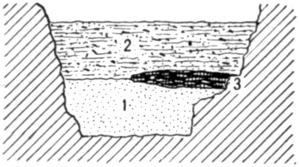
After clearing away the earth, roots, and rocks at the front, a straight vertical face at a distance of 18 feet from the entrance measured 9½ feet at top and 5 feet at the bottom between the solid rock wall on each side, and was 4 feet 4 inches high. The floor was not of solid rock entirely across, there being a crevice less than 4 feet wide which was not cleaned out, because no one could have lived in it. About the middle of this bank (vertically) streaks of red earth, burned elsewhere, extended 3½ feet out from the right wall; there was very little ashes and no charcoal mixed with it. Above this red the earth was dark like garden soil and contained a few shells and fragments of pottery, with a little charcoal and ashes; it had all been disturbed and apparently resulted from scraping the débris away from camp fires. Below this, the line of demarcation being very distinct, the earth was yellow and sandy, like river bottom land, and contained no foreign matter except roots of trees growing outside. Figure 23 shows a section on this line; the crevice is omitted from this and the subsequent illustrations.
At 20 feet in, a foot below the top of the dark earth, was some charred corn. The yellow earth became irregular, thinner, and higher against the side walls than at the center. (See fig. 24.)
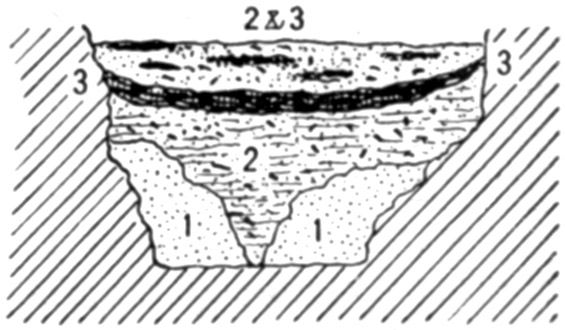
At 22 feet the yellow earth had nearly run out, there being only a small amount against either wall, while the darker earth reached down into the crevice that opened in the narrow strip of rock floor. [144]In the lower portion were mingled a few shells, pebbles, and specks of charcoal, as if it had been thrown there. Across the upper portion of the deposit extended fire beds, burned earth, ashes, shells, broken pottery, and occasionally a fragment of bone. (See fig. 25.)
At 24 feet it was found that what had been taken for a solid floor in the last section represented was only a large flat rock which had fallen into the crevice and wedged tightly. When this was passed the yellow earth reappeared, at a slightly lower level.
At 26 feet the yellow earth became mixed with red. It was excavated to a depth of 5 feet in the endeavor to discover the reason for this. As there was not the slightest trace of ashes or charcoal, the red admixture must be a natural result of staining by iron in some form and not due to heat. Above the yellow was the usual stratum of dark earth, containing culinary débris. In the central portion of this was a mass, sufficient to fill a wheelbarrow, of angular, unburnt fragments of limestone from 3 to 15 pounds in weight. On the surface of the dark earth were some ten or twelve fire beds, reaching from wall to wall, the edges overlapping and interlacing in so confusing a manner that the exact number could not be made out. (See fig. 26.) At this stage it appeared that the crevice, or at least its upper part, had been filled by river floods and a slight ridge of sand thrown across the mouth of the cave. The Indians, it seems, occupied both this ridge and the lower area behind it, throwing débris to the rear to fill up the depression instead of carrying it all to the outside. It is equally possible, however, that this waste was brought from points farther back and thrown here to fill and level the floor. These heavy fire beds came to an end at about 28 feet on the right and 29 feet on the left. A section at 28 feet is given in figure 27. At their inner margin, among the ordinary refuse characteristic of such deposits, [145]were many fragments of human bones, including ulnas of two individuals, one much larger than the other. They plainly indicated cannibalism, as they were broken when thrown here. Besides the ulnas, there are pieces of ribs, scapula, tibia, and feet.
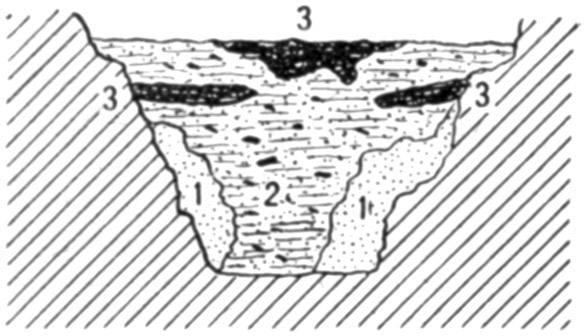
At 29 feet the underlying yellow earth became comparatively level across its upper surface, again closely resembling a river deposit. The darker earth above it contained a greater amount than heretofore of ashes, bones in small pieces, potsherds, mussel, snail, and periwinkle shells, and the like. More charred corn was found along here.
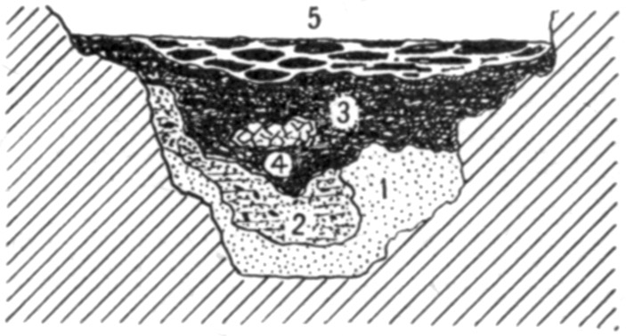
At 30 feet the yellow earth began to rise, and at 32 feet it was very little more than 3 feet lower than the top of the highest ashes. A section at this point is shown in figure 28. At 35 feet the strata became quite regular and uniform from wall to wall. The dark earth, next above the yellow, measured 3 feet in thickness at the center, and while showing by its admixture of ashes, etc., that it had been thrown here, had evidently formed the floor for a considerable time. The upper foot was burned red or dark from long-continued fires, the ashes above it being from 6 to 8 inches thick, and forming the present floor of the cave at this place. The dark earth contained much less of refuse than nearer the entrance; such shells and ashes as appeared were promiscuously distributed and not in little piles or masses as before. A section at 35½ feet appears in figure 29. It may be remarked here that this is the only sketch in which the upper line coincides with the surface of the deposits. In the others a thin covering, less than 6 inches at any point, of disintegrated material from walls and roof covers the ashes left by aboriginal fires. This is omitted from the drawings.
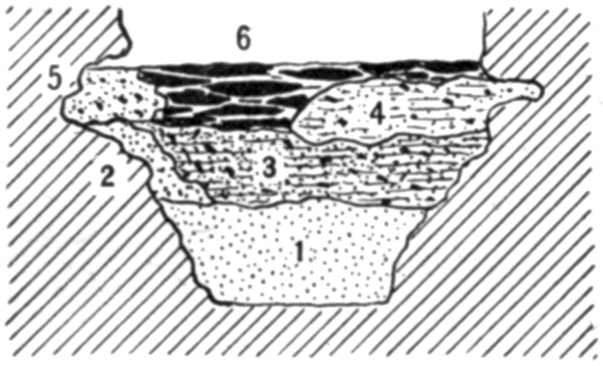
[146]At 38 feet the yellow earth had risen until it was within 3 feet of the top of the entire overlying deposit. The latter contained little of the dark earth, being mostly composed of ashes and burned earth, some of which resulted from fires made on the spot, but the greater part being thrown from other points. The rise of the yellow earth, consequently, is more rapid than the rise of the material covering it.
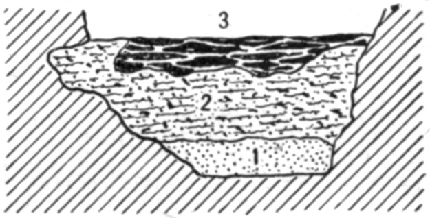
At 40 feet there was a dip in the yellow earth, extending for 4 or 5 feet and descending 2 feet at the deepest point. This may be due to drainage at a lower level.
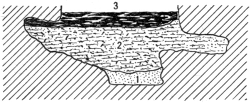
At 47½ feet a pocket of the dark earth extended a few inches into the underlying yellow earth. A hole seems to have been dug into the latter. There was no more of foreign material in this hole than elsewhere in the dark earth above and around it. It is shown in figure 30.
The amount of shells, pottery, etc., had been decreasing for several feet before this point was reached; indeed, from 40 feet onward there was very little of it—enough, however, to show that all the dark earth had been disturbed and thoroughly mixed. The fire beds, too, while holding their depth of about a foot, contained more earth between the successive layers of ashes, showing as great age, probably, as those nearer the entrance, but less continuous occupation. This condition prevailed to about 60 feet from the entrance, at which point the yellow earth, now mixed with sand and gravel, was only 3 feet below the surface of the floor. The appearance of this line is sketched in figure 31.
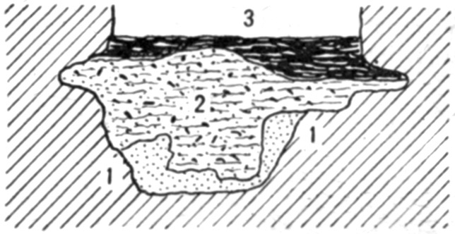
At 62 feet there was a dip in the yellow earth, extending to 67 feet and 2 feet deep at its lowest point; it then rose to the usual level.
At 70 feet ashes appeared in greater quantities; at 73 feet the dark earth was only a foot thick, the ashes and burned earth being 2 feet [147]thick and apparently all dumped, as there was no definite arrangement of the various parts. (See fig. 32.) A small perforated disk and a double-pointed bone needle were found here.
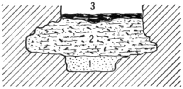
The fire beds now began to thin out rapidly, the dark earth also diminishing in quantity, until at 80 feet, from which point the entrance was no longer visible owing to curvature of the walls, there was only 5 or 6 inches of them in all, resting directly on the yellow earth, which contained much more clay than farther toward the front. The walls began to diverge here, forming a room whose greatest width was 11 feet 6 inches at 95 feet. At 100 feet a reverse curve brought the cavern on a course parallel to that which it had held up to 60 feet.
At 90 feet there was evidence of fire at one side, the ashes and burned earth being 5 inches thick at the wall, and thinning out to a feather edge within 4 feet. This was the last fireplace discovered which may not with certainty be attributed to white men. The yellow earth, presenting no evidence of having been disturbed since originally deposited, reached from the superficial layer of loose dry earth to the bottom of the trench, a depth of 4 feet 8 inches. Below this point the walls were less than 4 feet apart, and the space filled with gravel, as shown in figure 33. This gravel had exactly the appearance of that in gullies on the hills outside, and plainly dates back to the period at which the cave was formed. The stream which aided in the erosion, or which flowed through from some sink hole or other outside opening, carried this gravel into the crevice. Consequently, even if the space between the walls had been ample for dwelling purposes, an attempt to live here when the gravel was being carried in would result in the intending settler having his effects washed out into the river.
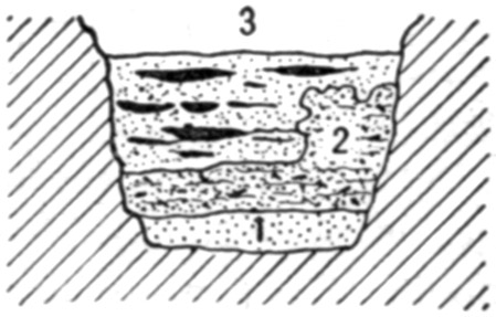
At 93 feet the side walls confining the yellow clay narrowed to a little less than 5 feet apart. The upper portion of the one to the left has been eroded into a recess or cavity, forming the chamber above mentioned. The earth on the rock floor in this recess [148]is nowhere more than a foot deep. A section is presented in figure 34.
At 100 feet the room came to an end. The space between the walls was 7½ feet at the floor level and 4 feet at a depth of 4 feet. At 105 feet the nearly vertical walls were only 5 feet apart on the floor; at 112 feet the space increased to 7 feet. A section showed about a foot of loose earth mixed with ashes; 3 feet of yellow clayey earth, rather compact; then gravel and sand. The latter was dug into for a foot, at which level the walls were converging and it was useless to go any deeper. Enough was done, however, to verify the supposition that this stratum was due to the action of running water seeking its outlet at the mouth of the cave.

At 103 feet, at the bottom of the yellow clay and on top of the gravel, was a chalcedony pebble about 2½ inches in diameter. The material is foreign to this locality. It had plainly been used as a hammer stone, and is the only object of human origin found anywhere below the dark earth. There was not the slightest evidence of any disturbance of the clay in which it rested.
At 120 feet the side walls were only 5 feet apart. At 125 feet they again diverged slightly, and a recess on the left forms a chamber 12 feet across. At 150 feet they had drawn in to 8 feet at the widest interval. A section showed loose dry earth, some of it cemented by drip from the roof until about as hard as lump chalk; then compact clayey earth, also with travertine in small lumps; below this the gravel and sand. The latter, at this point, seems to have been deposited in the last stages of the formation of the cave. Occasionally, along here, a small patch appeared that seemed to be ashes; but none of it was more than 6 inches below the top of the ground, and the substance may not have been ashes at all, but the fine white limestone dust that wears off from the stone. There was nothing in the trench, at any depth, after the chalcedony pebble, that could possibly be due to human intervention, except these small patches of ashes, if ashes they are.
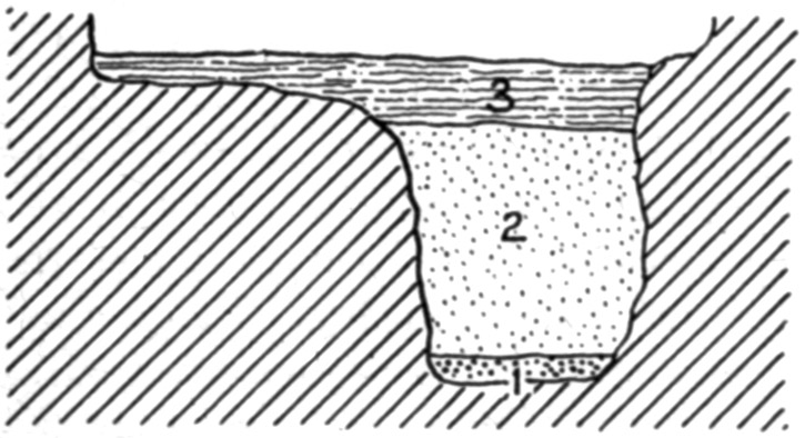
At 165 feet from the entrance the cave made its fourth turn and expanded into a chamber about 15 feet wide. Along the sides of this and in the various crevices opening from it were great quantities of clean ashes, plainly enough thrown there from fires made in the central part. The gravel came to within 3 to 5 feet of the top, [149]being quite irregular. On the gravel was dry clay, seamed and fissured in all directions so that it fell out under the pick in clods like angular pebbles from an inch to 3 or 4 inches across. This was clearly the result of muddy water settling in a hole and thoroughly evaporating. There was also some travertine in small lumps here and there through the clay, and above it was a mass fully 2 feet thick at one side of the trench but running out before it reached the other side. It was porous, almost spongy, and seemed to be the lime dust from the roof and sides cemented by dripping water. Above all this, so far as the trench extended toward the sides of the cave, was an inch to 4 inches of loose, dry, dark earth, which on the left dipped down to the clay, thus replacing the travertine.
At 175 feet the gravel had leveled down and was more or less mixed with clay and sand. Above this was another "mudhole deposit" of clay which had thoroughly dried out and become checked and cracked in all directions. On the right this was covered with travertine slightly mixed with earth and clay; on the left, above it and also at one place within it, was a coarse gritty earth fallen from the roof but not converted into a compact travertine. The section appears in figure 35. At 180 feet the trench was carried to a depth of 6 feet. This exposed a fine clay and sand, or silt, like that deposited in the eddies of streams. Above this was another deposit of "mudhole" material which had thoroughly dried out, checked and cracked in all directions so that it formed angular masses of various sizes, and had then become wet again so that it was now soft and sticky. To the left of this, on the silt also, was a small amount of the gravel. It had the appearance common to a bank of such material on the side of a little stream which has undermined and carried away part of it. Clearly, these three formations were of an age that witnessed the erosion of the cave. Next above them was a stratum of loose dark earth similar to that noticed in the front part of the cavern; but here were found no traces whatever of man's presence. Into the right side of this stratum projected the wedge-like edge of a mass of [150]travertine, which was not traced to a termination. Over all lay a deposit 3 or 4 inches thick of dark, nearly black earth, mixed with ashes. This is quite modern. The section appears in figure 36.
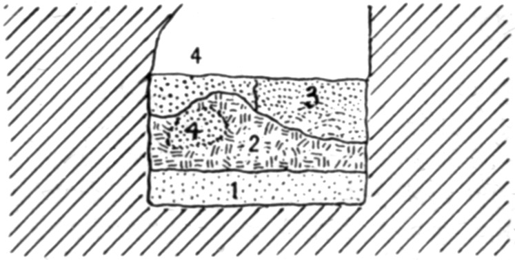
During the Civil War the cave was continuously resorted to by deserters, refugees, moonshiners, fugitives, and "food for powder, dodging the conscript." All these sought shelter in this chamber and behind it, in order that their fires might not be visible from the river. The piles of ashes in the crevices and corners were thrown there by these hiders-out, to get them out of the way. Similar but smaller piles of ashes are to be seen all along as far as the spring, 200 yards from the entrance.
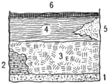
The presence of pottery of a type common to this region in fields and shell heaps, and of maize, denotes that all the fire beds, etc., are the results of habitation by the modern Indian. Where these ceased nothing else was found. In or below the yellow earth, clay, or gravel, nothing can be found; for until these were laid down and the stream of the cave had sought another outlet, there was no dry place in which to live.
It may be worth recording that a dead mulberry tree stood about 20 feet in front of the entrance to the cave. Under it was a narrow crevice filled with earth, but all around it was bare rock. A root, larger than the tree, grew into the cave and followed along one side wall as if fastened there for a distance of some 60 feet. Here the earth floor of the cave came high enough to cover it. This root was exposed for 160 feet in the trench, or 180 feet from the tree; at this point it was 3 inches in diameter and turned aside into a crevice. As the root could not have grown in the open air, it furnished proof that much deposited material has been carried out of the front portion of the cavern and away from the ledge since this tree was a sprout.
[151]
III. EXPLORATIONS ALONG THE MISSOURI RIVER BLUFFS IN KANSAS AND NEBRASKAToC
VICINITY OF WHITE CLOUD, KANSAS
About 4 miles southeast of White Cloud, Kansas, is the "Taylor Mound," from which Mark E. Zimmerman and William Park took 56 skeletons, or portions of skeletons, in a space not more than 6 by 20 feet. This was clearly an intrusive communal burial of skeletons carried from some other point and interred in the mound which owed its origin to persons who had piled it up at some previous time. The bones, which were not arranged in any order, were 30 inches beneath the present surface of the mound, but this does not mean they were no deeper originally, as the mound has been plowed for many years and is in a situation where it will easily wear down when cultivated.
A few feet away, at a depth of 7 feet, other bones, or fragments of bones, were found in a mass of burned clay. A cremation had taken place at some point away from the mound, and the resultant burned earth, with so much of the bone matter as was not destroyed by the fire, was carried here and buried. The depth in this instance is not significant; the earth is loose and very easily dug; besides, the grave pit was near the margin of the mound and earth had washed down over it from above.
Some stones, carried from neighboring ravines, have been exposed by the wear due to erosion from natural causes and from cultivation. The main portion of the structure is still intact, and it is probable that no deposits belonging to it at the time of its construction have been unearthed. A systematic exploration, showing the original construction as well as the alterations resulting from later burials, is much to be desired.
While this is the largest mound in the vicinity, and is claimed to be the largest mound in Kansas, it is not different except in size from many others within a few miles. All of them are made of the same earth as that which lies around them—a light, sandy loess which is easily removed with a shovel, requiring no picking or other loosening. In fact, it is almost as easy to dig as loose sand would be. Sometimes there are flat limestones in or around the graves; similar slabs are found not far away in the ravines.
[152]Not far from this mound is a large lodge site, one of the so-called "buffalo wallows" as they are commonly known. These are the ruins of aboriginal houses. The general construction is the same, the only practical difference being that some are square in outline, others round. This difference is not always apparent prior to the excavation. In the making, a pit was dug, square or round as desired, and the earth thrown out on every side. Posts were then set around the margin of the excavation, and the house built in the same manner as those with which we are familiar from accounts of early travelers. Many of them have been examined by Zimmerman and Park, who found masses of hard-burned earth in which are cavities and depressions due to the burning of straw, grass, twigs, and poles, used in the construction of the houses. This results from the destruction of the houses by fire. Sometimes the floor has a layer of this burned material which is evidently due to the falling in of the roof. Most of these are on the hilltops, but some of them are on narrow ridges leading from the high land to the creek or river bottoms. In the latter event there is always a village site on the low ground bordering the stream. The relics gathered up on these village sites are in no wise different from those found when the lodge sites are excavated; and also are of the same character as those picked up on what are no doubt modern village sites in the vicinity. This fact militates against the idea that the lodge sites are extremely ancient.
IOWA POINT
On a low hill, cut off on every side by steep ravines, is a small mound containing a cist grave. The bottom of this, which was dug slightly below the natural surface, was covered with a pavement of limestone slabs. The grave was roughly oval or triangular in outline, measuring about 7 by 9 feet. Around it was a wall of similar stones, set in contact and sloping outward at an angle of about 40 degrees from the vertical. There was nothing whatever in this grave.At the edge of the mound was a box grave 5½ by 2½ by 2½ feet, the longer axis on a radial line. It was made of small flat stones built up like a wall, the only grave of which I could learn that had any resemblance to the vault graves farther down the Missouri. In the grave were two skulls and some other bones, all bunched in the northern end.
NEAR THE MOUTH OF THE NEMAHA RIVER
Lewis and Clark, in their journal, mention that when camped near the mouth of the Nemaha, one or both of them went to an Indian village about 2 miles up the stream. He, or they, climbed a low ridge near the river and stood on a mound which commanded a fine [153]view of the surrounding country. There is a dispute as to the site of this mound; but the journal plainly says it was on the lower (east) side of a little creek which comes in here. Two miles farther up is a larger mound on higher ground which is generally supposed to be the one meant by the explorer; but this is on the other side of the creek and at some distance from the Pawnee village which was located near the mouth of the creek, on the lower side. The ground where this village stood is covered over a space of several acres with the ordinary débris of an Indian settlement; and it is significant that all the relics found are so similar to those which are called "ancient" when found in the lodge sites, that no one could determine from inspection which kind came from which place. Unless it may exist in the markings in the pottery, no distinction can be made between these specimens and similar ones from other localities.The Pawnees lived here until 1837, when the Iowas and Otoes made a sortie upon the unsuspecting inhabitants and killed all of them they could overcome. Two women of the Iowa tribe who were living on the reservation in 1914 remember seeing dead bodies lying around wherever the invaders could find and kill a resident.
A short distance below the explorers carved their names on a rock which projected into the stream. Accounts as to this spot differ; it is generally stated that in making a road around here, the rock containing the names was blasted away; but a man in the neighborhood who claims to know the exact spot says the blasting did not extend quite so far and that the names are covered by a mass of earth and rock which slid from the bluff many years ago. If this be true, a thrill awaits the man who finds the names some centuries from now, when the river has washed away all this accumulated material.
VICINITY OF TROY, KANSAS
Near the mouth of Wolf River is a village site on which Dr. R.S. Dinsmore, of Troy, has counted 125 tipi sites. Relics are very abundant here, especially the small chert "thumb-scrapers," which outnumber all other specimens.MOUTH OF MOSQUITO CREEK
Four miles east of Troy, on a ridge so steep that its top is inaccessible from either side, and so narrow that a wagon would make a track on each slope, is a little mound worn down until its true nature would not be suspected. Dr. Dinsmore was on this ridge one day and noticed a flat limestone rock. Knowing that it had no place in the loess, he began digging to ascertain the reason for it being there. At a depth of a few inches he found bones, and soon unearthed a number of skulls, with only his hands or a stick. Coming back later with tools, he found, in all, 56 skulls. Afterwards he found [154]others, and persons in the neighborhood have exhumed many more. The deposit represents a communal burial, from a village which probably stood on the level creek bottom not far away. A few skeletons showed an attempt at orderly arrangement. These were probably of individuals who had not been dead long at the time of the general burial. Most of the bones, however, skulls and others, were piled in the smallest possible area, as if gathered up in sacks or baskets from previous burials and carried here for reinterment. The soil is so loose as to be easily dug with the hands, like sand; but at the same time so fine and close packed as to shed water almost like a roof. Owing to the steep slope at every point, except toward the summit of the ridge, there must be some erosion, and consequently the age of the burials can not be great. Yet, the same conditions prevail in other places where a great antiquity is claimed for the remains. Frost necessarily disintegrates the soil to some extent; the wind or rain carries away the loosened portions; and this process is continuous. The shape of the mound shows that when the burials were made the ridge was essentially identical in form with its present aspect. The bones also are comparatively fresh in appearance, and it may be considered certain that they can not date back many generations.On the top of a hill rising from the opposite side of Mosquito Creek Dr. Dinsmore found a low mound, which, like that just described, would not have been suspected as such but for a stone projecting from the surface. Under this stone, with 8 inches of earth intervening, was a skull so completely mineralized that it appears to be carved from a block of limestone. No other portions of the body to which it belonged remained, though traces in the surrounding earth showed that at least the larger bones and perhaps the entire skeleton had been deposited. Bones in other parts of the mound were in their natural condition; that is, they were not altered from their ordinary appearance, although only in fragments. It is remarkable that this entire cranium should thus change while all the other bones, even the jaw, had disappeared. The description of this find is from Dr. Dinsmore, who has the skull in his office. Possibly he may be in error in stating that traces were found of other bones belonging with it. These may have belonged to another individual. The soil is ordinary sandy loess, containing lime but not in such quantity as to account for this alteration. Perhaps the skull may be from an older burial somewhere, the petrifaction having taken place before it was buried here.
RULO, NEBRASKA
Particular attention was paid to conditions a mile north of Rulo, where it is reported that human skeletons were found in the Kansan drift. It was not the intention of the discoverer to have it [155]understood that these remains were in undisturbed drift, but such is the impression that has gained credence.At the settlement of the country by whites the road constructed across a ravine here, on the section line nearest the river about three-eighths of a mile away, followed the natural contour and the crossing was made without difficulty. Since then a deep washout has worked its way to some distance above this point, making a long bridge necessary. From the head of the washout to the Missouri River the banks are vertical, or nearly so, on each side of the little stream. It was in the bank on the south side that the bones were found. It is stated they were 7 feet under the surface; if so there must have been a mound above them, for the lowest excavation does not reach over 5 feet below the present level of the ground, and at that extends slightly below the bottom of the grave.
Within 40 years the Missouri River, which is now more than a mile away toward the Missouri shore, flowed at the foot of a slight bluff terminating the slope from the high land toward the west; there was formerly a steamboat landing on the upper side of the ravine. On the lower side is a triangular area of about an acre, bounded by the bluff, the river bank, and the ravine. This was an excellent location for an Indian village or camp. A narrow level strip extends from the mouth of the ravine to a point near the bridge, some distance above where the remains were found. It is quite clear that the skeletons were the remains of individuals who had died at the camp on the river's bank and had been carried here for burial. This may have occurred within the last hundred years or in fact at any time while the Indians were still living in this vicinity.
The flood level of the Missouri is not more than 15 feet lower than the level space along the sides of the ravine. The little intermittent stream has cut down this depth through a deposit which is composed of river sediment, wash from the hills on each side, and material carried from higher levels by the brook itself in rainy seasons. At only one point is there a real glacial deposit, and this does not extend for more than 50 feet horizontally, and does not reach to the top of the bank. It is at some distance from the graves, and may be due to a lobe of the ice or to an iceberg. However formed or deposited here it has no relation whatever to the skeletons. In a sense, the material in which they were buried is "Kansan drift"; but it is drift which has been redistributed and has come into its present position within a few centuries at the most.
NEAR HOWE, NEBRASKA
Mr. Sam P. Hughes, who lives near Howe, has done considerable excavating in that vicinity. He is an intelligent man and an ardent student, but his ideas in regard to the age of his discoveries need [156]much revision downward. His chief work has been done north of Howe at a place 9 miles from the nearest point on the Missouri River. Here is a small level area at the end of a ridge sloping away in every direction except at the narrow isthmus connecting it with the fields beyond, which are at a level only slightly higher. Thus there is no chance for any accumulation from the adjacent surface. On this ridge are a few lodge sites which Hughes has excavated. In every respect they are similar to lodge sites reported from other localities in this region. The walls, the depression, the floor, the fireplace, are all the same. The depressions are filled with earth to a depth of 18 to 22 inches above the level of the old floor; and Hughes reports that wherever he has dug on this ridge he has found flint chips, charcoal, fragments of pottery, and scraps of bone to about the same depth. Next below the soil is the Kansan glacial drift; but the assertion that objects found at this depth are of the same age as the drift is not necessarily or even presumably correct.PERU, NEBRASKA
On various hills in the vicinity of Peru are lodge sites, some of them circular, some rectangular, some with straight sides and rounded corners. Most of them have been dug in at random; in every case after a certain depth of accumulated earth and trash is passed through, there is a layer of clay which formed the roof, and beneath this the hard earth floor with fireplace usually in the center but sometimes a little toward one side.PAPILLION, NEBRASKA
At the time of my visit, Dr. Frederick H. Sterns, of the Peabody Museum, was working near here. He described himself as "the man who is extremely anxious to find a glacial or other very ancient man, but so far has not succeeded in getting track of him." Dr. Sterns did not claim a period antedating the Indian for anything he had then unearthed—meaning the known Indian tribes.VICINITY OF OMAHA, NEBRASKA
To the southward of Omaha are many lodge sites of varying depths and diameters. The deepest one reported had a depth of 9 feet below the surrounding surface, and at the bottom of this was a pit (or "cache," as they are locally known) with an additional depth of 4 feet, or 13 feet of excavation in all. This was near the so-called "cannibal house," where 14 human frontal bones were found under conditions which indicate they had belonged to individuals who were eaten by other inmates of the lodge.[157]A short distance from these sites, across a ravine, is a bare, narrow ridge, very steep on each side, so that erosion would readily act. On the sloping summit of this are three small mounds which cover communal burials. From one of these, the one farthest from the summit of the hill, more than 80 skulls were taken and boys in the neighborhood have since taken many more. They are all of the ordinary Indian type, and can not have been buried more than a few generations ago; but this fact has not prevented an age of "twenty thousand years" being assigned to them. There is absolutely no reason for fixing this or any other date. There is nothing whatever to indicate the age, but 200 years would probably not be far from the mark, because erosion has been slight since the mounds were piled up.
LONG'S HILL
This ridge has attained some notoriety as the site of Gilder's discovery of the "Nebraska Man." The claim is made that human bones were found at a depth of 14 feet in absolutely undisturbed loess. The hill is a narrow ridge, facing the river on one side and a deep ravine on the other. It is somewhat winding in its course and is connected with the more level land in the rear at about half a mile from its end. A wagon road up the point, from the river bottom to the hilltop, shows undisturbed loess the entire distance. There is no possibility of accumulation by wash or in any other manner except decaying vegetation on any part of this ridge.Along the crest are several small mounds. Some of these, as shown by excavation, cover graves, and the presumption is that all of them mark burial places.
It is needless to make any résumé of Gilder's report, as it is so well known, further than to say that he found burials and fragmentary human bones at various levels from 2½ to 14 feet. At 4½ feet were burned bones lying upon burned earth and mingled with it. This layer, burned hard as a brick, served to prevent water from penetrating the earth immediately below; and it is in this earth that the deepest remains were found.
There are three ways, and only three, in which they could get there:
1. They were washed in when the loess was deposited, as claimed by the discoverers and by some of the Nebraska geologists.
In support of this view is the assertion that the bones were water-worn. On this point I can not venture any opinion, as I have not seen them. But I have found bones in mounds and in other situations where such wear was impossible and yet having the smoothed and rounded appearance characteristic of such action by water or the elements.
[158]In support of this theory, too, is the positive statement of Nebraska geologists who have had ample opportunity to become familiar with loess in all its phases; and they claim the deposit is the original and has not been disturbed.
It is necessary for these advocates, however, to tell where such fragments of bones could have come from and how they could have been washed to the place where found, when all these bluffs were covered with water, as they had to be at that time.
2. The bones could have been carried by rodents into their burrows or runways, as Hrdli[vc]ka suggests. In this case the material in contact with the bones would have to be somewhat different in appearance and consistency from that which lay a few inches, or perhaps only an inch, away. The Nebraska men say this was not the case.
3. There may have been an excavation or pit similar to that in which the Hurons buried their dead. But as no such burial pits have been discovered in this part of the country, this supposition must be excluded.
A corollary to the last is that a deep but small pit similar to the so-called "caches" in the lodge sites may have been dug here and the bones thrown in. There is no indication whatever of a lodge site or any other form of habitation at this point, but I have found such pits in the vicinity of Indian houses, though not just on their site. The deepest one I have ever found was 10½ feet and less than 6 feet in diameter. There would be no difficulty in digging into this loose material as far as an excavator cared to go, until he had reached a depth at which he could no longer get the loosened earth to the surface of the ground. As mentioned above, a pit south of Omaha had a depth of 13 feet, or only 1 foot less than is claimed for this—or rather for the greatest depth at which it is claimed fragments of bone were found.
The objection made to this theory is that the earth thrown out of the hole was unmixed, presenting throughout the appearance and consistency of loess as it occurs where exposed in ravines or on slopes in the vicinity. It is contended that if any previous excavation had been made here and filled up afterwards the mixed earth would be easily distinguished from that which was not removed, and that the line of demarcation would be easily discernible.
As a rule, this is true; but when dry loose earth of homogeneous consistency is thrown out of a pit and then thrown in again without becoming mixed with any other it is sometimes impossible to distinguish it at a later excavation. This is especially true of earth free from vegetable matter, as ordinary sand; or composed largely of vegetable mold, as the soil in overflow lands which have built up [159]mainly from floods carrying uniform soil sediment. The line of demarcation between the dug and the undug earth in such conditions may become indistinguishable except when a vertical face is made which shall show a clear section of both in contact.
It is now too late to learn anything about the matter from the site itself. So many persons have been digging that it would be impossible to know when the limit is reached between the original excavation—assuming it to have been made—when the bodies were interred, and that resulting from the modern researches. The question of age hinges upon the appearance of the earth in which the bones were found; and the only way in which we can now learn anything about it is to trench across the hill at some of the other burial places, in the hope of finding bones at a similar level, and determining from the conditions in which these are found how they came there.
It is beyond question that any soil, humus, or other discolored matter thrown into an excavation with ordinary soil or subsoil will be apparent for an indefinite time afterwards. But on some of these high points and ridges there is even now not a trace of soil. Frost and wind have worn bare spots where nothing grows or has grown for a long time. As this region was a prairie devoid of even brush when the whites settled here, it is evident that such slight protection as grass or weeds afford would not be sufficient to hold the earth in place in winter, and when the ground is once swept bare such humble forms of growth may not get a foothold in future. Anyone who has studied surface geology knows these facts.
So at present the whole question of the age of these bones resolves itself into a statement of one party that they were found in undisturbed loess, as reported; and of the inability of another party to show that there may have been an error of observation or a mistaken interpretation.
There need be no such doubt in regard to the age of the mounds or the lodge sites. It would not take many centuries for mounds upon these sharp, exposed ridges to be entirely washed away, in spite of the fact that the fine loess is almost impermeable. Rain may not reduce them to an appreciable extent, but frost and wind will gradually wear them down. As to the lodge sites, their similarity to modern Indian houses is so pronounced that we are fully justified in attributing them to the same degree of culture as that of the Indians of a century ago. The only point of difference is that the latter dwellings have not such deep excavations, but the incursion of war-like tribes, or the restlessness that impels a primitive community to be frequently on the move, seems a simpler explanation of the difference than to suppose that identical types are separated by a great period of time.
[160]Three points must be taken into consideration in fixing a definite age for these remains:
1. The relics found in and around the lodge sites, except for the markings on some of the pottery, are in no wise different from those picked up on the sites of villages which were occupied when Lewis and Clark came through here.
2. Fairly solid bones of animals, and occasionally of humans, are found in the bottoms of the lodge sites, even where these are damp most of the year. In the pits, where such remains are preserved by ashes, this would not mean much; but where they are found in clayey earth it is evident that "thousands of years" is a meaningless term to apply to them.
3. Persons who claim these "thousands of years" for pretty much everything they find in the ground must explain why it is that while the bones and implements of these assumed "ancients" are found in such quantities and in such good preservation, those of later Indians should have entirely disappeared.
The only tenable theory of age is the amount of accumulation in the depressions of the lodge sites. Above the clay which formed the roof, and is next to the floor now, is a depth of material sometimes (it is said) as much as 20 or even 22 inches of mingled silt, decayed vegetation, and soil from the surrounding wall. It is used as an argument of age that as these sites are on hilltops where there can be no inwash, this depth must indicate a very remote period for their construction. But a large amount of the earth thrown out into the surrounding ring or wall will find its way back into the depression. The water will stand in them a good part of the year, and the soil remain damp even in prolonged drought; vegetation is thus more luxuriant than on the outside, and its decay will fill up rather rapidly. In addition, much sand blows from the prairies as well as from the bottom lands, and whatever finds its way into the pit will stay there; it will not blow away again as it would in open ground. The weeds, also, will catch and retain much of this dust which would pass over a dry surface. Consequently the allowance of an inch in a century, which is the most that advocates of great age will allow for accumulation, is much too small.
The topography of the region was essentially the same when these remains were constructed as it is now. The hills and valleys were as they now exist; the erosion has been very slight as compared with what has taken place since the loess was brought above the water, to which it owes its origin. This statement is fully proven by the position of the mounds and lodge sites. Any estimate of age must be only a guess at the best, but it is a safe guess that no earthwork, mound, lodge site, or human bone along this part of the Missouri River has been here as long as 10 centuries.
[161]
IV. ABORIGINAL HOUSE MOUNDSToC
The small, low, flattened mounds of the lower Mississippi Valley are a problem to archeologists. They have been studied principally near the Mississippi River, in Arkansas and Missouri, and for many years it was thought that in the latter State they are confined entirely to the southeastern portion. Recently they have been found much farther to the north and the west than they were supposed to exist.
A group, rather limited as to number and to the area covered, is at the head of a narrow valley trending northward from Granite Mountain in Iron County.
"Near Iron Mountain, in St. François County, more than 500 of these small mounds, arranged in parallel rows following the direction of the watercourses, were counted within a radius of 3 miles."[1]
The next group known north of this is on the right bank of Plattin Creek in Jefferson County, about 12 miles from the Mississippi.
"A group of some 50 similar mounds is situated on the right bank of the Meramec, about 6 miles above its mouth, in Jefferson County."[2]
The most northern group so far observed is near Ferguson in St. Louis County, Missouri, where 46 are located on a narrow ridge which has the same general elevation as the table-land. The ridge extends around the head of a ravine, and the mounds are placed along its crest or on the gentle slopes near the top. There are 10 or 12 at the southern edge of Ferguson, on an overflow bottom bordering a small creek.
Toward the west from the swamp region a small group is in a broad valley near Alton in Oregon County, which borders on Arkansas. They are scattered along a gentle slope which has a little stream at the foot.
In Dent County four groups are known. One is on the infirmary farm south of the town of Salem. Most of these are but slightly changed from their natural condition. Another group is 6 miles east of Salem. These also are largely intact. A third is on the road from Salem to Short Bend. The fourth is at the edge of Salem, on the Rolla road.
"On the high plateau of Dallas County, north of the Niangua ... within an area smaller than 10 square miles, 860 were counted."[3]
[162]Three groups are well marked in Phelps County. A mile east of Rolla they begin at the line of the Frisco Railway and extend southward in a shallow valley or "draw." Some are on the overflow flat bordering the little stream, but most of them are on the slopes to either side.
South of Dillon they extend for a mile in a slight depression.
Beginning at the Soldier's Home in St. James, the largest number yet found out of the swamp region lie for 2½ miles on both sides of a small creek running eastward north of the Frisco Railway. These reach from low land subject to overflow to an elevation of fully 50 feet up the hillsides.
Several groups occur in Pulaski County. Four miles southwest of Big Piney post office, near the site of what is known as "The Ranch House," is a little wet-weather stream along both banks of which are probably a hundred of these structures. Farther up this stream are two other groups, the three including a distance of about 4 miles in length between their outer limits. West of these and south of Bloodland is a fourth group belonging with these.
In the level bottom between Big Piney River and the branch flowing from the Miller Spring 2 miles from Big Piney post office a number of these mounds formerly existed; and on the opposite side of the Big Piney, in an extensive bottom, were many of them. All these have now disappeared under cultivation.
On the outer bend of the Devil's Elbow, on Big Piney 3 miles above its mouth, some of these mounds stood. They are described as being from 2 to 3 feet high; the number was not stated, but there is not room for many in the narrow strip where they were located.
In the extreme western part of Morgan County, at Stover, is a group scattered over an area at least half a mile across in any direction. The distance between the mounds varies from 25 to 150 feet. They are mostly on gentle slopes, though some are on the crest of the ridges. Many of these are well preserved, some of them having never been under cultivation.
In Osage County there are more than a hundred at the eastern edge of Rich Fountain. They are in low flat ground which is muddy or even boggy in wet weather.
It will be noticed that all those from Alton westward and north-westward are in line with the route from southeastern Missouri to the plains of Kansas and Nebraska.
Practically, however, the northern limit of this type, in great numbers, is in St. François County, near Farmington. From here they extend almost continuously into Louisiana and Texas.
In nearly every part of southern Missouri east of the Iron Mountain Railway they occur in closely connected groups, reaching sometimes for miles except where the continuity is broken by a slough or other [163]unfavorable condition. They are found everywhere—on high, well-drained levels; on sloping ground, sometimes so steep that it may well be called a hillside; in low "crawfish land"; in swamps where, in the driest weather, even after a prolonged drought, they can be reached only by wading through water or muck. The last, however, may have been more easily accessible when built, their present condition being due to the general subsidence of this region during the earthquake period of 1811. The existing sloughs and sluggish bayous are the widenings and extensions of streams which at the time these mounds were constructed were no doubt bordered by banks above ordinary overflow and readily reached by canoes. Manifestly the country was well populated, and therefore presumably practically timberless; consequently the flood water would rapidly pass away and the streams not be choked by drift and other débris as is the case at present.
Various theories, most of them advanced by persons who are but slightly, if at all, familiar with the country, have been propounded to account for mounds of this character. Their vast number has led some writers to believe that they can not be artificial but must be due to natural phenomena; as, for instance, that these, as indeed all mounds, were piled up by floods, Noachic, glacial, or local; or that they result from the industry and energy of burrowing animals, such as foxes, badgers, ground hogs, rabbits, prairie dogs, gophers, chipmunks, or even ants; the character of the assumed flood or the species of the supposed burrower depending to some extent upon locality, but principally upon the theorizer's insufficient knowledge of animal industry or of the action of torrential waters. Others are convinced they are formed by the piling up of earth around a bush, clump of grass, stone, or other object acting as a nucleus about which wind-borne material may accumulate—overlooking the fact that clay, gravel, or gumbo soil can not be carried by wind, and that lighter soil or sand will form elongated instead of circular masses. Another supposition is that they are due to stream erosion; flood waters washing away the soil between them and thus leaving the earth composing the mound in its original position. The same objection applies to this as to the wind-blown theory, namely, that we can not imagine water acting with such mathematical regularity and intelligent discrimination, especially upon slopes which lie at all sorts of angles with the trend of the current.
Persons who recognize their human origin have suggested that they were erected as stands for hunters, from which they could detect game at a greater distance, or could take better aim as the animal passed; or perhaps as camping places while waiting; but in many places more than half the area of the ground over several [164]acres is occupied by such piles of earth, promiscuously distributed. This implies more hunters than animals.
For a long time it was supposed that they were burial mounds, like so many such structures found over the country; but this idea has been dispelled by the failure to discover in them any evidences of such purpose; no human bones nor any of the artificial objects commonly placed with the dead have ever been found in them unless under such conditions as to show their presence was accidental.
Two very plausible theories have found general acceptance: That they were the sites of dwellings, placed on them to be out of the mud in wet weather; and that they were in the nature of garden beds, thus elevated for growing any food products which needed a comparatively dry soil, or might be injured by temporary accumulation of water from excessive rainfall.
But they were not "residence mounds" or "house sites" in the sense that they furnished a base or foundation for structures which were used as dwellings; for there has never been found on their surface or in the earth immediately around them any of the débris invariably accompanying Indian huts or houses, such as fireplaces, ash beds, burned rocks, broken implements, or fragments of bones and pottery. These considerations also interfere with a full acceptance of the hypothesis that they are remains of houses built of wood and covered with earth. It is true that such evidence is very frequently found in other localities; but to establish the fact that they were residence sites, refuse of this kind should be found wherever the mounds occur.
J.B. Thoburn arrived at this conclusion from the resemblance of some of them in their outlines to the grass-covered houses of the Pawnees; and it is believed that this tribe in its migration from the south followed approximately the route along which these small elevations are found. When the Pawnees—assuming they were the builders—passed on westward they could not procure timbers of sufficient strength to hold up the earth, so they used light frames and covered them with grass.
Bushnell arrived earlier at the same conclusion. He says, concerning a few mounds of this character in Forest Park, St. Louis: "In the case of the seven mounds on the elevated grounds, the finding of potsherds, pieces of chipped chert, and the indication of fire, all on what appeared to have been the original surface, would point strongly to their having been the remains or ruins of earth-covered lodges." He gives citations from early explorers in support of this theory, and adds, "But in other mounds these indications did not occur."[4]
[165]Such an explanation finds support in the vast number of these structures. In building, the aborigines naturally chose the sort of timber which was soft and light, consequently easy to cut and to handle, such as willow or cottonwood. This soon decays. But no matter what variety of wood was utilized, not many years would be required, under the conditions supposed, to weaken its fiber until it could no longer uphold the weight of earth on the roof, and a new house must be erected. Several such renewals would be needed in the course of a century; so that the ruins of an ordinary village might create the impression that a large settlement had existed on its site.
The explanation of "agricultural use" is probably correct in some instances, for frequently the mounds are made of earth gathered up around their base, and so not only would be of value in a wet season, but would afford a much greater depth of fertile soil for sustenance of plants. In some localities modern farmers find that on such mounds crops are much better than on the low spaces between them. On the other hand, a majority of the small mounds in the lower counties of southeastern Missouri are composed either of the hard, reddish, sandy clay which forms the subsoil of the land above overflow; or of the tough, waxy, black "gumbo" of the swampy or flat lowlands. In either case they are almost invariably sterile, so that in a cultivated field the position of a mound is easily determined even from a considerable distance by the feebler growth on its surface. Moreover, in many places, hundreds of them occurring within an area of a few square miles are built on clay lowlands where crawfish abound, within a few rods of sandy, well-drained ridges whose soil is never muddy more than a few hours after the hardest rain, and produces as fine corn and wheat as can be raised in any part of the State.
In short, no matter what suggestion has been offered as to their purpose or uses, objections to it can be brought and sustained. It is not improbable that, in the end, it will be found the difficulty lies in trying to place in a hard and fast category a variety of structures which are similar in appearance but which were intended for various uses. With more comprehensive study, it may be that a classification is possible which will interpret what is now obscure. Instead of uniformity, there was probably great diversity of motives, ideas, and beliefs which led to the building of these as well as of other mounds; and when the key is once obtained the explanation which will account for one may be very different from that which as clearly accounts for another.
A few of these mounds have been explored by the writer, but no discoveries were made upon which can be based a definite statement as to their probable purpose.
[166]
NEW MADRID COUNTY
On the farm of A.B. Hunter, 7 miles north of New Madrid, more than 60 of these mounds, irregularly placed, extend for half a mile along the west bank of St. John's Bayou, the extreme width of the group being about 200 yards. The largest mound, standing on the edge of the terrace, was 6 feet high and 75 feet across. On the original surface, over a small area at the central part, were decayed fragments of human bones; so this was probably erected as a tumulus. The others were much smaller; from a foot to 3 feet high, and 30 to 50 feet in diameter. Six of these, varying in size from the largest to the smallest, were thoroughly excavated within the original margin and down to the undisturbed earth beneath them. No artificial object was found in any of them except here and there a fragment of pottery or a small amount of ashes or a piece of charcoal, not intentionally deposited but gathered up and carried in with the earth in the course of construction. There were no distinct fire-beds or ash piles at the bottom, or in any part of the mound; nor were there any holes in which posts may have stood.ST. FRANÇOIS COUNTY
Nearly 2 miles south of Farmington, on Quesnel's land, are about 30 very small, low mounds, none more than 18 inches high or 25 feet across. They are on the general level, some of them on a gentle slope, of the first upland above the St. François River and a mile from that stream at its nearest point.Half a mile to the south of these is a group of similar mounds on the farm of Isaac Hopkins, on a gently sloping hillside, and from 30 to 40 feet above the level of the overflow bottom land. One of these has been gradually worn away by the encroachment of a gully until more than half of it has disappeared. While the curvature of its surface is very apparent, and the remnant of its margin sufficiently distinct to show its regularity of outline, careful inspection of the face formed by the erosion fails to reveal any trace of stratification, or line of demarcation between the bottom of the mound and the original surface. There is precisely the same uniformity of change from the grass roots to the underlying gravelly soil that exists in the exposed bank at any point to either side of the mound. Mr. Hopkins, desirous of knowing what might be in the mound, or why it was built, has noted the appearance of the earth from the time the gully reached its margin. At no time has its appearance differed in the least from what it presents now.
On the river bottom portion of Mr. Hopkins's farm, and on the adjoining Goings and Townshend farms to the southward, are many mounds lying along both sides of the Belmont division of the Iron [167]Mountain Railway. Fully 100 were observed within a distance of a mile; and they are said to continue both up and down the river. They are all above flood stage, except in time of extreme high water. They range from a foot to 3 feet high, and from 20 to 40 feet across; but some of them have been lowered and broadened by cultivation. They are of the same earth as the ground around them. Mr. Hopkins says crops are much better on the mounds than on the area between them. This is no doubt due to the greater amount of productive soil in the one case, and to the excess of moisture in the other; the railway embankment impeding drainage in the lower part. Oak trees 4 feet in diameter grew on the mounds before they were cleared off.
Two of these mounds were completely removed, down into the subsoil. The first was 18 inches high and 35 by 40 feet across; the variation in breadth resulting from continual cultivation in one direction. It contained nothing whatever of artificial character, not even a scrap of pottery. There were no post holes, no indications of a fire bed, no trace of a distinction between the mound and the soil below it. In fact, except for the greater thickness of the superficial dark earth there was no difference between the appearance of the face of the excavation and that of a hole dug at random in the field.
The second mound was somewhat larger than the first, being 2 feet high and 40 feet across, and at a little higher level toward the edge of the field. It was the largest which could be excavated of this group. As in the first mound opened, there was no worked object, if a small flint flake be excepted; no ashes; no fire bed; no trace of demarcation between the mound and the original surface of the ground, though in each mound the excavation over the entire area was carried down into the gravelly, hard-packed subsoil. Its artificial origin is clearly proven, however, by four holes dug into the earth beneath it before its construction. Nine feet a little north of the center, which was assumed to be the highest point of the mound, was a hole (A) 12 by 14 inches and 14 inches deep, with a flat bottom, the sides as regular as could be expected in hard soil dug out in primitive manner. Nine feet west of the center was a hole (B) a foot across, 10 inches deep, with a solid though somewhat irregular bottom. Near the center was a conical hole (C) a foot deep and the same across the top. Four feet from it, west of north, was another (D) of about the same size and shape. The measures given are of course only approximate, as the sides of all the holes were somewhat uneven, but they are practically correct. The depth was measured from the top of the gravelly subsoil. Fourteen feet east of south from the center was an irregular hole (E) about 2 feet deep to the bottom of the loose dirt in it. This had not been dug, but was [168]due to the decay of a tree which grew here before the mound was made. At the top of the dirt filling this hole was a piece of decayed bark, apparently oak, which had grown in the air; and farther down fragments of root bark. Eight feet east of the center was a hole (F), similar to the last, 10 inches deep and averaging 2 feet across. This, also, resulted from the decay of a stump.
A plan of the holes is given in figure 37. The dotted lines are merely to show direction and distance.
This mound offers confirmation of the belief that such structures, or some of them at least, mark the sites of dwellings. With the two trees, E and F, the posts, A and B, would form the corners of an irregular quadrangle; the two posts, C and D, would support the inner ends of roof timbers. While no trace of posts or roof timbers remained, it is difficult to imagine for what other purpose these holes would be dug; and in this heavy, wet earth all traces of wood must in time disappear. Conversely, the total absence of a fireplace, potsherds or other remains, and of any sign of a floor, would serve to dispel the assumption that this spot was ever inhabited even for a short time. The evidence is as strong one way as it is the other.
In short, the limited observations above recorded leave the question of origin and purpose just where it was.
Some years ago one of the mounds at Ferguson, St. Louis County, was opened. No remains of any sort were discovered, according to the report of the excavators; but on the original surface, at the center of the mound, was a fire bed in and about which were ashes, charcoal, and fragments of rude pottery.
No excavations have ever been made in the mounds near Granite Mountain; but a tortuous little stream has undercut several of them, thus making vertical sections as in the case of the mound at Hunter's, near Farmington. In some mounds only a small portion near the [169]margin has been removed; in others the erosion has progressed to such an extent that observations were possible at varying distances, to and beyond the center. In every instance a monotonous uniformity of appearance prevails from the top of the mound into the underlying gravel. At no level is there a sign of a floor, fire bed, or other evidence of human work; and no difference can be detected between the earth upon which the mound rests and that on either side. Yet the mounds are indubitably artificial.Exactly the same remarks apply to several mounds on the County Farm, near Salem. A little creek and a drainage ditch have cut away varying portions of them, and they merge insensibly into the soil and gravel on either side.
In further support of the theory that these mounds are the remains of earth-covered houses, a few extracts relating to the area under discussion will be given from Dr. Cyrus Thomas in the Twelfth Annual Report of the Bureau of Ethnology:
Near "Beckwith's Fort," in Mississippi County, Missouri, are (p. 189)—
Low, flattish, circular mounds * * * [which] appear to belong to two classes, those used for dwelling sites and those used for burial purposes, the former being the higher and the color of the surface layer darker than that of the other class. This darker color of the surface layer is probably due to the fact that immediately below it are found fire-beds with burnt earth, charcoal, ashes, and the bones of animals, (mostly split). There are seldom any human skeletons or entire vessels of pottery in the mounds of this class though the earth is filled with fragments of broken vessels.
In describing mound excavations in Crittenden County, Arkansas, the explorer states (p. 227):
As an almost universal rule, after removing a foot or two of top soil, a layer of burnt clay in a broken or fragmentary condition would be found, sometimes with impressions of grass or twigs, which easily crumbled but was often hard and stamped apparently with an implement made of split reeds of comparatively large size. This layer was in places a foot thick and frequently burned to a brick red or even to clinkers.
Below this, at a depth of 3 to 5 feet from the surface, were more or less ashes, and often 6 inches of charred grass, immediately covering skeletons. The latter were found lying in all directions, some with the face up, others with it down, and others on the side. With these were vessels of clay, in some cases one, sometimes more.
The positions of the skeletons in this mound would indicate that while the inmates of the house were asleep the roof fell and killed them. It was customary among some southern Indians to bury the dead under the floors of the houses; but the text clearly shows that these skeletons were lying on the floor. It would be supposed from most reports, not only in the volume quoted, but from various other sources as well, that only the walls of these houses were plastered with mud, the roof being of thatch alone. It seems to be [170]overlooked that the tops of the houses would have even more need of such protection than the sides. The marks indicating that the clay was "stamped apparently with an implement made of split reeds" are only the impressions of the reeds or saplings by which the clay was supported; the "brick like" or "clinker like" condition of the clay being due, of course, to the destruction of the house by fire.Below this, at a depth of 3 to 5 feet from the surface, were more or less ashes, and often 6 inches of charred grass, immediately covering skeletons. The latter were found lying in all directions, some with the face up, others with it down, and others on the side. With these were vessels of clay, in some cases one, sometimes more.
Adair, in his History of the Southern Indians, says they daub their houses with tough mortar mixed with dry grass; that they build winter or hot houses after the manner of Dutch ovens, covered with clay. Again:
They are lathed with cane and plastered with mud from bottom to top, within and without, with a good covering of straw.
This seems to mean that the entire building was plastered with mud, and then covered with grass to shed the rainfall.In a mound in Arkansas County, Arkansas (Twelfth Ann. Rept. Bur. Ethn., p. 231)—
About 2 feet under the surface was a thick layer of burnt clay, which probably formed the roof. In tracing out the circumference a hard clay floor was found beneath, and between the two several inches of ashes, but no skeletons. There were a great many pieces of broken dishes so situated as to lead one to believe they were on top of the house at the time it was burned.
The fact that no skeletons or utensils were discovered on the floor finds its most reasonable explanation in the supposition that the inmates, finding their abode to be unsafe, moved out and took their possessions with them. This would account, also, for the absence of such remains in similar mounds farther north. The abundance of pottery fragments found in this case, and in many others, may mean only that these were worked in as a part of the clay roofing. They would be of some service in holding the clay in place in wet weather.It is quite probable that the continuous, though fragmentary, layer of burned clay on the floor so often noted is due in part at least to the material forming the roof. The walls would be more apt to fall outward than inward, and would be more liable to crumble than to fall as an intact mass. In fact, this is clearly shown by the statement (p. 229) that in certain house sites in St. Francis County, Arkansas,
The edges are all higher and have a thicker layer of this [burned] material than the inner areas.
from 30 to 50 feet in diameter, measuring to the tops of their rims, which are raised slightly above the natural level. The depth of the depression at the center is from 2 to 3 feet. Near the center, somewhat covered with earth, are usually found the baked earth, charcoal, and ashes of ancient fires, and [171]around these and beneath the rims [that is, the surrounding ring or embankment] split bones and fresh-water shells. Often mingled with this refuse material are rude stone implements and fragments of pottery.
the similarity in the size, form, and general appearance of these depressions and earthen rings to those of the earth lodges of the abandoned Mandan towns along the Missouri River.
The positions and relations of these beds * * * make it evident that upon the site of one burned dwelling another was usually constructed, not infrequently a third, and sometimes even a fourth, the remains of each being underlaid and usually overlaid in part by very dark, adhesive clay or muck. * * *
The peculiar black color of these beds is chiefly in consequence of the large proportion of charcoal with which they are mixed, some of it doubtless the fine particles of burned grass and reed matting with which the cabins appear to have been thatched.
These layers of "very dark" material undoubtedly are remains of mud from the adjacent swamps, which was mixed with or plastered over the grass roofs. It is difficult to understand how they could have become mixed after the burning.The peculiar black color of these beds is chiefly in consequence of the large proportion of charcoal with which they are mixed, some of it doubtless the fine particles of burned grass and reed matting with which the cabins appear to have been thatched.
As showing the extent to which this prolonged occupancy was carried, we are informed (p. 254) that in Coahoma County, Mississippi, a mound was—
oval and rounded on top, 210 feet long, 150 broad at the base, and 16 feet high. This mound and several smaller ones near it are so nearly masses of fire beds, burnt clay, fragments of stone and pottery, together with more or less charcoal and ashes, as to indicate clearly that they are the sites of ancient dwellings thus elevated by accumulation of material during long continued occupancy.
The Mandan houses, as described by Lewis and Clark, Catlin, and others, when fallen into ruins would leave exactly such mounds or hut rings as those found in Missouri and Arkansas.
[172]It is now generally conceded that the wall or embankment at Aztalan, Wisconsin, concerning which so many wild theories have been promulgated, was simply a series of such house sites connected by a low ridge. The evidences of mysterious sacrificial altars seem to be due only to the destruction of such houses by fire.
In Wisconsin, also, and in Minnesota, are many small mounds apparently of this character which are due to an extinct tribe known to the Sioux and Chippewas as "The Ground House Indians."
In 1887 I became acquainted, at Munising, Michigan, with Mr. William Cameron. He was of the Scotch clan of Camerons, a nephew of a former Governor of Canada. Educated for a profession, he made a visit to relatives in Canada in early manhood, and the attractions of the wilderness proved so great that he never returned to his home. At the time I met him he was 84 years of age, in full possession of his mental faculties. For more than 60 years he had traversed the Lake region, his fur trading and trapping expeditions having carried him over all the country from Montreal to the mouth of the Mackenzie River. Much of his life had been spent among the Indians, especially the Sioux and Chippewas. He learned from them all they could tell him of their tribal history and former methods of living. The Chippewas told him that when they first came into the country they found the Sioux in possession, but finally, obtaining arms from the French, they drove the Sioux westward.
The "old men" of the Sioux corroborated this tradition and told Cameron that as they went westward they came to a race of people who lived in mounds which they piled up. These people were large and strong, but cowardly. "If they had been as brave as they were big," said the Sioux, "between them and the Chippewas we would have been destroyed; but they were great cowards and we easily drove them away."
Mr. B.G. Armstrong, of Ashland, Wisconsin, told me that he had taken great pains to investigate this tradition. From all that he could gather by much inquiry among the Indians and from his own observations, he was satisfied of its correctness. These people, whom the Sioux called Ground House Indians, built houses of logs and posts, over and around which they piled earth until it formed a conical mass several feet thick above the roof. Their territory extended from Lake Eau Claire, about 30 miles south of Lake Superior, to the Wisconsin River near Wausau or Stevens Point; down the Wisconsin a short distance; thence west into Minnesota, but how far he could not say; then around north of Yellow Lake back to the Eau Claire region. The Sioux exterminated the tribe, the last survivors being an old man and a woman who had married a Sioux. They were taken to the present site of Superior, near Duluth, and "died [173]about 200 years ago"—that is, in the last quarter of the seventeenth century.
Gordon, an intelligent Indian living at the town of the same name, a short distance south of Superior, was familiar with this tradition, as were other Indians with whom I talked, and who accepted it as a well-known fact. Gordon related that he had heard "the old men" say these Indians erected their houses of wood and piled several feet of dirt over them; and they buried their dead in little mounds out in front of their houses and a few hundred feet away. He told of a mound that was opened near Yellow Lake in which the position and condition of the skeletons, two or three of children being among them, showed "as plainly as anything could" that they had been sitting or lounging around the fire, when the roof fell in and crushed them.
There is a "Ground House River" in eastern Minnesota, which probably derives its name from this people.
FOOTNOTES:
[1] Bushnell, D.I., jr., Archeology of the Ozark region of Missouri. Amer. Anthrop., n.s. vol. 6, no. 2, p. 298.
[2] Bushnell, D.I., jr., Archeology of the Ozark region of Missouri. Amer. Anthrop., n.s. vol. 6, no. 2, p. 298.
[3] Ibid., p. 297.
[174]
V. ARCHEOLOGICAL WORK IN HAWAIIToC
INTRODUCTION
The ethnologist or archeologist desiring to conduct explorations on the Hawaiian Islands will find it necessary to begin his labors at the Bishop Museum in Honolulu. This museum contains an extensive collection of articles, classified, arranged, and labeled, illustrating every phase of native life as it has existed since the islands have been known to white men, as well as many of the implements and objects pertaining to agriculture, fisheries, and domestic occupations of earlier times. Models or casts of houses, and of individuals engaged in various lines of industry, give the visitor a clear idea as to the routine of ordinary daily life. A careful study of all these things enlightens him in regard to what he may expect to find and to the meaning of such discoveries as he may make.
The extensive library which belongs to the museum contains every publication relating not alone to the islands but to all the archipelagoes of the southern Pacific that it is possible to procure; and among the most valuable of the volumes are the reports and memoirs of the museum itself, in which are set forth the observations and deductions of numerous investigators who, either in behalf of the museum or under its auspices, have endeavored to find a solution for the many problems involved.
Equally valuable to the student are the information, interpretations, and instruction freely placed at his disposal by those connected with the museum, especially by Dr. Brigham, the former director, whose long and busy life has been devoted almost entirely to a study of the Polynesian groups; by Professor Gregory, the present director, who with tireless energy is the impelling force behind various lines of scientific research; by Mr. Stokes, curator of the ethnological department, who for more than a score of years has been surveying, photographing, and collecting in every part of the islands; by Mr. Thomas G. Thrum, of Honolulu, who has completed, in manuscript, a volume containing a list and description of more than 500 heiaus on the islands; and by various other men who, in private life, have devoted much time and close attention to whatever may pertain to native life and customs.
[175]
MOLOKAI ISLAND
Following the advice of those whose knowledge gave them authority to speak decisively, the initial base of research was the island of Molokai, which presents the best conditions for study. It lies off the usual lines of travel, offers no inducement to tourists who wish to have the benefit of good roads and comfortable hotels, and consequently is seldom visited except by those who are called on business or who go as the guests of the few residents there.Mr. George Cooke, one of the owners of a large cattle and sheep ranch on the island, and greatly interested in its aboriginal history, gave most generous aid in a reconnoissance of such parts as he had time to visit. He placed his beautiful summer residence at the disposal of Prof. Gregory and the writer, and conducted the explorers to nearly all the places of interest which could be approached by automobile. Mr. James Munro, manager of the ranch, also rendered valuable assistance. Owing to his long residence here he has become thoroughly familiar with every noteworthy feature, and pointed out many remains which, without his guidance, would have been missed altogether. Fully acquainted with the life of the Hawaiian people, he made clear the origin and purpose of many things that, lacking his intelligent explanation, would have been without significance.
Although there are now comparatively few Hawaiians on Molokai, it is evident that the island at one time supported a dense population. Along the southern, or leeward, coast are numerous fish ponds formed by building a stone wall across an inlet or, more frequently, by constructing it with the ends on shore and carrying it around a section of the open sea. The walls are strong enough to resist the waves, well above the level of high tide, and surround spaces of various areas up to 70 acres. These ponds were stocked with numerous kinds of fish which, thus protected from their natural enemies, increased rapidly and formed an unfailing food supply. The antiquity of these ponds is denoted by the amount of silt partially filling them, brought down from the mountains by erosion of the soil. They are still used to some extent by Hawaiians as well as by other residents.
Inland, low walls of stone or earth, or both, surround hundreds of old taro patches, one variety of these plants requiring an abundant supply of water during its growth. The poi made from taro was the principal vegetable food of the inhabitants. Sweet potatoes were also a leading article of diet. The fields in which they were grown may still be identified here and there by the little ridges heaped up. All these, with the addition of migratory birds and fowls which at certain seasons swarmed on the different islands, supplemented by various nuts and fruits growing spontaneously, provided a varied and ample food supply. Mammals, except the pig, dog, and rat [176](really a large mouse), which came in with the early natives, were unknown prior to the advent of the whites. There were no land reptiles and few indigenous noxious insects; although mosquitoes, not to mention certain domestic pests, abound in a few places, and there are some scorpions and centipedes; but these, like measles, smallpox, tuberculosis, and worse diseases, are adjuncts of an enforced civilization. The mongoose, brought in to destroy rats, and the myna bird, to devour insects, are themselves now beginning to be detrimental.
Along the coasts, on the headlands and lower hills, and to a less extent farther inland, are village sites, foundations of temples and houses, garden patches inclosed by stone walls, and long rows of stones, some of which are borders of roads or trails, others being for purposes which are undetermined. Among these, taro beds and sweet potato patches may still be traced.
The most remarkable among the remains are the great temple site on Senator Cooke's ranch, toward the east end of the island, and the "paved trail" 10 miles down the coast from Kaunakakai, the principal village and harbor. The former is rectangular in outline, built on irregular ground, of stones large and small, to form a level platform on which a thousand persons could assemble without being hampered for lack of room. The outer faces of the walls vary from 3 to 20 feet in height; and except at the lowest parts there are terraces or steps all around, about 5 feet in height and of differing width. Surrounding this platform, extending for half a mile up the little valley of which it marks the entrance, on the slopes to either side, and on the nearly level area reaching down to the sea in front, are all the indications of a populous settlement.
It is said that the ruins were formerly much more numerous and extensive, the larger part of them being swept out of existence by a great rush of water from the mountains "a long time ago."
The "paved trail" is a causeway of large stones. Some parts of it are obliterated by slides and encroaching ravines; other parts preserve the original condition and appearance. The width is not quite uniform, as the stones are of different sizes, but it departs very little either way from 6 feet. So far as can be judged in its present overgrown state, it extends in a straight line for about 2 miles, from the beach to a point on the hill at an altitude of fully 1,000 feet. To what it led, or why it was built, are questions awaiting an answer.
All of these places are now abandoned except a few villages along the coast. The people are not here to occupy them, and even if they were the conditions have become so changed that residence about them is no longer feasible. At the temple site, for example, the extent of the old taro beds predicates an abundance of water; at present, the one family living near by must carry it in a dry season [177]from the well or spring of a neighbor. There is no steady water supply within miles of the "paved trail."
Clearly, extensive changes have taken place in recent times in climate and perhaps in topography. Fifty years ago forests of large trees grew over hundreds of square miles on the southern slopes of Molokai where at the present time there is only grass, or where algaroba trees, similar to the mesquite of the southwestern United States, are now spreading. This deforestation is still going on; dead or dying trees fringe the timber still standing. The cause of this progressive barrenness has not, so far, been, fully ascertained; there is undoubtedly a connection between it and the diminished water supply, though which is cause and which is effect, or whether both are due in common to some atmospheric phenomenon, is unknown. One result, however, is apparent. The roots of the forest trees do not extend deep into the earth, but spread out over the surface like those of pine trees. Thus much of the rainfall was prevented from escaping rapidly and such as was not absorbed by the roots made its way into the ground beneath the upper soil, whence it percolated downward to feed the springs. Now the greater part of the water runs off and is lost. For this reason large areas once well populated are no longer habitable.
Molokai, like other islands of the group, contains no stone except of volcanic or coral formation. There is no chert or similar material from which chipped implements can be made; nor, as would naturally be expected, is there any obsidian suitable for such manufacture. It may occasionally be seen on the sites of villages, but always in small angular fragments seldom more than half an inch in any dimension, always coarse-grained, even porous, and never of a quality which can be flaked into definite forms. No doubt its only use was as an abrasive, after being pounded fine. Rarely, quartz or chalcedony is found; it resembles the deposit around hot springs or in fissures, and, like the obsidian, is in fragments too small to be utilized except as a grinding or polishing material for smoothing wrought objects.
Manufactured stone specimens are confined principally to three general classes: Adzes, for working in wood; pestles, for pounding the taro root; and discoids, for games. The last are exactly similar to the chunkey stones so abundant in the States, except that none of them have concave or hollowed faces, and they are used in the same way. There were three forms of the game: To hurl or roll a disk farther than an opponent; to strike a pole or other mark set up; and to test the inherent magical powers of the stones by rolling them in such a way that they would collide, the object in this case being to see which one might prove victorious by breaking the other or forcing it out of its course. A suitable arena for the contest was prepared by [178]carefully leveling and smoothing a straight, narrow strip of ground to any length desired, a slight wall being thrown up along each margin.
Pottery was unknown, there being no clay suitable for making it. Calabashes or gourds and wooden trays served as receptacles, though stone dishes or bowls are sometimes found. Along the coast occur sinkers, either plummet-shaped or half-ovoid like an egg divided lengthwise. This form has a groove around the longer diameter, crossing the flat face, and was tied to a white shell as a sinker in catching squids or cuttlefish, a hook being attached to the line. Coral was much used as files or rasps. There are a few objects whose purpose is problematical; and some highly polished black disks which, laid flat and covered with a film of water, make excellent mirrors; but aside from what is here mentioned, not much worked stone is found. Wood, bone, and shell served as the raw material for nearly all other needs.
Graves, or what are supposed to be graves, marked by cairns 3 or 4 feet high, or perhaps by only one or two layers of stones, are found, though rare. Many so-called caves—which are merely "tunnels," "bubbles," or "blow-holes" in the lava—were utilized as burial vaults. The natives vigorously protested against an attempt to excavate any of these, claiming that their ancestors or members of their families are buried in them and must not be disturbed. In the dunes human skeletons are frequently exposed by the shifting of the sands by the high wind. The natives seem to have little regard for these. Perhaps they are of the "common people," while cairns cover the chiefs or priests. There is a tradition that in "the old times" most of the dead were cast into the ocean as an offering to the Shark God.
There are no mounds or other structures of earth; everything was built of stone. All structures began at the surface of the ground. No evidence has been found of an occupation earlier than that of the present Hawaiian people. At no point examined in ravines or cliffs was there the slightest hint of human life at a period antedating that beginning with the race discovered by Captain Cook. Consequently no extended excavations were attempted. The results of some examinations made in three different places will be presented.
About 10 miles in an air line from Kaunakakai and the same distance from Mr. Cooke's home, on a mountain known as Mauna Loa, is a narrow, sharp ridge extending nearly south and terminating abruptly at the junction of two deep ravines. On the end of this are two house sites, or heiaus, which had never been disturbed. They are as nearly rectangular as the irregular stones of which they are built will permit. The larger (A) has its south wall at the edge of the low cliff, with its sides nearly on the cardinal lines. [179]Omitting inches from the measurements, its outer dimensions are: North wall 38 feet, south wall 32 feet, east wall 33 feet, west wall 32 feet. The corresponding inside measurements are 21 feet, 19 feet, 21 feet, and 22 feet. Thirteen feet north from the north wall is a stone pile 13 feet north and south by 10 feet east and west, 18 inches high. Ten feet west of this is a single layer of stones covering an area 7 feet east and west by 4 feet north and south. At 9 feet out from the middle of the west wall is a platform 7 by 7 feet, its west edge on large stones in place. At the west end of the north wall are three large flat stones, one of them forming the corner, the two others west of this, the three being up-edged and in a continuous line.
Within the inclosure, at the southern end, is a closely laid pavement formed of a single stratum of loose stones, laid on the earth, and covering a space 20 feet east and west by 10 feet north and south. Along the inside of the wall, at the northeast corner, is a similar pavement 12 feet north and south by 4 feet 6 inches east and west, and a foot high. Both of these pavements were probably intended for seats and beds. On the larger pavement, 5 feet from the south wall, 9 feet from the east corner, was a boulder, its diameters 11, 12, and 15 inches, whose largest surface lay uppermost and was hollowed out to form, a deep saucer-shaped depression like a mortar; but as there was nothing to grind, it was probably to crack or pound nuts in. At the middle of the southeast quarter of the inclosure was a pile of stones 3½ feet across and 1 foot high; there was nothing under them. Seven feet from the north wall, 10 feet from the east wall, was a fireplace formed of two slabs on the east and west sides and a flattened boulder on the south side, all upedged, the north side being left open. Its bottom was undisturbed earth, a foot lower than the level of the platforms. It would seem, though this is uncertain, that the platforms or pavements were on the original surface level, the unpaved space being cleared out to the level of the bottom of the fireplace, and that this space had been filled with earth blown in by the winds after the spot was abandoned. From outside to outside the upedged stones measured 26 by 28 inches; the space inside 18 by 20 inches. On the west edge was a large grinding stone, the amount of wear on its surface indicating much use. A pavement 4 feet wide reached from the open side of the fireplace to the north wall.
In the cavity was about half a bushel of small stones, most of them burned. When meat was to be baked, a fire was made in the pit and as many of the stones as required were heated; they were placed in the body cavity, in the mouth, and in slits cut in the skin of the animal, which was then deposited in the pit, closely covered, and left until thoroughly cooked. Similar ovens or barbecue holes, and [180]the same method of cooking, are still in use among the natives in their villages.
Views of this house site and of the fireplace, taken from various directions, are shown in plates 38-40.
Nearly north of the house site (A), at a distance of 91 feet, is the similar structure (B). The ground on which this is built is 6 feet lower than at (A). Its measurements are 23 by 24 feet outside, 13 by 18 feet inside, longest north and south. The entire interior is paved. For a space of 8 feet from the north end the pavement is a foot higher than in the south end. Beginning at the foot of the south wall, on the outer side, and extending for 29 feet toward (A), there is a closely laid stone pavement 10 feet wide at the wall and gradually diminishing to a width of 5 feet; its termination is nearly square, the slight curve being apparently not intentional. The west edge of this pavement is in a straight line, the east edge being curved.
Partial views are given in plate 41.
Neither (A) nor (B) has any opening for a doorway, nor is there any apparent method of easy entrance, though a slight platform on the north side of (A) may have supported steps of wood.
These walls, as in all other heavy structures observed, were made by carefully laying up two rows of large stones at a little distance apart and filling the space between them with stones of any convenient size, thrown in at random. Timbers set in them formed the skeleton structure of a house which was completed of poles and smaller growth, the sides and roof being thatched. The weight of the stones held the main timbers against the force of the wind even in severe storms.
The surface over hundreds of acres around these ruins is covered with house sites, long straight rows of stones, and garden lots surrounded by stone walls. Shop refuse, mostly chips and spalls from adz making, sea shells broken to extract the mollusks, coral for abrading, adzes in all stages of finish, and many "olimaikis" (chunkey stones) are found. A mile away is a chunkey yard or bowling alley about 600 feet long on the crest of a ridge which overlooks the ocean on both sides of the island.
THE RAIN HEIAU
A mile from the Cooke residence is a peculiar structure, said to be the only one of its kind in the entire Hawaiian group. Native tradition has it that "a long time ago" a rain wizard who was angered by the people of this district sent such rains that everything was on the point of being washed out to sea. Another wizard told the people to make a heiau (temple, or sacred building) with many [181]small compartments which were to be left uncovered in order that the raindrops, each of which was as large as a man's head, could be caught and held in them, and burned. The rain would cease when the first wizard learned that he was being circumvented.
PLATE 38 a, Heiaus A and B, on Molokai Island, looking westToList

PLATE 38 b, Heiau A, on Molokai Island, looking northToList
PLATE 38 c, Heiaus A and B, on Molokai Island, looking southToList
PLATE 39 a, Heiau A, on Molokai Island, looking southToList
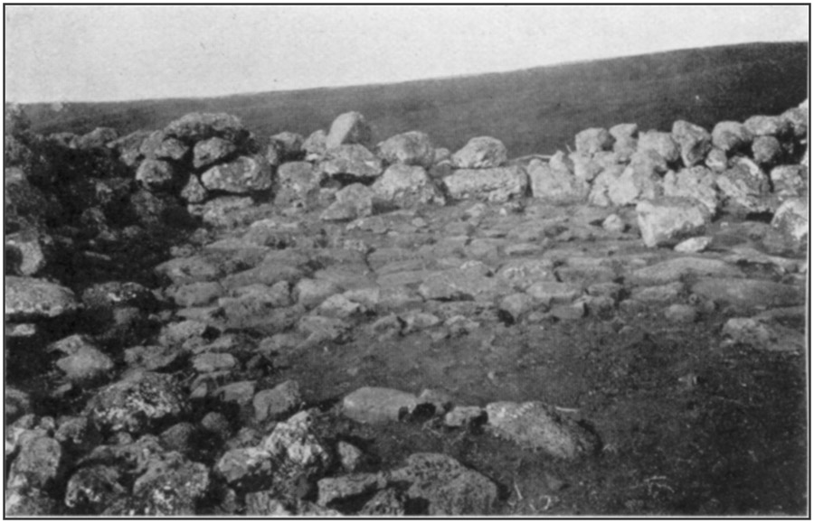
PLATE 39 b, Platform in Heiau A, looking southeastToList
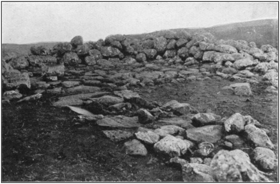
PLATE 39 c, Paved way in Heiau A, looking southwestToList
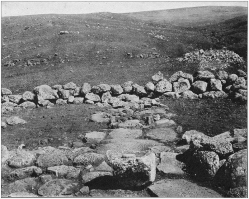
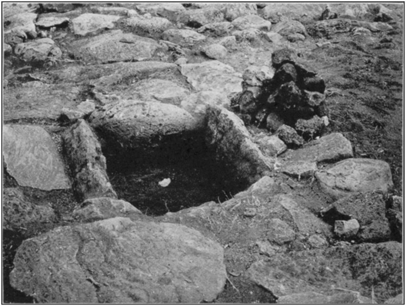
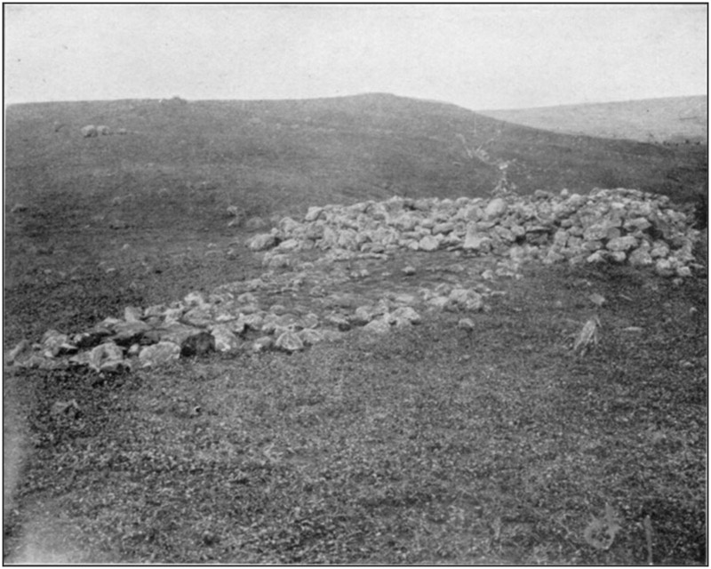
PLATE 41 a, Heiau B, on Molokai Island, looking northwestToList
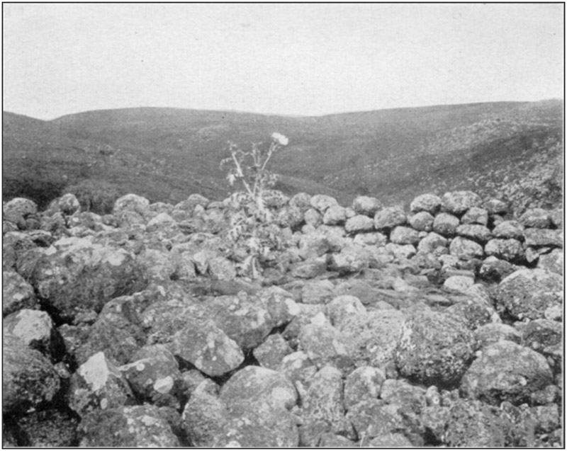
PLATE 41 b, Heiau B, showing stone-paved interior, looking northeastToList
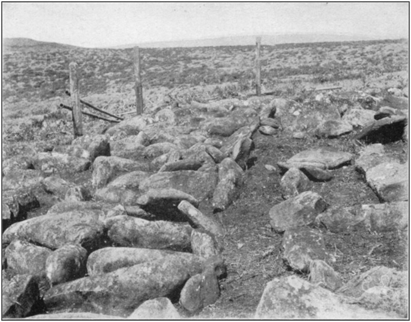
PLATE 42 a, The "Rain Heiau," Molokai Island, looking westToList
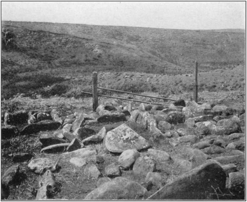
PLATE 42 b, The "Rain Heiau," looking southToList
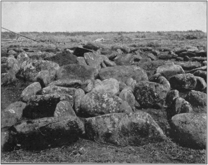
PLATE 43 a, The "Rain Heiau," looking northToList
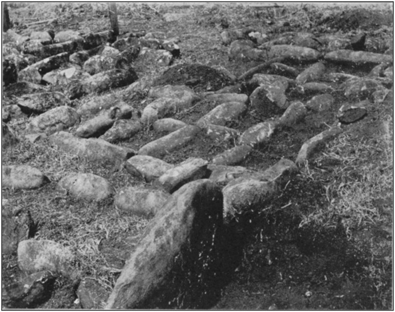
PLATE 43 b, The "Rain Heiau," looking southwestToList
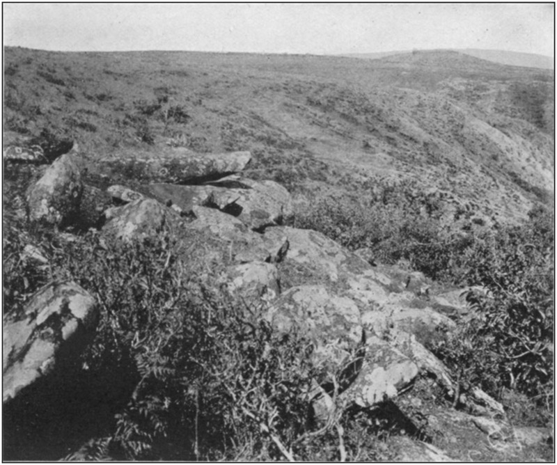
PLATE 44 a, The "Sacrifice Stones" on Molokai Island; looking southwestToList
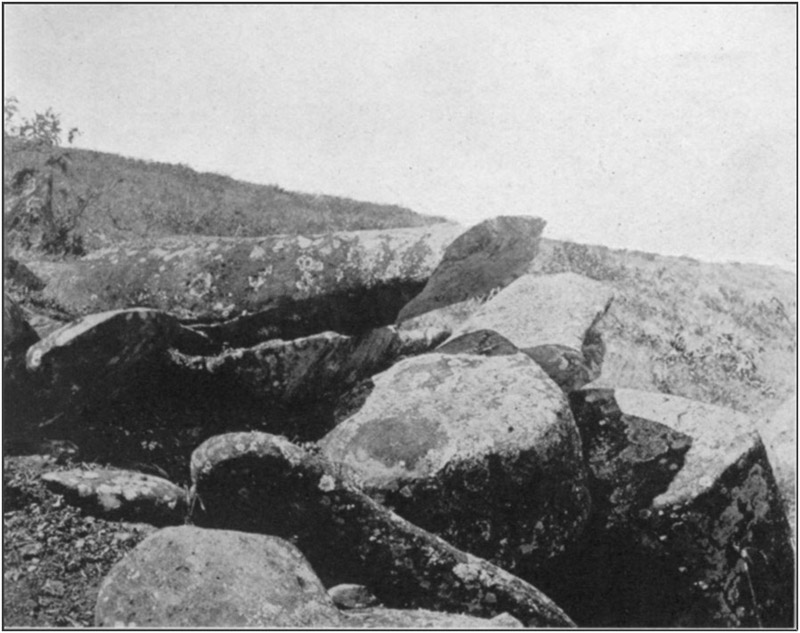
PLATE 44 b, The "Sacrifice Stones," looking westToList
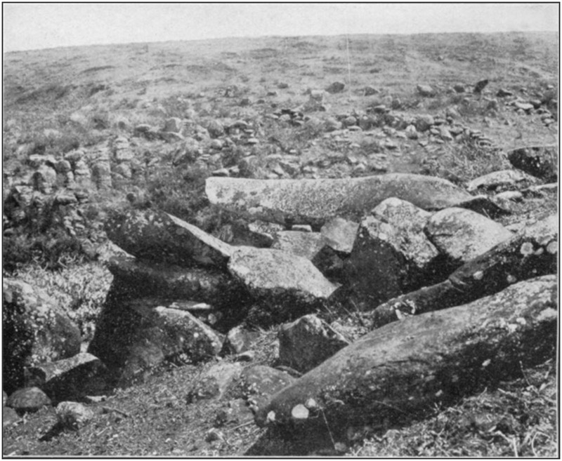
PLATE 45 a, The "Sacrifice Stones," looking northwestToList
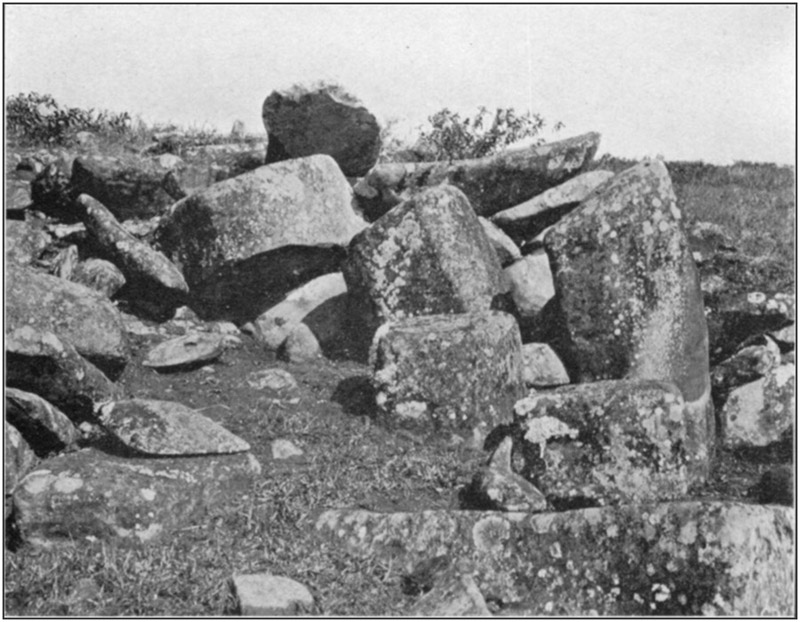
PLATE 45 b, The "Sacrifice Stones," looking southToList
Partial views are shown in plates 42 and 43.
THE SACRIFICE STONES
On the south side of a ravine with steep slopes and bowlder-strewn bottom, half a mile from the "Rain Heiau," is a pile of stones, most of them the natural outcrop, but some of them intentionally placed. The entire mass measures about 27 feet across each way. The highest stone is a weather-worn slab, with the upper surface somewhat convex, 6 feet 9 inches long, 2 feet 3 inches wide on the bottom, 1 foot 3 inches wide on top, 1 foot 4 inches thick. It lies nearly east and west, the upper end on the ground, the lower end on a large bowlder, beyond which it projects for 28 inches. Beneath this, with a space of 8 inches between them, is another stone, 5 feet long, 2 feet 4 inches wide, and 10 inches thick. Its upper surface is concave, the entire margin being higher than the central portion. It lies north and south, the southern end being supported by three small superposed slabs.These two are supposed to be sacrificial stones, on which victims were extended at full length, face downward. In this position they were easily slain by being decapitated or the neck or head being broken with a club or a stone. That they were utilized for some definite purpose is evident from the fact that the projecting ends of both have been broken off square, the spalls splitting back along the under-surface.
Views are given in plates 44 and 45.
On the opposite slope of the ravine from the sacrifice stones are two old dancing platforms, made by digging the earth down on the [182]hillside to form a level area, the lower margin of which is supported by a high wall of heavy stones. Near the platforms, on the steep slope, is a space of a fourth of an acre surrounded by a stone wall; and a row of stones marks and preserves a trail or path from them to the bottom of the ravine, terminating at what seems to be a small reservoir surrounded by stones and earth, with a dam above and to one side of it to shut out storm water.
One hundred and fifty yards up the ravine from the dance platforms are two large artificial depressions in weathered bowlders. They have the appearance of mortars or nut-crushing holes, but are supposed to be for catching water during rains, as it is known that the natives made these miniature reservoirs or catch basins, the water being dipped out into vessels as it accumulated.
HAWAII ISLAND
There are reports of former heiaus, house sites, etc., in and around Hilo, and there are numerous so-called "caves," many of which were used by the earlier natives as receptacles for their dead. The term "cave" is not to be taken in its usual meaning of a cavity due to erosion by water, or the small recesses due to wind scouring. In the Hawaiian Islands it means a tube or tunnel; a hollow space due to gas expansion; or a hole formed by gas or steam expansion or explosion in the lava while it is still soft or flowing; and which is now accessible where the top has fallen in or where it has reached the face of a cliff. These still exist practically as they were at the time of their formation.Of remains upon the surface, the clearing-up processes necessary for cultivation, and the improvements in and around the towns and villages, have either entirely destroyed them or so defaced them that they are now only shapeless ruins. Most or all of the near-by caves are in lava flows of comparatively recent origin and no reports of interments in them could be definitely verified. Human bones were found in three caves near Olaa, 10 miles from Hilo, but no objects of any sort were with them. The condition of the bones showed they had not been long deposited; in fact, with one skeleton were hobnailed leather shoes, with the bones of the feet still in them.
Three skeletons were discovered in a small cave near the dock in making an excavation for a railway cut. An old man living in the vicinity protested vigorously against any disturbance of them, saying they had been his friends and he had helped bury them. In deference to his sentiment the line of the track was deflected so as not to disturb the spot.
Nearly all of the bones mentioned above were soft and decayed, owing to the water which had percolated through the roof and dripped on them.
[183]
KILAUEA
It seemed probable that burials, or places where religious rites had been performed, might be found in the vicinity of the volcano. A number of caves were visited, but no evidence could be found to indicate that bodies were ever deposited in them, and persons living in that region had never heard of anything of the sort being found. A few of the caves were dry, but most of them were wet or have become obstructed by falling in of the sides or roof. Ledges and terraces within the ancient crater may contain graves, but lava flows and ash deposits have obliterated all traces of such if they ever existed.WAIMEA
From 2 to 4 miles west of Waimea, on both sides of the road to Kawaihae, are numerous stone walls, house sites, garden inclosures, taro terraces, and other forms, of uncertain use and purpose. The remains extend over many hundreds of acres. It is said that up to about 1840 this was an important town, containing at one period about 17,000 inhabitants.QUARRY ON MAUNA KEA
Waimea is the point from which to start for the quarries where the ancients obtained the hard black stone for making adzes. A great amount of work was done there, and refuse is abundant. It is 48 miles from Waimea to the quarries, part of the way by cattle trail through rough country, and they are at an elevation of more than 10,000 feet, considerably above the winter snow line. An examination was not attempted, as a visit to them involved securing a camping outfit and hiring guides and helpers at exorbitant wages.KAWAIHAE
The "Great Temple" built by King Kamehameha I is on a bluff 100 feet high, separated from the beach by a low level space 100 yards wide. This flat contains many stone structures, but their number, design, and character can not be ascertained on account of the almost impenetrable growth of algaroba. One of them is a rectangle about 50 by 150 feet, the walls high and thick; probably it is an older temple. There is some modern work here, because in one place a wall is cemented, perhaps by ranchmen.The "Great Temple" measures 80 by 200 feet on the outside, 50 by 150 feet inside, longest north and south. The two ends and the side toward the land are nearly intact and from 10 to 20 feet high according to the surface of the ground. At the north end, inside, is a platform 80 feet north and south by 45 feet east and west, the [184]four walls carefully and regularly laid up, the space within them filled with large stones, and the surface leveled with beach pebbles. It ends 4 feet within the wall next the sea, the top of this wall being on a level with the bottom of the platform. At the south end is another platform 40 feet east and west by 20 feet north and south, abutting against the east and south walls. A step or terrace 6 feet wide extends the full length of its north side. It has a less finished appearance than the platform at the north end. The central space, between the two, is paved with large stones which apparently pass under both platforms and extend from the foot of the east wall nearly to the west wall, a slight ditch separating it from the latter. The west wall stands below the top of the slope, and its outer face is from 10 to 20 feet high, in three platforms each 8 feet wide. On the slope below are several structures a few feet square formed by two parallel rows of stones with a cross wall at the lower ends, the cellar-like space thus inclosed being filled with pebbles to a level with the top of the walls.
From the northeast and northwest corners long walls extend northwest and southwest toward the beach. Their outer ends are lost in the thicket.
EAST POINT DISTRICT
From Kapoho southward to Kalapana and beyond many remains are reported, but residents say they are of rather modern date, some of them having been occupied since white people came into the country to live. Lava flows of recent date have covered a few.NAPOOPOO
The large heiau at which Captain Cook made his landing, and where he allowed himself to be worshipped as a god, is about in its original condition, having been repaired in recent years. When Captain Cook attempted to seize the King as a prisoner, the natives naturally rallied to the King's defense. A stone or other missile struck Cook on the head.Early in the last century an old Hawaiian who as a small boy witnessed the affray told Rev. Mr. Paris (as related by his daughter) that if Cook had been the god he pretended to be, the blow would not have hurt him; but when he fell with a loud groan the people knew he was only a man like themselves and, enraged at the deception practiced on them, quickly made an end of him.
HONAUNAU
The wall of the City of Refuge is nearly intact, as is that of the large heiau. Another heiau was destroyed by a tidal wave. The place is now a public park. Stokes, of the Bishop Museum, has done [185]much work here and at Napoopoo. The result of his labors will be published.KEAUHOU
The "Slide," made here in the time of King Kamehameha I, consists of two stone walls from 50 to 75 feet apart, the space between them being filled with stones to provide a level surface from side to side and to equalize the slope from top to bottom. It begins a mile from the foot of the hill, and its terminus was on a level area near the coast. The lower end is now so displaced and overgrown for a fourth of a mile that it can no longer be traced; the remainder of it is practically intact. The slope is not uniform, being somewhat determined by the natural surface, so that it is steeper in some parts than in others. Near the upper end some short stretches are quite steep, presenting from below the appearance of terraces. In places, flat stones are laid pavement fashion from side to side, or rows of stones which seem to be the tops of walls extend across. These were probably to prevent crawling of the smaller material used as a leveler. The slide, according to an old Hawaiian, was covered with one variety of grass, on which was laid another variety; but he could not say whether the two layers had their stems parallel or crosswise. Kukui-nut oil was used plentifully to act as a binder and to give a slick surface. The "sliders," as well as he could remember the description of them, were like sleds with runners; not flat boards like a toboggan. Small depressions here and there, either basin-shaped or well-shaped, have led to excavations in the hope of finding something; but they are due only to falling-in of tubes, tunnels, or bubbles in the lava.A somewhat similar but very much smaller slide is said to be on the coast 40 miles south of this one. At present it can be reached only from the shore, making a canoe voyage necessary.
Two ruined and overgrown heiaus are near the water line a mile from the slide. Both are built on bare lava, and at very high tides waves dash over them. Possibly the shore has sunk since they were built. Near by, on the flat lava, covered by every tide, are rock carvings rudely resembling the outlines of human figures. They must be of rather recent origin, as the stone is constantly subject to wear by the shingle. Stokes has copied them.
MOOKINI
At the extreme northwest corner of the island of Hawaii is a heiau in excellent preservation, there being but few fallen stones. The ground around is entirely free of growth except for grass and a few weeds, which may explain its appearance of newness; it has a very modern aspect, though it seems to antedate the discovery. It [186]measures 120 by 275 feet, longest east and west. The east wall is 11 feet high with a narrow terrace from end to end about midway the height. The north wall is 18 feet high. The south wall, which is in a somewhat irregular line, is 5 to 6 feet high. On the outside of the south wall, which forms one side of each, are two inclosures. One, near the east corner, measures 65 feet east and west and 15 feet wide, with its west wall at the edge of an opening which gives access to the interior of the heiau. The wall of this inclosure is 4 feet high. The other inclosure measures 21 feet east and west by 28 feet north and south, the west end flush with the west end of the temple. Its wall is 3 feet high.The main west wall is 12 feet high. A platform 2 to 4 feet wide, probably a seat or bench, extends along the inside of the south wall. An interior wall 4 feet high, not straight but approximately parallel with the north wall, with a space 10 to 15 feet wide separating them, has one end against the east wall, the other end coming near enough to the west wall to leave only a narrow passageway.
The entire space inside is paved with large stones; on these, as a floor, are several walls whose purpose is not clear; they run in various directions. Near the west end are some small inclosures, also a raised platform in which are 13 "wells," said to be intended to "hold the blood of those offered up as a sacrifice." Possibly the bodies or bones of victims were placed in them, though it is more probable that they held posts or idols.
On the outside, 20 feet from the west wall, is a "sacrifice stone," 6 by 8 feet, averaging 15 inches thick. It is somewhat dished, with a natural depression 12 inches deep.
The heiau is about 200 yards from the ocean. Walls, like fallen fences, extend diagonally from the corners at the west end; the northern one terminates 200 yards away on an outcrop of lava; the southern one has about the same length and ends 50 feet from a similar wall that reaches in a rude semicircle, convex uphill, for 300 yards to the top of a cliff over the ocean. On the opposite side of a small cove within the farther end of this wall is a stone which is known to the natives as the "Shark" or the "Shark God." It is 8½ feet long, 32 inches across at the widest part, averages 14 inches thick, and has somewhat the shape of a coffin with narrowed ends. Lying just on the break of the slope, it inclines slightly down the bank. The end toward the water is carved in a fairly good representation of a turtle's head; on the opposite end are nine artificial cup-like depressions from 1½ to 3 inches in diameter with a depth rather less than half the width; three are on top, three on the end, three on the lower side. Like any long stone supported at the center with the ends free, it gives a metallic note when struck with a knife or other [187]small piece of metal. It is already defaced by curious experimenters, and will probably be broken up some day in search of the "treasure" inside, or to "see where the music comes from."
For nearly a mile south of the heiau, covering the space between the ocean cliff and a line approximately parallel to it a fourth of a mile up the hill, are many inclosures and long walls. Low walls surround spaces 10 to 15 feet across, filled level with earth, which are either house sites or burial places. Some inclosures, still smaller, with no break in the wall, are supposed to be graves; and graves may also be marked by the many small piles of stones. Other stone heaps, some straight, some crescent-shaped, from 10 to 20 feet long, all the curved ones convex to the windward, were wind shelters. Some of them are known to be made by modern hunters as blinds in plover shooting.
In at least two places are long parallel rows of large stones placed singly, 1 foot to 3 feet apart, the rows separated by a space of from 4 to 6 feet. One set has a dozen or more rows.
Inside of one of the inclosures, directly up the hill from the old landing, is a large stone with an artificial depression of 2 gallons capacity. It was intended as a mortar for pounding nuts.
LAUPAHOEHOE
An old lava flow has pushed out into the ocean in a shape somewhat resembling "a leaf floating on the water," which is the meaning of the word. It forms a nearly level area of 12 or 13 acres, only a few feet above tide. Toward the outer end are numerous walls and inclosures, mostly in ruins and overgrown with trees and bushes. Some of them are clearly modern; others are ancient. Near the lighthouse are the remnants of a heiau; only a part of its walls can be traced.A wall 3 feet high, beginning at a large stone at one corner, incloses a space 26 by 27 feet, outside measurement; the interior is filled with earth and small stones to a level with the top of the walls. At the end toward the ocean, is a platform 20 feet wide, terminating 50 feet from the sea. On this platform is a space 7 by 12 feet, outlined by large rocks. Halfway between the platform and the water is a wall which may be recent.
Near this inclosure is one hexagonal in outline, the walls 2 feet high, and the space inside, 11 by 17 feet, filled with earth to a foot above the top of the wall.
On top of the bluff, 350 feet above tide level, is a heiau the west wall of which was removed in making a deep cut for the railway. The inside dimensions are 70 feet east and west, 115 feet north and south. The interior area, originally irregular, was somewhat leveled, [188]and covered with a pavement of cobblestones which were carried up from the beach, as were many of the large stones in the wall. The pavement has been torn up in cultivating the ground. The wall is from 4 to 6 feet high inside. This is a little more than the original height, as it was repaired and raised for use as a corral. Along the outside of the north wall, at the west end, is a heavy wall which, with the main wall, forms a "well," nearly filled with rocks. There are no supporting platforms outside, but along the north and east walls are revetments reaching halfway up the face. The southeast corner is rounded and braced or buttressed. These forms of support have been noticed in only one other place. There is a house site within, at the northeast corner. On the wall, placed there in adding to its height, were a broken taro pestle and a very dense siliceous rock, of high specific gravity, and filled with olivines. It weighs about 75 pounds. The ends have been chipped off to give it an ellipsoidal form, otherwise the wave-worn surface is unworked, except that one of its larger faces is rubbed smooth, almost polished, by use as a grinding stone, for which purpose it is excellently adapted by reason of its unusual abrasive quality.
MAUI ISLAND
There are not many aboriginal structures on Maui, but among those which can be found are some of extreme interest on account of their size and complicated arrangement.KAUPO, OR MOKULAU
A mile and a half from the coast at Kaupo, or Mokulau landing, at the eastern end of the island, are two large heiaus. As it would have required a week's time and a considerable outlay of money to reach them, by reason of the distance and lack of roads, they were not visited.WAILUKU
At the mouth of the Iao Valley, a mile north of Wailuku, is a sand dune having a nearly level area of about an acre at each end, connected by a curved ridge whose sharp crest is lowered about 20 feet by erosion. On each extremity is a stone inclosure, with several walls on the slopes below them except on the eastern side, toward the ocean. Here a stream has encroached upon the bottom of the dune to such an extent that only a portion of the inclosure nearer town is still remaining, one side and part of each end having fallen into the ravine. The wall along the opposite, or western, side is buried in the sand, only the highest stones still projecting. From the north wall a facing of large stones extending down the surface of the dune for a vertical [189]distance of 15 feet has prevented erosion by the winds. No protection was necessary below this point as the action of rain water on the lime from disintegrated coral rock contained in the deposit has caused the sand to "set" or harden.The other heiau, at the north end of the dune, is apparently unfinished. None of it has disappeared, but the plan is difficult to make out. At its northern end is a protecting layer of stones reaching 25 to 30 feet down the slope, in three separate terraces. Similar terraces are on the slope below the southern end of the east wall. Here and there within the structure are well-like spaces filled with stones. The purpose of these is unknown. Stones of varying sizes, mostly small, within the walls indicate a pavement or floor, but the dense growth of lantana brush and the accumulated sand preclude any careful examination or accurate description of these remains.
WAIHEE
Southward from the mouth of the Waihee Valley, 5 miles north of Wailuku, is a range of sand dunes from 200 to 300 feet high, extending for half a mile or more in a wide curve, with the concave side facing the ocean. The level space thus bounded is about a fourth of a mile in its greatest width and contains 50 or 60 acres. Approximately parallel with the windings of the shore line, at an average distance of 200 feet from it, is a strong stone wall, built at an unknown date but prior to the advent of the whites. The plain purpose of this wall was to protect from high tides the low land lying behind it and reaching nearly to the foot of the dunes. This area is now cultivated in a variety of crops, mainly rice. Formerly it was a great taro patch of a Hawaiian settlement. A modern flume, which follows closely the line of an ancient ditch, brings down the necessary water from Waihee Creek.In front of the wall a space of 5 or 6 acres is covered with a stone pavement on which are the walls of old houses and inclosures. They are protected on the seaward side by thousands of cubic yards of water-worn stones, piled up like a revetment or riprap, which terminate abruptly at the southern end but extend to the mouth of the creek at the north. The dunes show many angular rocks of the same general material, in their lower portion, so they all probably belong to a spur or projection from the mountain, washed clean at the front by waves, and covered at the rear by the dunes. Some of the stones along the water front were rolled by tides and wave-currents from the débris carried down by the creek from the mountains. At high tides waves surmount this natural breakwater, but spread out over the level pavement and sink between the stones, so that dwellers upon the site were not disturbed by their action.
[190]At its northern extremity the high wall connects with a rear corner of an extensive heiau, which was either never completed or has been partially demolished. The unfinished appearance of this, as of all similar remains, is explained by the natives as being due to the interrupted efforts at their construction by "the little people" (fairies), thousands of whom took part in the work. They must complete their task in one night; at the first gleam of dawn they must instantly disappear, leaving their work as it was at the moment, and could never gather at that spot again.
The highest part of the heiau wall still upright is about 10 feet; but some of the stones within, promiscuously heaped, are 2 to 3 feet higher. The structure is about 100 by 250 feet, longest on the line from water to hill. A cross wall, possibly somewhat modified in recent times, divides it into two unequal parts, the seaward portion being nearly square and 5 feet higher than the part at the rear. On the latter are small inclosures of stone, the space within them paved with gravel. If of the same age as the remainder of the structure they may have been for priestly seclusion or preparation, though they may be houses of later natives who took advantage of the foundation made by their ancestors.
Measurements or clear descriptions of these remains are not possible, owing to overgrowth. A satisfactory study, to distinguish between ancient and modern parts, or between undisturbed stones and those not in their original position, would require careful survey with transit and level after the brush is cleared away; and this must be followed up with considerable excavation as well as removal of loose rock; all of which would demand the labor of a dozen men for three months. Even at that, there is no certainty that definite knowledge would be gained; but it is not to be had in any other way.
BURIAL PLACES
Near the top of a remnant of a crater rising from the shore line of the ocean, 11 miles from Wailuku on the road to Kahakuloa, is a stone wall built on the leeward slope, the only place on which it could be constructed, as much the larger part of the crater has been blown out into the sea. Between the wall and the summit are at least a dozen stone-covered graves; possibly there are others not seen, as much of the brush is impenetrable. Some of them are sunken; others appear quite recent.Many such graves are found on the dunes. They are all modern, some of them still surrounded by the original wooden fences.
[191]
IN THE IAO VALLEY
The deepest valley on Maui is that of the Iao River. The sides, nearly vertical in places, have an elevation of about 3,000 feet. About 2 miles above the town of Wailuku, well within the mountain, are walls made of stones of varying sizes up to half a ton or more. They extend over several acres of land and their structure is quite complicated. Mostly, they are borders of taro patches, though some of them mark house sites or garden inclosures. One wall, supporting a terrace, is 8 to 10 feet high and contains very heavy stones.Near the head of the Iao Valley there are fully 40 acres of taro beds. A trail formerly led from this spot to the south shore of the island, near Lahaina. It can not now be traced, being obliterated by slides.
Residents of Wailuku say these places were in use only 50 or 60 years ago.
Many evidences of former occupation have been destroyed in operating the extensive sugar plantations.
KAUAI ISLAND
There seems to be less evidence of Hawaiian occupancy on Kauai than on any other of the five principal islands. Comparatively few heiaus are reported. Some of those which were in existence when the whites came have been destroyed or defaced to such a degree in establishing sugar plantations that their original form is uncertain; while others are so covered with vegetation, either natural or due to cultivation, that nothing definite can be ascertained as to their size or structure.The site which might be considered as possessing the greatest interest is an aboriginal quarry and workshop where material for stone implements was obtained and shaped into desired forms. There can be no doubt as to the existence of such a place; but no one now knows its location, unless it be some of the older Hawaiians, who, however, profess entire ignorance in regard to it. Mr. William H. Rice, of Lihue, once induced some natives to conduct him to the spot. He believes that if he alone had gone his guides would have fulfilled their promise; but unfortunately several other men joined him, and the natives, either suspicious of their intentions, or not wishing the premises to become publicly known, pursued a devious and wearisome journey through the jungle, crossing gulches and clambering up and down cliffs until the white men were thoroughly bewildered and exhausted; then announced that they "couldn't find it," and led the party home.
[192]
LIHUE
At Niumahu, 2 miles from Lihue, on the road leading south and west from the harbor of Nawiliwili, is a fish pond known as Alakoka. It is a short distance above the mouth of the river, where the little valley widens in a half-moon shape, the stream flowing close to the bluff on the right. The bottom land on the other side is so low as to be swampy. Along the river bank on this side is a heavy wall of stone and earth, reaching the higher land at each end, thus forming a pond of 15 or 20 acres in which the ancient Hawaiians kept their surplus catch of fish. The wall has been raised and strengthened by its present owner, a Chinese, who raises ducks instead of fish.WAILUA
Near the mouth of the Wailua River, 6 miles from Lihue, is the former abode of the royal family. The place is so overgrown, except in the few cultivated spots, that no examination of it can be made. No traces of the residences are apparent, although the stone boundary walls of the grounds are still standing. The site of the royal cemetery is set aside as public property. There is nothing now to indicate that any interments were ever made in it. The "Birthstone," on or by which all prospective heirs to the throne must be born in order to insure their right to the succession, still lies in the brush near the foot of a little cliff. In case of a dispute among the claimants to the throne this stone had the power, by some means of which the knowledge has now been lost, to determine which, if any, of the contestants was entitled to possession.The "Sacrifice Stone," also, is in its original place, being so large that it can not be easily removed. Formerly this had a grass roof over it, supported by high poles. When the victim's life was extinct his body was suspended to a rafter or crossbeam at the top of the structure and left there until the flesh had decayed. The bones were then interred on top of the bluff in the rear. It is said that the corpses of chiefs and others of high rank were wrapped in banana leaves and steamed until the flesh fell away. The skeletons were then buried.
A mile from the mouth of the Wailua River, on a narrow plateau between it and a small tributary, the summit level being about 200 feet above the water, is a heiau in fairly good condition. It is one of the large structures of its kind, but is so overgrown that measurements or close description are not possible. It is supposed to be the one which was sacred to the devotions of the highest priesthood. The common people were not allowed to venture near it, and even the king could not visit it without special permission involving the most complicated ceremonies. It has passed into possession of the county and [193]will be restored as nearly as can be to its pristine state and thus preserved.
On a mass of loose rocks, resulting from disintegration of an old lava flow, projecting into the ocean half a mile east from the mouth of the Wailua River, and near the race track, is a heiau of irregular construction. The extreme measurements are 80 feet north and south by 200 feet east and west. The wall on the side toward the sea is higher and wider along the central half than it is nearer the ends. Small inclosures, bounded by single rows of stones, probably mark the sites of houses for priests and attendants. Along the inner side of the wall next to the water are four depressions, remains of partially filled well-like or cistern-like excavations; similar hollows, obscured by brush, are also next to the inner foot of the opposite wall. A large rock in the form of a triangular prism, standing upright, with one end firmly imbedded in the ground, was no doubt a "god" of some kind; it has a slight hollow or "cup" pecked in the flat top. There are several irregular rows of stones outside of the inclosure. Dense growth prevents the examination necessary for a closer description.
DUNE BURIALS
Four miles east of Lihue a spur of the plantation railway was run into the dunes to procure sand for making fills. In the course of this work human bones were found, the remains of one individual in one spot and of at least two others not far away. None of these bones seemed to have been long underground. Search in the vicinity, over bare spots among the ridges whose upper portions have been carried away by the winds, revealed indications of burials in at least six other places. Such bones as were found were decayed or in fragments. Among them was part of the skull of a very young infant. A quantity of cooking stones, some coral rasps or files, and a much weathered fragment of a wooden bowl, denoted that camps had been made on the dunes. As the beach is smooth, firm, and extensive, providing an excellent place for landing canoes or dragging seines, these remains probably pertain to parties or families who maintained fishing camps here.At the mouth of the Wailua River, on the east side, was a "City of Refuge." It is now partially destroyed, many of the stones having been taken away to make a fill in the road. It was rectangular in form, 360 feet east and west, 60 feet north and south, made of large stones, some of them weighing a ton or even more. The eastern portion of the interior is artificially made a foot higher than the western. The structure is 300 feet from the water. Midway down the gentle slope in front, opposite the western end, is a slightly crooked row, [194]100 feet long, of very large stones. A similar row is near the water on the side between the inclosure and the river.
WAIMEA
There were formerly several heiaus within a few miles of Waimea. Some of them have been destroyed by cultivation, while others are difficult to find and impossible to examine in the cane fields or dense brush.At the east foot of a rocky peak 13 miles by road from Waimea, at an elevation of more than 3,600 feet, is a small heiau almost on the brink of the canyon. Within the walls it is 30 feet across each way. On the south line are three large stones in line, one at each corner, the third about midway between them. No doubt their position determined the location of the structure. It stands on a slight slope. The west wall is 2 feet high inside, the earth having washed down level with its top outside. The north wall is a foot higher than the floor at the west end, and is completely buried at the east, as are the south and west walls along their entire length except for a protruding stone here and there. In fact, the whole interior seems to have received a heavy deposit of earth, carried in from the outside by wind and rain. All these features give an appearance of antiquity to the ruin.
Directly below it, well toward the bottom of the canyon, which is said to be 3,000 feet deep, is a long, narrow, curved ridge with rounded top and almost vertical sides. The upper part, apparently an old lava flow, is darker in color than the surrounding precipices, its surface checkered and seamed by weathering and erosion, so that it has an almost startling resemblance to a huge serpent crawling out of the side of the mountain and, with head laid flat on the extreme point of the cliff, watching something in the stream bed a thousand feet below. If the old Hawaiians had been familiar with ophidians, as were the American Indians, this "Snake God" would no doubt have held high rank among their divinities.
CONCLUSIONS
As intimated above, much additional information regarding antiquities in the Hawaiian Islands can be found in publications of the Bishop Museum in Honolulu. Descriptions, with illustrations, of a number of heiaus are given by Mr. Thrum in the "Hawaiian Annual" for 1906 to 1910, inclusive; and his forthcoming volume will completely cover this branch of archeology. The Bishop Museum has undertaken to make a complete survey and report of all the ancient remains, while Dr. Brigham has almost finished for publication an exhaustive treatise which will include all his observations [195]and deductions along the same lines. With these tasks ended, there will be nothing for anyone else to do, except to take measures for the restoration and care of the principal structures.All the aboriginal remains on the islands are the work of the present Hawaiian race. When the earliest of these people came here they found the islands without inhabitants. There are no evidences of any prehistoric population nor any indications whatever of underground remains. Consequently, so far as can be ascertained, excavations would not result in the discovery of any prehistoric objects or of anything essentially different from what can be seen on the surface or found slightly covered by very recent natural accumulation. At the same time, all the remains are well worthy of study and preservation. These conclusions meet the full approval and indorsement of both Mr. Thrum and Dr. Brigham.
[197]
INDEX
| Page. | |||
| Account's Caves | 131 | ||
| Adair, quoted on construction of houses | 170 | ||
| Adzes— | |||
| chert, from Miller's Cave | 79 | ||
| stone, in Molokai | 177 | ||
| Akers Post Office, cave in vicinity of | 18 | ||
| Alabama, explorations in | 133-150 | ||
| Alabaster— | |||
| from Wyandotte Cave | 108-109 | ||
| See Stalagmite; Travertine. | |||
| Alford's Cave | 140 | ||
| Allen, Valentine, acknowledgment to | 29 | ||
| Altars, Supposed Sacrificial, origin of | 172 | ||
| See Sacrificial Stones. | |||
| Alton, house mounds near | 161 | ||
| Animals— | |||
| bones of, found in cave | 33 | ||
| of Molokai | 176 | ||
| Antler, Objects Of, from Sell Cave | 48 | ||
| Arkansas County, Ark., excavation of mound in | 170 | ||
| Arklow Cave | 125 | ||
| Arlington— | |||
| cairns in vicinity of | 40 | ||
| caves in vicinity of | 34, 35 | ||
| Armstrong, B.G., tradition investigated by | 172 | ||
| Arnholdt Cave | 90 | ||
| Arrowheads discovered in caves | 31, 39 | ||
| Ash Cave | 89 | ||
| Ashes— | |||
| beds of, in caves | 31, 32, 33, 38 | ||
| curious cavities in | 67-68 | ||
| deposit of, in Miller's Cave | 65-66 | ||
| Ashley Creek, cave on | 19 | ||
| Awls— | |||
| bone, in Miller's Cave | 74 | ||
| from Goat Bluff Cave | 37 | ||
| Axes— | |||
| from Miller's Cave | 78 | ||
| grooved, found in cave | 39, 40 | ||
| Aztalan, Wis., theory concerning wall at | 172 | ||
| Bagnell Hill, cave on | 94 | ||
| Bailey's Cave | 140 | ||
| Baker's Lake, cave on | 89 | ||
| "Ballroom" of Bates Cave | 23 | ||
| Barnard Cave | 140-141 | ||
| Barren County, Ky., explorations in | 119 | ||
| Bat Cave— | |||
| in Colbert County | 134 | ||
| in Shannon County | 18 | ||
| near Crocker | 55 | ||
| on the Osage River | 95 | ||
| Bates Cave | 22-23 | ||
| Battle Ground near Miller's Cave | 59 | ||
| Beads— | |||
| columella, from cairn | 87 | ||
| shell, found in cairn | 28 | ||
| stone, in cave | 31 | ||
| Bear Creek, rock house on | 118 | ||
| Becker, Philip, examination of cave refuse by | 84 | ||
| "Beckwith's Fort," mounds near | 169 | ||
| Bedford, caves in vicinity of | 103, 104 | ||
| Beer Cave, popular name for Steuffer Cave | 99 | ||
| Belcher Cave | 121 | ||
| Bell, Robert A., cave on farm of | 51 | ||
| Bell's Cave | 122 | ||
| Ben Smith's Cave | 119 | ||
| Berry, George, cave on land of | 43 | ||
| Big Creek Cave | 18 | ||
| Big-Mouth Cave | 138 | ||
| Big Piney— | |||
| caves in vicinity of | 57, 81 | ||
| house mounds on | 162 | ||
| Big Piney Post Office, cave in vicinity of | 56 | ||
| Birthstone of Kauai Island | 192 | ||
| Bishop Museum, value of, to students | 174 | ||
| Blatchley, W.S.— | |||
| caverns described by | 102 | ||
| quoted | 103-104, 107, 110 | ||
| Bledsoe County, Tenn., cave in | 128 | ||
| Bloodland, house mounds near | 57 | ||
| Blowing Cave | 136 | ||
| Blue River, caves on | 111 | ||
| Blue Spring Cave | 18 | ||
| Bluewater Cave | 134 | ||
| Bluff City, caves in vicinity of | 124, 125 | ||
| Bode Cave | 94 | ||
| Boiling Spring Of The Gasconade, cave near | 34 | ||
| Bond, John R., cave on farm of | 92 | ||
| Bone Cave | 120 | ||
| [198]Bones, Animal, in caves | 33, 37, 72, 73 | ||
| Bones, Human— | |||
| in Bell's Cave | 51 | ||
| in cairn at Devil's Elbow | 86-87 | ||
| in cairns on Helm's farm | 88 | ||
| in Caldwell's Cave | 132 | ||
| in cave on Meshach Creek | 121 | ||
| in Colyer's Cave | 133 | ||
| in Cub Run Cave | 113 | ||
| in dune burials | 193 | ||
| in Goat Bluff Cave | 36, 37, 38, 39 | ||
| in Gourd Creek Cave | 34 | ||
| in Haunted Cave | 116 | ||
| in Hawaiian caves | 182 | ||
| in Miller's Cave | 67, 69-72, 73, 76 | ||
| in mound | 151 | ||
| in Ramsey's Cave | 82 | ||
| in Sell Cave | 47-49 | ||
| See Skeletons; Skulls. | |||
| Bowling Green, caves near | 118 | ||
| Bradley Cave | 112 | ||
| Brandon, cave near | 138 | ||
| Bridal Cave, beauty of | 90 | ||
| Briggs, Capt. J.B., cave owned by | 117 | ||
| Briggs, Ike, cave on land of | 116 | ||
| Briggs's Cave | 116 | ||
| Brigham, Dr., work of | 174, 194 | ||
| Brooks Cave | 56 | ||
| Brumley, cave in vicinity of | 91 | ||
| Bryant's Bluff, rock shelters in | 40 | ||
| Bucher Cave | 51 | ||
| Buckner Cave. See Harry Buckner Cave; Joel Buckner Cave. | |||
| Buffalo Wallows, so-called | 152 | ||
| Bunch Cave | 90 | ||
| Burial Cave near Sheffields | 135 | ||
| Burial Customs in Hawaii | 192 | ||
| Burial Places on Maui Island | 190 | ||
| Burials— | |||
| communal | 151, 153, 157 | ||
| dune | 193-194 | ||
| in Goat Bluff Cave | 36 | ||
| in Gourd Creek Cave | 30 | ||
| inclosed in flat stones | 88 | ||
| on Lost Hill | 27 | ||
| See Cairns; Graves. | |||
| Burksville, cave near | 111 | ||
| Bushnell, D.I., JR.— | |||
| conclusion of, regarding house mounds | 164 | ||
| quoted on house mounds | 161 | ||
| Cairns— | |||
| at Miller's Cave | 59 | ||
| at Sugar Tree camp | 40 | ||
| containing double burial | 19 | ||
| in vicinity of Eugene, Mo. | 96 | ||
| near Pillman's Cave | 83 | ||
| near Woodland Cave | 84 | ||
| of common occurrence | 17 | ||
| on Helm's farm | 87-89 | ||
| on Lost Hill | 24-28, 84 | ||
| on the Gasconade | 40, 99 | ||
| See Burials; Graves. | |||
| Caldwell's Cave | 131-132 | ||
| Camden County, Mo.— | |||
| explorations in | 89-91 | ||
| geological formations in | 91 | ||
| Cameron, William, tradition obtained by | 172 | ||
| Camp-ground Cave | 51 | ||
| Cannibal House, so-called, near Omaha | 156 | ||
| Cannibalism, discoveries indicating | 77 | ||
| Cave, meaning of term, in Hawaii | 182 | ||
| Cave Earth, composition of | 16 | ||
| Cave Exploration, conditions considered in | 101 | ||
| Cave Man, no trace of, in Ozark Hills | 15 | ||
| Caves. See Caverns. | |||
| Caverns— | |||
| air of | 14-15 | ||
| as habitations | 14 | ||
| development of | 13-14 | ||
| floors of | 14 | ||
| method of measuring | 17 | ||
| proper examination of | 16 | ||
| Cavities In Ash-bed | 67-68, 73 | ||
| Cedar Grove, cave in vicinity of | 18 | ||
| Chattanooga, caves in vicinity of | 132 | ||
| Chaumont Station, cave near | 117 | ||
| Cheatham's Ferry, cave near | 134 | ||
| Chippewas, Sioux driven westward by | 172 | ||
| Chunkey Stones in Molokai | 177, 180 | ||
| City Of Refuge— | |||
| at mouth of Wailua River | 193 | ||
| wall of | 184 | ||
| Civil War, caves as shelters during | 23 | ||
| Clarksville, cave in vicinity of | 123 | ||
| Clemmens Creek Cave | 89 | ||
| Coahoma County, Miss., large mound in | 171 | ||
| Coal Pit Hollow, mention of | 24 | ||
| Coffee Cave | 134 | ||
| Cokely Cave | 90 | ||
| Colbert County, Ala., caves of | 134, 135 | ||
| Cole County, Mo., explorations in | 100 | ||
| College Cave | 128 | ||
| Collinsville, cave in vicinity of | 139 | ||
| Colossal Cave | 115 | ||
| Colyer's Cave | 133 | ||
| Communal Burial. See Burials, communal. | |||
| Cook, Captain, death of | 184 | ||
| Cooke, George, acknowledgment to | 175 | ||
| Cooking, method of, in Molokai | 179 | ||
| Cookville, caves in vicinity of | 42 | ||
| Crawford County, Ind., explorations in | 107 | ||
| Crittenden County, Ark., mound excavations in | 169 | ||
| Crump's Cave | 118 | ||
| Cub Run Cave | 113-115 | ||
| Culver's Cave | 136 | ||
| Current River, caves of | 18 | ||
| [199]Daerhoff, Ben, cave on farm of | 95 | ||
| Dallas County, Mo., house mounds in | 161 | ||
| Dancing Platforms in Molokai | 181-182 | ||
| Davis, J.W., caves on farm of | 42 | ||
| Daylight In Caves, use of term | 16 | ||
| Dekalb County, Ala., caves of | 137-139 | ||
| Dent County, Mo., caves of | 20-22 | ||
| Devil's Elbow— | |||
| burials at | 88 | ||
| house mounds at | 162 | ||
| walled graves at | 84 | ||
| Dillon, house mounds near | 42, 162 | ||
| Dinsmore, Dr. R.S., excavations made by | 153-154 | ||
| Discoids, Stone, in Molokai | 177 | ||
| Dixon, cave in vicinity of | 89 | ||
| Dixon's Cave | 116 | ||
| Donnehue's Cave | 103 | ||
| Donnelson's Cave | 103-106 | ||
| Double Cave | 54-55 | ||
| Drip Rock— | |||
| deposits of, in Berry Cave | 43 | ||
| meaning of the term | 16 | ||
| See Stalactite; Stalagmite. | |||
| Dry Cave | 90 | ||
| Dry Creek, cave on | 56 | ||
| Dry Fork Post Office, caves near | 119 | ||
| Dunbar's Cave | 123-124 | ||
| Dunes, Burials In | 193 | ||
| Dunlap, caves in vicinity of | 128-129 | ||
| Edenville Road, cave on | 57 | ||
| Edgar Springs, cave in vicinity of | 23 | ||
| Edmonson County, Ky., caves of | 115-118 | ||
| Eidson, Will Robert, cairns on farm of | 90 | ||
| Eigenmann, Professor, conclusions of | 105 | ||
| Eldon, cave in vicinity of | 96 | ||
| Ellis Cave | 138 | ||
| Eminence, supposed cave near | 20 | ||
| Esmith Caves | 119-120 | ||
| Eugene, graves in vicinity of | 96 | ||
| Farmington, mounds near | 162, 166 | ||
| Fearin Cave | 139 | ||
| Ferguson, Mo.— | |||
| excavation of mound near | 168 | ||
| house mounds near | 161 | ||
| Fish, eyeless | 18 | ||
| Fishing Cave | 18 | ||
| Fishponds— | |||
| at Niumahu | 192 | ||
| of Molokai | 175 | ||
| Flintworking Site | 59 | ||
| Food Supply of Molokai | 175 | ||
| Foote, A.L., cave on land of | 44 | ||
| Ford's Cave | 119 | ||
| Fort Deposit Cave— | |||
| cross sections of | 144-149 | ||
| description of | 143-150 | ||
| Fort Payne Cave | 137-138 | ||
| Fortification, Indian, near Miller's Cave | 59 | ||
| Fossil Cave— | 91 | ||
| plan of | 92 | ||
| section of | 92 | ||
| Franklin County, Tenn., caves of | 131 | ||
| Freeburg, caves in vicinity of | 97, 99 | ||
| Freeman's Cave | 81-83 | ||
| French Lick Springs, cavern near | 107 | ||
| Game played in Molokai | 177 | ||
| Garvin Cave | 112 | ||
| Gasconade River, caves on | 96, 97, 98, 99 | ||
| Gascondy, cave in vicinity of | 98 | ||
| Gilder's Discovery | 157 | ||
| Gill, De Lancey— | |||
| observations of | 48 | ||
| theory of | 17 | ||
| Glaize Creek, cave near | 91 | ||
| Glass Fragment, from Goat Bluff Cave | 37 | ||
| Glover, Robert, cave on farm of | 122 | ||
| Goat Bluff Cave, description of | 35-39 | ||
| Gods, Stone | 186, 193 | ||
| Gold In Caves, beliefs concerning | 21, 30 | ||
| Gordon, tradition related by | 173 | ||
| Gouge, from Miller's Cave | 79 | ||
| Gourd Creek— | |||
| cairns at mouth of | 24-25 | ||
| village site on | 34 | ||
| Gourd Creek Cave— | |||
| description of | 29 | ||
| exploration of | 28-34 | ||
| Graham Cave | 83 | ||
| Granite Mountain, mounds near | 168 | ||
| Gravel in caves | 16 | ||
| Graves— | |||
| cist, at Iowa Point | 152 | ||
| near Bell's Cave | 123 | ||
| near McKennan's | 52 | ||
| of Molokai | 178 | ||
| on Laughlin's ranch | 44 | ||
| on Saline Creek | 95 | ||
| walled, at Devil's Elbow | 84-87 | ||
| See Cairns; Burials. | |||
| "Great Temple" of Hawaii | 183-184 | ||
| Green River, rock shelters on | 118 | ||
| Gregory, Professor— | |||
| mention of | 175 | ||
| work of | 174 | ||
| "Ground House Indians," mounds made by | 172 | ||
| Ground House River, probable origin of name | 173 | ||
| Grundy County, Tenn., caves of | 130 | ||
| Gulfs, formation of | 108 | ||
| Gulfs Of Lost River | 107 | ||
| Gumbo for making vessels | 69 | ||
| Guntersville, caves in vicinity of | 139, 140 | ||
| Guthoerl, Peter— | |||
| cave on farm of | 20 | ||
| mounds on farm of | 22 | ||
| Ha-ha-ton-ka, caves in vicinity of | 89 | ||
| Hamilton County, Tenn., caves of | 132 | ||
| Hammers found in cave | 39 | ||
| Hardin County, Ky., caves of | 112 | ||
| Hardin's Cave | 139-140 | ||
| [200]Harlow Cave | 112 | ||
| Harrison County, Ind., explorations in | 111 | ||
| Harrison's Cave | 136 | ||
| Harry Buckner Cave | 113 | ||
| Hart County, Ky., explorations in | 112 | ||
| Haunted Cave | 116 | ||
| Hawaii, archeological work in | 174-195 | ||
| Heiaus— | |||
| at Kaupo | 188 | ||
| at Napoopoo | 184 | ||
| described by Mr. Thrum | 194 | ||
| of Hawaii Island | 185-187 | ||
| of Wailua | 192-193 | ||
| of Waimea | 194 | ||
| on Maui Island | 190 | ||
| on Mauna Loa | 178-180 | ||
| sacred to priesthood | 192 | ||
| Helm, Daniel, cairns on farm of | 87 | ||
| Henson's Cave | 129 | ||
| Hilo, archeological work in vicinity of | 182 | ||
| Hixson's Cave | 129 | ||
| Holmes, W.H., suggestion made by | 15 | ||
| Holston River, cave on | 125 | ||
| Honaunau, work of Stokes at | 184-185 | ||
| Honey Landing, cave at | 139 | ||
| Hopkins, Isaac, mounds on farm of | 166-167 | ||
| House Mounds— | |||
| defined | 17 | ||
| in Dent County | 22 | ||
| in Miller County | 96 | ||
| in St. François County, Mo., plan of | 168 | ||
| near Dillon | 42 | ||
| near Ranch House | 56-57 | ||
| near Rolla | 41 | ||
| near St. James | 42 | ||
| near Stover | 100 | ||
| of the lower Mississippi Valley | 161 | ||
| on Brush Creek | 99 | ||
| theories concerning origin of | 163-165 | ||
| See Village sites. | |||
| House Sites. See Heiaus. | |||
| Howe, Nebr., excavations near | 155 | ||
| Hrdlička, Dr. Aleš, reference to | 158 | ||
| Hublin's Cave | 130 | ||
| Hughes, Sam P., work of | 155-156 | ||
| Hunter, A.B., mounds on farm of | 166 | ||
| Hurricane Bluff Cave | 97 | ||
| Hut Rings | |||
| at Beckwith's Fort | 170 | ||
| similar to ruins of Mandan houses | 171 | ||
| Hutchins Cave | 112 | ||
| Hutchinson, Harrison, cave on farm of | 97 | ||
| Iao Valley, remains in | 191 | ||
| Illinois, explorations in | 111 | ||
| Implements— | |||
| found in cave | 113 | ||
| found in Molokai | 177 | ||
| found near cemeteries | 123 | ||
| from Sell Cave | 46 | ||
| Indian Ford Cave | 96-97 | ||
| Indian Fort, on the Osage River | 99 | ||
| Indian Mound Cave | 124 | ||
| Indiana— | |||
| cave region of | 102 | ||
| explorations in | 102-111 | ||
| Iowa Point, grave at | 152 | ||
| Iron Mountain, house mounds near | 161 | ||
| Iron Mountain Railway, mounds along | 167 | ||
| Irvin, George, cave on farm of | 96 | ||
| Isboll Caves | 135 | ||
| Jackson, General, cave used by, as storage room | 143 | ||
| Jackson County, Ala., caves of | 135 | ||
| Jerome, rock shelters in vicinity of | 40 | ||
| Joel Buckner Cave | 113 | ||
| Jones Farm, cave on | 24 | ||
| Jurggenmeyer, Conrad, cave on farm of | 94 | ||
| Kamehameha I, King— | |||
| "slide" made in time of | 185 | ||
| temple built by | 183 | ||
| Kansan Drift, skeletons reported found in | 155 | ||
| Kauai Island, investigations in | 191-194 | ||
| Kentucky, explorations in | 112-123 | ||
| Kerr's Mill, cave near | 44 | ||
| Key, Buck, cave on farm of | 133 | ||
| Key Rocks | 24 | ||
| Key's Cave | 133 | ||
| Kilauea, investigations near | 183 | ||
| Killian Caves | 138-139 | ||
| Knives— | |||
| discovered in cave | 31 | ||
| flint, found in cave | 39 | ||
| found in cairn | 27 | ||
| Lackaye's Bluff Cave | 97 | ||
| Laird's Cave | 112 | ||
| Lakey's Cave | 128-129 | ||
| Land Company's Cave | 129 | ||
| Lane, George, mound on farm of | 24 | ||
| Lane's Cave | 56 | ||
| Lauderdale County, Ala., caves of | 133-134 | ||
| Laughlin Ranch, cairns on | 44 | ||
| Laupahoehoe, ruins at | 187 | ||
| Lawrence County, Ind., explorations in | 102-106 | ||
| Leavenworth, caves in vicinity of | 111 | ||
| Lewis And Clark— | |||
| mound mentioned by | 152 | ||
| names of, carved on rock | 153 | ||
| Library Of Bishop Museum, contents of | 174 | ||
| Lihue, fishpond near | 192 | ||
| Limrock, caves near | 135, 136 | ||
| Linn Creek, cave formerly near | 91 | ||
| Linnville Cave | 124 | ||
| Little-mouth Cave | 138 | ||
| Little Piney— | |||
| cave near | 40 | ||
| cave on | 23, 34 | ||
| mound on | 24 | ||
| village site on | 34 | ||
| [201]Little Wyandotte Cave | 111 | ||
| Lock's Cave | 112 | ||
| Lodge Sites on Long's Hill | 159-160 | ||
| Logan County, Ky., reconnoissance in | 122 | ||
| Long's Hill, the site of Gilder's discovery | 157 | ||
| Lookout Mountain, Caves on west slope of | 138 | ||
| Lost Hill— | |||
| cairn on | 84 | ||
| described | 25 | ||
| Love's Cave | 120 | ||
| Lucas, F.A., expert on animal bones | 128 | ||
| Luckenhoff, John, cave on farm of | 94 | ||
| Mccreary Cave | 121 | ||
| Mcderment's Caves | 141-142 | ||
| Mcwilliams Farm, cave on | 42 | ||
| Mammal Cave | 116 | ||
| Mammoth Cave, Ky. | 115 | ||
| caves near | 115-117 | ||
| Mammoth Cave, Mo., rumors of, not verified | 20 | ||
| Mammoth Cave Of Illinois | 111 | ||
| Marengo Cave | 107 | ||
| Maries County, Mo., explorations in | 96-98 | ||
| Marion County, Tenn., caves of | 131-132 | ||
| Marsh, Henry, cave on farm of | 23 | ||
| Marshall County, Ala., explorations in | 139-150 | ||
| Martin County, Ind., caves of | 106 | ||
| Martin, Lewis, cave on place of | 113 | ||
| Maui Island, aboriginal structures on | 188-191 | ||
| Mauna Kea, quarry on | 183 | ||
| Maxey's Cave, described | 43 | ||
| Meramec River, house mounds on | 161 | ||
| Meramec Valley, relics seldom found in | 22 | ||
| Meshach Creek, caves on | 121 | ||
| Mill Cave | 106, 118, 121 | ||
| Miller, Daniel S., cave on farm of | 57 | ||
| Miller, Walter, cave on farm of | 54 | ||
| Miller County, Mo., explorations in | 91-96 | ||
| Miller's Cave— | |||
| description of | 57-81 | ||
| measurements of | 61-62, 63 | ||
| plan of | 62 | ||
| shells in | 66-67 | ||
| Milltown, cave near | 107 | ||
| Milltown Cave, change in | 108 | ||
| Missouri River, explorations along | 151-160 | ||
| Mitchell, cave in vicinity of | 104 | ||
| Mix Cave | 53-54 | ||
| Moab, village site near | 83 | ||
| Molokai— | |||
| deforestation of | 177 | ||
| former population of | 175 | ||
| investigations in | 175-182 | ||
| kind of stone found in | 177 | ||
| Money Cave | 21 | ||
| Monroe County, Ill., explorations in | 111 | ||
| Monroe County, Ky., explorations in | 120-121 | ||
| Montauk, cave in vicinity of | 19 | ||
| Monteagle, caves in vicinity of | 131 | ||
| Montgomery County, Tenn., explorations in | 123-124 | ||
| Morgan Cave | 90 | ||
| Morgan County, explorations in | 100 | ||
| Morrell Cave | 125-128 | ||
| Mortars— | |||
| found in caves | 39, 74, 77, 78 | ||
| large stone used as | 187 | ||
| Mosquito Creek, communal burial on | 153 | ||
| Mounds— | |||
| mentioned by Lewis and Clark | 152 | ||
| not found in Molokai | 178 | ||
| See House mounds; Lodge sites; Village sites. | |||
| Munfordville, Ky., caves in vicinity of | 112-113 | ||
| Munro, James, acknowledgment To | 175 | ||
| Murrell's Cave | 134 | ||
| Napoopoo, investigations at | 184 | ||
| National Museum, objects shipped to | 81 | ||
| Natural Bridge Cave | 100 | ||
| "Nebraska Man," theories regarding | 157-158 | ||
| Nemaha River, mound on, mentioned by Lewis and Clark | 152 | ||
| New Madrid County, Mo., mounds of | 166 | ||
| Newburg, cave in vicinity of | 41 | ||
| Newsom Springs, caves near | 134 | ||
| Niangua River, caverns on | 89 | ||
| Nickajack, caves near | 131 | ||
| Nickajack Cave | 132 | ||
| Niles, cave near | 19 | ||
| Northtown, cave in vicinity of | 112 | ||
| Olaa, bones in caves near | 182 | ||
| Omaha, investigations in vicinity of | 156 | ||
| Onyx Caves | 22, 34-35, 90 | ||
| Orange County, Ind., explorations in | 106-107 | ||
| Orangeville, caves in vicinity of | 107 | ||
| Osage County, Mo., explorations in | 98 | ||
| Ozark Region, explorations in | 13-100 | ||
| Page, Robert, cave on land of | 55 | ||
| Palmer, Dr. E.E., rock house on land of | 120 | ||
| Paoli, caves in vicinity of | 106 | ||
| Papillion, Nebr., work near | 156 | ||
| Paris, Rev. Mr., story of Captain Cook related to | 184 | ||
| Park, William— | |||
| buffalo wallows examined by | 152 | ||
| skeletons exhumed by | 151 | ||
| "Paved Trail" in Molokai | 176 | ||
| Pawnee Village Site | 153 | ||
| Payne Cave | 119 | ||
| Perforator And Knife from Wright Cave | 93 | ||
| [202]Perforators, Bone, in cave | 31 | ||
| Peru, Nebr., lodge sites near | 156 | ||
| Pestle And Grinding Stone found at Laupahoehoe | 188 | ||
| Pestles— | |||
| found in caves | 39, 74, 77, 78 | ||
| in Molokai | 177 | ||
| Peters Creek, caves on | 119-120 | ||
| Petroglyphs— | |||
| near Miller's Cave | 60-61 | ||
| on Gasconade River | 89 | ||
| See Pictographs. | |||
| Phelps, James, cave on farm of | 24 | ||
| Phelps County, Mo.— | |||
| caves of | 22-42 | ||
| house mounds in | 162 | ||
| Phillips Cave | 51 | ||
| Pickett's Cave | 129 | ||
| Pictographs— | |||
| reported near Paydown | 97 | ||
| See Petroglyphs. | |||
| Pillman, John, cave on land of | 83 | ||
| Pipes— | |||
| fragment of, in cave | 31 | ||
| from cairn | 27 | ||
| from Miller's Cave | 69, 80 | ||
| Piquet Orchards, cave near | 89 | ||
| Plattin Creek, house mounds on | 161 | ||
| Poinsett County, Ark., mounds in | 171 | ||
| Polishing Stones. See Rubbing stones. | |||
| Pool Hollow, cave in | 41 | ||
| Pot from Goat Bluff Cave | 38-39 | ||
| Pottery— | |||
| from Miller's Cave | 77 | ||
| from Sell Cave | 46-47 | ||
| of Gourd Creek Cave | 31 | ||
| place where made | 59 | ||
| unknown in Molokai | 178 | ||
| Poyner's Cave | 116-117 | ||
| Pride's Cave | 134 | ||
| Proctor's Cave | 116 | ||
| Pulaski County, Mo.— | |||
| caves of | 42-89 | ||
| house mounds in | 162 | ||
| Quarries— | |||
| in Hawaii | 183 | ||
| on Kauai Island | 191 | ||
| Railroad Cave | 55 | ||
| Rain Heiau of Molokai | 180-181 | ||
| Ramsey's Cave | 81-83 | ||
| Ranch House, house mounds near | 56 | ||
| Refuse, meaning of the term | 16 | ||
| Renaud Cave | 23 | ||
| Rice, William H., investigations of | 191 | ||
| Rich Fountain, house mounds in vicinity of | 99, 162 | ||
| Richland Cave | 52 | ||
| Riddle Cave | 56 | ||
| Riden, J.W., cave on farm of | 22 | ||
| Riden's Cave | 57 | ||
| River Cave | 90, 98 | ||
| Roaring Spring, description of | 58 | ||
| Robbers' Cave | 90 | ||
| Rock Ledges Quarry, discovery at | 102 | ||
| Rock Shelters | 24 | ||
| defined | 16-17 | ||
| in Bryant's Bluff | 40 | ||
| of Colbert County, Ala. | 134 | ||
| on Big Piney | 89 | ||
| Rolla, house mounds near | 41 | ||
| Rolla Road, house mounds on | 22 | ||
| Rollins, Sam T., cave on farm of | 52-53 | ||
| Roof Dust, use of the term | 16 | ||
| Ross, Joseph, cairns on farm of | 85, 88 | ||
| Roubidoux Cave | 52 | ||
| Roubidoux Creek, caves on | 42, 43, 44, 45, 51, 52 | ||
| Rowlett Cave | 113 | ||
| Rowlett's Station, caves in vicinity of | 112, 113 | ||
| Royal Family Of Hawaii, former abode of | 192 | ||
| Rubbing Stone from Sell Cave | 48 | ||
| Rulo, Nebr., investigations near | 154 | ||
| Sacrificial Altars. See Altars; Sacrificial stones. | |||
| Sacrificial Stones in Hawaiian Islands | 181, 186, 192 | ||
| St. Elizabeth, caves near | 94-95 | ||
| St. Francis County, Ark., house mounds in | 170 | ||
| St. François County, Mo., mounds of | 166 | ||
| St. James, house mounds near | 42, 162 | ||
| St. John's Bayou, mounds along | 166 | ||
| Salem, Mo.— | |||
| caves in vicinity of | 20 | ||
| house mounds near | 22, 161 | ||
| Saline Creek, grave on | 95 | ||
| Salt Cave | 115-116 | ||
| Saltpeter— | |||
| Hublin's Cave worked for | 130 | ||
| made in Fearin Cave | 139 | ||
| manufactured in Morrell Cave | 126 | ||
| mining for, in Barnard Cave | 140-141 | ||
| Saltpeter Cave— | |||
| in Barren County, Ky. | 119 | ||
| in Crawford County, Ind. | 110-111 | ||
| in Dent County, Mo. | 21 | ||
| in Hardin County, Ky. | 112 | ||
| in Jackson County, Ala. | 136 | ||
| in Marshall County, Ala. | 140 | ||
| in Phelps County, Mo. | 41 | ||
| in Pulaski County, Mo. | 57 | ||
| in Texas County, Mo. | 19-20 | ||
| Schord, John W., cave on farm of | 56 | ||
| Sell, Dr. W.J., cave on farm of | 45 | ||
| Sell Cave, described | 45-51 | ||
| Sequatchie College, cave near | 128 | ||
| Sequatchie County, Tenn., caves of | 128 | ||
| Sequatchie River, cave on | 131 | ||
| Serpent, ridge in form of | 194 | ||
| Sewanee, cave in vicinity of | 131 | ||
| Shannon County, Mo., caves of | 18-19 | ||
| Shark God— | |||
| stone known as | 186 | ||
| tradition concerning | 178 | ||
| Sheffields, cave at | 135 | ||
| [203]Shell, objects of, from Miller's Cave | 79 | ||
| Shell Heaps in Colbert County, Ala. | 135 | ||
| Shellmound, caves in vicinity of | 131 | ||
| Shells, accumulation of, in Miller's Cave | 66 | ||
| Shelter Cave, defined | 16-17 | ||
| Shiloah Cave | 102 | ||
| Shoal Creek, cave on | 134 | ||
| Shoals, caves in vicinity of | 106 | ||
| Short Bend Cave | 20-21 | ||
| Short Bend Post Office, caves near | 20, 21 | ||
| Short Bend Road, house mounds on | 22 | ||
| Short Cave | 117-118 | ||
| Sink Holes near Onyx Cave | 35 | ||
| Sinkers, found in Molokai | 178 | ||
| Sinkin Creek, caves near mouth of | 18 | ||
| Sioux, driven westward by Chippewas | 172 | ||
| Skeletons— | |||
| communal burial of | 151 | ||
| found near Rulo | 154 | ||
| in mound in Crittenden County | 169 | ||
| See Bones, human; Skulls. | |||
| Skivers, from Miller's Cave | 79 | ||
| Skulls— | |||
| found at Lost Hill | 26, 27, 28 | ||
| petrified | 154 | ||
| See Bones, human; Skulls. | |||
| Slabs, stone, used in vault | 26-27 | ||
| Slick Rock Cave | 120 | ||
| "Slides" of Hawaii | 185 | ||
| Smith, James I., caves on land of | 19 | ||
| Smith Caves | 19 | ||
| Smith's Cave . See Ben Smith's Cave. | |||
| Smith's Grove, cave near | 118 | ||
| Smithsonia, cave at | 133 | ||
| Spearheads discovered in cave | 31 | ||
| Specimens From Caves, where found | 17 | ||
| Speers Cave | 100 | ||
| Spring Creek Cave | 83 | ||
| Spring Cheek Valley, house mounds in | 22 | ||
| Stalactites— | |||
| abundant in Morrell Cave | 125 | ||
| beauty of, in Bridal Cave | 90 | ||
| See Stalagmite. | |||
| Stalagmite— | |||
| abundance of, in Morrell Cave | 126 | ||
| in Killian Cave | 139 | ||
| in Luckenhoff Cave | 94 | ||
| in Onyx Cave | 35 | ||
| masses of, in McDerment's Cave | 142 | ||
| See Alabaster; Drip rock; Onyx; Travertine. | |||
| Standing Rock, near Linn Creek | 91 | ||
| Star Cave | 107 | ||
| Stark's Cave | 96 | ||
| Steffy's Cave | 113 | ||
| Sterns, Dr. Frederick H., work of | 156 | ||
| Steuffer Cave | 99 | ||
| Stokes, Mr., work of | 174 | ||
| Stover, house mounds near | 100, 162 | ||
| Stratman, Henry L., cave on farm of | 98 | ||
| "Strawhorn's" Hollow, cave in | 41 | ||
| Students, journey through cave by | 105-106 | ||
| Sugar Tree Camp, cairns at | 40 | ||
| Sullivan County, Tenn., explorations in | 124-128 | ||
| Tavern Creek, cave on | 95 | ||
| Taylor Mound | 151 | ||
| Teeth, deductions from wear of | 48, 49 | ||
| Temple . See Great Temple. | |||
| Temple Hill, cave near | 119 | ||
| Temple Site on Senator Cooke's ranch | 176 | ||
| Tennessee, explorations in | 123-133 | ||
| Tennessee River, caves on | 139 | ||
| Terrell Land, cave on | 18 | ||
| Texas County, Mo., caves of | 19-20 | ||
| Thoburn, J.B., conclusion of, regarding house mounds | 164 | ||
| Thomas, David, village site on farm of | 83 | ||
| Thomas Cave | 118, 125 | ||
| Thrum, Thomas G., work of | 174, 194 | ||
| Thumb-scrapers, abundant on village site | 153 | ||
| Tick Creek Cave | 41 | ||
| Tillman, Charles, Grave on Land of | 95 | ||
| Tillman, John, graves on land of | 96 | ||
| Todd County, Ky., explorations in | 122-123 | ||
| Tompkinsville, caves in vicinity of | 121 | ||
| "Tonky," caves in vicinity of | 89 | ||
| Toronto, caves in vicinity of | 90 | ||
| Tradition— | |||
| concerning the Shark God | 178 | ||
| of the "Ground House Indians" | 172 | ||
| Travertine— | |||
| from Wyandotte Cave | 108 | ||
| See Alabaster; Onyx; Stalagmite. | |||
| Troy, Kansas, explorations in vicinity of | 153-154 | ||
| Tuley, John Black, cave on land of | 121 | ||
| Tunnel Cave | 56 | ||
| Turkey-Pen Slough, village site at mouth of | 40 | ||
| Tuscumbia, Mo., village site in vicinity of | 95-96 | ||
| Twin Caves | 22 | ||
| Vienna, cave in vicinity of | 96 | ||
| Village Sites— | |||
| in vicinity of Arlington, Mo. | 40 | ||
| on Big Piney | 83 | ||
| on Gourd Creek | 34 | ||
| on Saline Creek | 96 | ||
| on Wolf River | 153 | ||
| Pawnee | 153 | ||
| See House mounds; Hut rings; Lodge sites; Mounds. | |||
| [204]Waihee, remains at | 189-190 | ||
| Wailua, investigations at | 192-193 | ||
| Wailuku, heiaus at | 188-189 | ||
| Waimea, remains near | 183, 194 | ||
| Warren County, Ky., explorations in | 118 | ||
| Watson Cave | 22 | ||
| Waynesville— | |||
| cairns in vicinity of | 44 | ||
| caves in vicinity of | 43, 51, 52, 56 | ||
| Welburn's Cave | 140 | ||
| Welch's Cave | 18 | ||
| White Cloud, Kans., explorations in vicinity of | 151-153 | ||
| White's Cave | 115 | ||
| Widener, Charles E., cave on farm of | 23 | ||
| Wild-Hog Cave | 23 | ||
| Wilson, Jack, remarkable will of | 92-93 | ||
| Wilson Cave | 92-94 | ||
| Wolf River, village site on | 153 | ||
| Wood, G.S., Indian cemetery on farm of | 123 | ||
| Woodland Hollow, cave in | 84 | ||
| Worley, E.S., cave on farm of | 125 | ||
| Wright Cave | 91-92 | ||
| perforator from | 93 | ||
| Wyandotte Cave | 108-110 | ||
| size of | 102 | ||
| Wynne's Cave | 113 | ||
| Yancy Mills, caves in vicinity of | 23, 24 | ||
| Yellow Lake, mound opened near | 172 | ||
| Yoark, Martha, home of | 44 | ||
| Yoark Cave, described | 43-44 | ||
| Zimmerman, Mark E.— | |||
| buffalo wallows examined by | 152 | ||
| skeletons exhumed by | 151 | ||
End of Project Gutenberg's Archeological Investigations, by Gerard Fowke

*** END OF THIS PROJECT GUTENBERG EBOOK ARCHEOLOGICAL INVESTIGATIONS ***

***** This file should be named 18931-h.htm or 18931-h.zip *****
This and all associated files of various formats will be found in:
        http://www.gutenberg.org/1/8/9/3/18931/

Produced by Robert Connal, Jeannie Howse, Alicia Williams,
Bruce Albrecht and the Online Distributed Proofreading
Team at http://www.pgdp.net (This file was produced from
images generously made available by the Bibliothèque
nationale de France (BnF/Gallica) at http://gallica.bnf.fr)


Updated editions will replace the previous one--the old editions
will be renamed.

Creating the works from public domain print editions means that no
one owns a United States copyright in these works, so the Foundation
(and you!) can copy and distribute it in the United States without
permission and without paying copyright royalties.  Special rules,
set forth in the General Terms of Use part of this license, apply to
copying and distributing Project Gutenberg-tm electronic works to
protect the PROJECT GUTENBERG-tm concept and trademark.  Project
Gutenberg is a registered trademark, and may not be used if you
charge for the eBooks, unless you receive specific permission.  If you
do not charge anything for copies of this eBook, complying with the
rules is very easy.  You may use this eBook for nearly any purpose
such as creation of derivative works, reports, performances and
research.  They may be modified and printed and given away--you may do
practically ANYTHING with public domain eBooks.  Redistribution is
subject to the trademark license, especially commercial
redistribution.


*** START: FULL LICENSE ***

THE FULL PROJECT GUTENBERG LICENSE
PLEASE READ THIS BEFORE YOU DISTRIBUTE OR USE THIS WORK

To protect the Project Gutenberg-tm mission of promoting the free
distribution of electronic works, by using or distributing this work
(or any other work associated in any way with the phrase "Project
Gutenberg"), you agree to comply with all the terms of the Full Project
Gutenberg-tm License (available with this file or online at
http://gutenberg.org/license).


Section 1.  General Terms of Use and Redistributing Project Gutenberg-tm
electronic works

1.A.  By reading or using any part of this Project Gutenberg-tm
electronic work, you indicate that you have read, understand, agree to
and accept all the terms of this license and intellectual property
(trademark/copyright) agreement.  If you do not agree to abide by all
the terms of this agreement, you must cease using and return or destroy
all copies of Project Gutenberg-tm electronic works in your possession.
If you paid a fee for obtaining a copy of or access to a Project
Gutenberg-tm electronic work and you do not agree to be bound by the
terms of this agreement, you may obtain a refund from the person or
entity to whom you paid the fee as set forth in paragraph 1.E.8.

1.B.  "Project Gutenberg" is a registered trademark.  It may only be
used on or associated in any way with an electronic work by people who
agree to be bound by the terms of this agreement.  There are a few
things that you can do with most Project Gutenberg-tm electronic works
even without complying with the full terms of this agreement.  See
paragraph 1.C below.  There are a lot of things you can do with Project
Gutenberg-tm electronic works if you follow the terms of this agreement
and help preserve free future access to Project Gutenberg-tm electronic
works.  See paragraph 1.E below.

1.C.  The Project Gutenberg Literary Archive Foundation ("the Foundation"
or PGLAF), owns a compilation copyright in the collection of Project
Gutenberg-tm electronic works.  Nearly all the individual works in the
collection are in the public domain in the United States.  If an
individual work is in the public domain in the United States and you are
located in the United States, we do not claim a right to prevent you from
copying, distributing, performing, displaying or creating derivative
works based on the work as long as all references to Project Gutenberg
are removed.  Of course, we hope that you will support the Project
Gutenberg-tm mission of promoting free access to electronic works by
freely sharing Project Gutenberg-tm works in compliance with the terms of
this agreement for keeping the Project Gutenberg-tm name associated with
the work.  You can easily comply with the terms of this agreement by
keeping this work in the same format with its attached full Project
Gutenberg-tm License when you share it without charge with others.

1.D.  The copyright laws of the place where you are located also govern
what you can do with this work.  Copyright laws in most countries are in
a constant state of change.  If you are outside the United States, check
the laws of your country in addition to the terms of this agreement
before downloading, copying, displaying, performing, distributing or
creating derivative works based on this work or any other Project
Gutenberg-tm work.  The Foundation makes no representations concerning
the copyright status of any work in any country outside the United
States.

1.E.  Unless you have removed all references to Project Gutenberg:

1.E.1.  The following sentence, with active links to, or other immediate
access to, the full Project Gutenberg-tm License must appear prominently
whenever any copy of a Project Gutenberg-tm work (any work on which the
phrase "Project Gutenberg" appears, or with which the phrase "Project
Gutenberg" is associated) is accessed, displayed, performed, viewed,
copied or distributed:

This eBook is for the use of anyone anywhere at no cost and with
almost no restrictions whatsoever.  You may copy it, give it away or
re-use it under the terms of the Project Gutenberg License included
with this eBook or online at www.gutenberg.org

1.E.2.  If an individual Project Gutenberg-tm electronic work is derived
from the public domain (does not contain a notice indicating that it is
posted with permission of the copyright holder), the work can be copied
and distributed to anyone in the United States without paying any fees
or charges.  If you are redistributing or providing access to a work
with the phrase "Project Gutenberg" associated with or appearing on the
work, you must comply either with the requirements of paragraphs 1.E.1
through 1.E.7 or obtain permission for the use of the work and the
Project Gutenberg-tm trademark as set forth in paragraphs 1.E.8 or
1.E.9.

1.E.3.  If an individual Project Gutenberg-tm electronic work is posted
with the permission of the copyright holder, your use and distribution
must comply with both paragraphs 1.E.1 through 1.E.7 and any additional
terms imposed by the copyright holder.  Additional terms will be linked
to the Project Gutenberg-tm License for all works posted with the
permission of the copyright holder found at the beginning of this work.

1.E.4.  Do not unlink or detach or remove the full Project Gutenberg-tm
License terms from this work, or any files containing a part of this
work or any other work associated with Project Gutenberg-tm.

1.E.5.  Do not copy, display, perform, distribute or redistribute this
electronic work, or any part of this electronic work, without
prominently displaying the sentence set forth in paragraph 1.E.1 with
active links or immediate access to the full terms of the Project
Gutenberg-tm License.

1.E.6.  You may convert to and distribute this work in any binary,
compressed, marked up, nonproprietary or proprietary form, including any
word processing or hypertext form.  However, if you provide access to or
distribute copies of a Project Gutenberg-tm work in a format other than
"Plain Vanilla ASCII" or other format used in the official version
posted on the official Project Gutenberg-tm web site (www.gutenberg.org),
you must, at no additional cost, fee or expense to the user, provide a
copy, a means of exporting a copy, or a means of obtaining a copy upon
request, of the work in its original "Plain Vanilla ASCII" or other
form.  Any alternate format must include the full Project Gutenberg-tm
License as specified in paragraph 1.E.1.

1.E.7.  Do not charge a fee for access to, viewing, displaying,
performing, copying or distributing any Project Gutenberg-tm works
unless you comply with paragraph 1.E.8 or 1.E.9.

1.E.8.  You may charge a reasonable fee for copies of or providing
access to or distributing Project Gutenberg-tm electronic works provided
that

- You pay a royalty fee of 20% of the gross profits you derive from
     the use of Project Gutenberg-tm works calculated using the method
     you already use to calculate your applicable taxes.  The fee is
     owed to the owner of the Project Gutenberg-tm trademark, but he
     has agreed to donate royalties under this paragraph to the
     Project Gutenberg Literary Archive Foundation.  Royalty payments
     must be paid within 60 days following each date on which you
     prepare (or are legally required to prepare) your periodic tax
     returns.  Royalty payments should be clearly marked as such and
     sent to the Project Gutenberg Literary Archive Foundation at the
     address specified in Section 4, "Information about donations to
     the Project Gutenberg Literary Archive Foundation."

- You provide a full refund of any money paid by a user who notifies
     you in writing (or by e-mail) within 30 days of receipt that s/he
     does not agree to the terms of the full Project Gutenberg-tm
     License.  You must require such a user to return or
     destroy all copies of the works possessed in a physical medium
     and discontinue all use of and all access to other copies of
     Project Gutenberg-tm works.

- You provide, in accordance with paragraph 1.F.3, a full refund of any
     money paid for a work or a replacement copy, if a defect in the
     electronic work is discovered and reported to you within 90 days
     of receipt of the work.

- You comply with all other terms of this agreement for free
     distribution of Project Gutenberg-tm works.

1.E.9.  If you wish to charge a fee or distribute a Project Gutenberg-tm
electronic work or group of works on different terms than are set
forth in this agreement, you must obtain permission in writing from
both the Project Gutenberg Literary Archive Foundation and Michael
Hart, the owner of the Project Gutenberg-tm trademark.  Contact the
Foundation as set forth in Section 3 below.

1.F.

1.F.1.  Project Gutenberg volunteers and employees expend considerable
effort to identify, do copyright research on, transcribe and proofread
public domain works in creating the Project Gutenberg-tm
collection.  Despite these efforts, Project Gutenberg-tm electronic
works, and the medium on which they may be stored, may contain
"Defects," such as, but not limited to, incomplete, inaccurate or
corrupt data, transcription errors, a copyright or other intellectual
property infringement, a defective or damaged disk or other medium, a
computer virus, or computer codes that damage or cannot be read by
your equipment.

1.F.2.  LIMITED WARRANTY, DISCLAIMER OF DAMAGES - Except for the "Right
of Replacement or Refund" described in paragraph 1.F.3, the Project
Gutenberg Literary Archive Foundation, the owner of the Project
Gutenberg-tm trademark, and any other party distributing a Project
Gutenberg-tm electronic work under this agreement, disclaim all
liability to you for damages, costs and expenses, including legal
fees.  YOU AGREE THAT YOU HAVE NO REMEDIES FOR NEGLIGENCE, STRICT
LIABILITY, BREACH OF WARRANTY OR BREACH OF CONTRACT EXCEPT THOSE
PROVIDED IN PARAGRAPH F3.  YOU AGREE THAT THE FOUNDATION, THE
TRADEMARK OWNER, AND ANY DISTRIBUTOR UNDER THIS AGREEMENT WILL NOT BE
LIABLE TO YOU FOR ACTUAL, DIRECT, INDIRECT, CONSEQUENTIAL, PUNITIVE OR
INCIDENTAL DAMAGES EVEN IF YOU GIVE NOTICE OF THE POSSIBILITY OF SUCH
DAMAGE.

1.F.3.  LIMITED RIGHT OF REPLACEMENT OR REFUND - If you discover a
defect in this electronic work within 90 days of receiving it, you can
receive a refund of the money (if any) you paid for it by sending a
written explanation to the person you received the work from.  If you
received the work on a physical medium, you must return the medium with
your written explanation.  The person or entity that provided you with
the defective work may elect to provide a replacement copy in lieu of a
refund.  If you received the work electronically, the person or entity
providing it to you may choose to give you a second opportunity to
receive the work electronically in lieu of a refund.  If the second copy
is also defective, you may demand a refund in writing without further
opportunities to fix the problem.

1.F.4.  Except for the limited right of replacement or refund set forth
in paragraph 1.F.3, this work is provided to you 'AS-IS' WITH NO OTHER
WARRANTIES OF ANY KIND, EXPRESS OR IMPLIED, INCLUDING BUT NOT LIMITED TO
WARRANTIES OF MERCHANTIBILITY OR FITNESS FOR ANY PURPOSE.

1.F.5.  Some states do not allow disclaimers of certain implied
warranties or the exclusion or limitation of certain types of damages.
If any disclaimer or limitation set forth in this agreement violates the
law of the state applicable to this agreement, the agreement shall be
interpreted to make the maximum disclaimer or limitation permitted by
the applicable state law.  The invalidity or unenforceability of any
provision of this agreement shall not void the remaining provisions.

1.F.6.  INDEMNITY - You agree to indemnify and hold the Foundation, the
trademark owner, any agent or employee of the Foundation, anyone
providing copies of Project Gutenberg-tm electronic works in accordance
with this agreement, and any volunteers associated with the production,
promotion and distribution of Project Gutenberg-tm electronic works,
harmless from all liability, costs and expenses, including legal fees,
that arise directly or indirectly from any of the following which you do
or cause to occur: (a) distribution of this or any Project Gutenberg-tm
work, (b) alteration, modification, or additions or deletions to any
Project Gutenberg-tm work, and (c) any Defect you cause.


Section  2.  Information about the Mission of Project Gutenberg-tm

Project Gutenberg-tm is synonymous with the free distribution of
electronic works in formats readable by the widest variety of computers
including obsolete, old, middle-aged and new computers.  It exists
because of the efforts of hundreds of volunteers and donations from
people in all walks of life.

Volunteers and financial support to provide volunteers with the
assistance they need, is critical to reaching Project Gutenberg-tm's
goals and ensuring that the Project Gutenberg-tm collection will
remain freely available for generations to come.  In 2001, the Project
Gutenberg Literary Archive Foundation was created to provide a secure
and permanent future for Project Gutenberg-tm and future generations.
To learn more about the Project Gutenberg Literary Archive Foundation
and how your efforts and donations can help, see Sections 3 and 4
and the Foundation web page at http://www.pglaf.org.


Section 3.  Information about the Project Gutenberg Literary Archive
Foundation

The Project Gutenberg Literary Archive Foundation is a non profit
501(c)(3) educational corporation organized under the laws of the
state of Mississippi and granted tax exempt status by the Internal
Revenue Service.  The Foundation's EIN or federal tax identification
number is 64-6221541.  Its 501(c)(3) letter is posted at
http://pglaf.org/fundraising.  Contributions to the Project Gutenberg
Literary Archive Foundation are tax deductible to the full extent
permitted by U.S. federal laws and your state's laws.

The Foundation's principal office is located at 4557 Melan Dr. S.
Fairbanks, AK, 99712., but its volunteers and employees are scattered
throughout numerous locations.  Its business office is located at
809 North 1500 West, Salt Lake City, UT 84116, (801) 596-1887, email
business@pglaf.org.  Email contact links and up to date contact
information can be found at the Foundation's web site and official
page at http://pglaf.org

For additional contact information:
     Dr. Gregory B. Newby
     Chief Executive and Director
     gbnewby@pglaf.org


Section 4.  Information about Donations to the Project Gutenberg
Literary Archive Foundation

Project Gutenberg-tm depends upon and cannot survive without wide
spread public support and donations to carry out its mission of
increasing the number of public domain and licensed works that can be
freely distributed in machine readable form accessible by the widest
array of equipment including outdated equipment.  Many small donations
($1 to $5,000) are particularly important to maintaining tax exempt
status with the IRS.

The Foundation is committed to complying with the laws regulating
charities and charitable donations in all 50 states of the United
States.  Compliance requirements are not uniform and it takes a
considerable effort, much paperwork and many fees to meet and keep up
with these requirements.  We do not solicit donations in locations
where we have not received written confirmation of compliance.  To
SEND DONATIONS or determine the status of compliance for any
particular state visit http://pglaf.org

While we cannot and do not solicit contributions from states where we
have not met the solicitation requirements, we know of no prohibition
against accepting unsolicited donations from donors in such states who
approach us with offers to donate.

International donations are gratefully accepted, but we cannot make
any statements concerning tax treatment of donations received from
outside the United States.  U.S. laws alone swamp our small staff.

Please check the Project Gutenberg Web pages for current donation
methods and addresses.  Donations are accepted in a number of other
ways including checks, online payments and credit card donations.
To donate, please visit: http://pglaf.org/donate


Section 5.  General Information About Project Gutenberg-tm electronic
works.

Professor Michael S. Hart is the originator of the Project Gutenberg-tm
concept of a library of electronic works that could be freely shared
with anyone.  For thirty years, he produced and distributed Project
Gutenberg-tm eBooks with only a loose network of volunteer support.


Project Gutenberg-tm eBooks are often created from several printed
editions, all of which are confirmed as Public Domain in the U.S.
unless a copyright notice is included.  Thus, we do not necessarily
keep eBooks in compliance with any particular paper edition.


Most people start at our Web site which has the main PG search facility:

     http://www.gutenberg.org

This Web site includes information about Project Gutenberg-tm,
including how to make donations to the Project Gutenberg Literary
Archive Foundation, how to help produce our new eBooks, and how to
subscribe to our email newsletter to hear about new eBooks.
No comments:
Post a Comment